Sacramento International Airport (SMF)
Sacramento International Airport (SMF)
SMF
Sacramento International Airport (SMF)
Sacramento, CA
Latest photos of Sacramento International Airport (SMF)
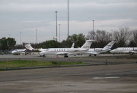
Steve Nation
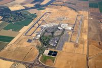
Allen M. Schultheiss
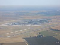
JT$
| FAA Information Effective | 2026-07-09 |
| Airport Identifier | SMF |
| Airport Status | Operational |
| Longitude/Latitude |
121°35'26.8000"
W /
38°41'43.6000"
N -121.590778 / 38.695444 (Estimated) |
| Elevation | 26.90 ft / 8.20 m (Surveyed) |
| Land | 6000 acres |
| From nearest city | 10 nautical miles NW of Sacramento, CA |
| Location | Sacramento County, CA |
| Magnetic Variation | 13E (2020) |
| Airport Use | Open to public |
| Wind indicator | Yes |
| Segmented Circle | No |
| Control Tower | ATCT |
| Beacon Color | White-Green (lighted land airport) |
| Landing fee charge | No |
| Sectional chart | SAN FRANCISCO |
| Region | AWP - Western-Pacific |
| Responsible ARTCC | ZOA - OAKLAND |
| Tie-in FSS | RIU - RANCHO MURIETA |
| FSS on Airport | No |
| FSS Toll Free | 1-800-WX-BRIEF |
| NOTAMs Facility | SMF (NOTAM-d service available) |
| Certification type/date | 1973/05 |
Runway 17L/35R
| Dimensions | 8605 x 150 ft (2623 x 46 m) |
| Surface | CONC (GOOD) |
| Surface treatment | Saw-cut or plastic Grooved |
| Edge lights | High |
| 17L | 35R | |
|---|---|---|
| Alignment | 181° | 1° |
| Physical elevation | 26.90 ft | 22.10 ft |
| Coordinates | 38.707138 / -121.580059 | 38.683514 / -121.580456 |
| Traffic pattern | Left | Right |
| Runway marking | Precision instrument , Good Condition | Non-precision instrument , Good Condition |
| ILS type | ILS/DME | |
| VGSI | 4-light PAPI on left | 4-light PAPI on left |
| RVR equipment | touchdown, rollout | touchdown, rollout |
| Approach light | MALSR | |
| CL lights | Yes | Yes |
| TDZ lights | Yes |
Runway 17R/35L
| Dimensions | 8598 x 150 ft (2621 x 46 m) |
| Surface | CONC (GOOD) |
| Surface treatment | Saw-cut or plastic Grooved |
| Edge lights | High |
| 17R | 35L | |
|---|---|---|
| Alignment | 181° | 1° |
| Physical elevation | 24.80 ft | 22.50 ft |
| Coordinates | 38.707340 / -121.601082 | 38.683733 / -121.601474 |
| Traffic pattern | Right | Left |
| Runway marking | Precision instrument , Good Condition | Precision instrument , Good Condition |
| ILS type | ILS/DME | ILS/DME |
| VGSI | 4-light PAPI on right | 4-light PAPI on right |
| RVR equipment | touchdown, midfield, rollout | touchdown, midfield, rollout |
| Approach light | ALSF2 | MALSR |
| Runway end lights | No | No |
| CL lights | Yes | Yes |
| TDZ lights | Yes | No |
- BIRDS ON AND IN VICINITY OF ARPT.
- TWY RMK #2: THE MAXIMUM ALLOWABLE GROSS AIRCRAFT LOAD FOR TWYS G1, G2, AND THE GENERAL AVIATION PARKING APRON IS: 70,000 LBS FOR SINGLE GEAR AIRCRAFT; 170,000 LBS FOR DUAL GEAR AIRCRAFT; AND 250,000 LBS FOR DUAL TANDEM GEAR AIRCRAFT.
- TWY RMK #2 CONT: AN ACFT CANNOT EXCEED THE AIRPLANE DESIGN GROUP III CRITERIA OR MUST HAVE A WHEEL BASE OF LESS THAN 60 FT.
- MILITARY AIRCRAFT PARKING LIMITED. CONTACT ARPT OPNS IF PARKING IS REQUIRED (916) 806-5309.
- PORTION OF TWY W 500 FT EAST OF TWY A TO 2100 FT EAST OF TWY A IS NOT VISIBLE FROM ATCT.
- TWY Y4 RESTRICTED TO AIRCRAFT WITH A WINGSPAN OF LESS THAN 118 FT (GROUP III).
- UNPAVED SFC NORTH OF TWY P AND EAST OF TWY A AND SOUTH OF CARGO 1 RAMP CLSD TO HEL.
- ACFT MUST PUSH BACK TAIL TO THE NORTH FROM TRML GATES A1, A3 AND A5.
- WEST RAMP SPOTS 63W, 65W, 66 & F1 RSTRD TO TOW IN AND TOW OUT ONLY FROM TXL B2. WHEN PUSHING BACK FOR DEP FROM WEST RAMP SPOTS 63W, 65W, 66 & F1 EACH ACFT IS TO PUSH BACK ONTO TXL B2 AND PULL FWD TO THE ENG START LINE PRIOR TO STARTING ENGS. ADG V ACFT PRKD ON SPOT 66 IS TO PUSH ONTO TWY A AFTER RCVG APVL FROM ATC.
- TWY B1 RSTRD TO ACFT WITH A WINGSPAN OF LESS THAN 118 FT (GROUP III).
- NOISE SENSITIVE AREAS W OF ARPT ON SAC RIVER. LCL TURN DISCOURAGED FOR JET ACFT. WHEN CONDUCTING IFR APCH IN VFR CONDITIONS EXECUTE MISSED APCH AT DEP END OF RYS. PLAN VFR PATTERNS TO E. USE MIN POWER SETTINGS.
- ALL ACFT CTC ATC GND CTL PRIOR TO MOVEMENT ON RAMP.
- CROP DUSTERS OPER INVOF ARPT AT OR BELOW 200 FT AGL.