Santa Maria Pub/capt G Allan Hancock Fld Airport (SMX)
Santa Maria Pub/capt G Allan Hancock Fld Airport (SMX)
SMX
Santa Maria Pub/capt G Allan Hancock Fld Airport (SMX)
Santa Maria, CA
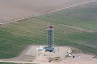
Latest photo of Santa Maria Pub/capt G Allan Hancock Fld Airport (SMX)
Nick Taylor
| FAA Information Effective | 2026-07-09 |
| Airport Identifier | SMX |
| Airport Status | Operational |
| Longitude/Latitude |
120°27'29.1000"
W /
34°53'59.8000"
N -120.458083 / 34.899944 (Estimated) |
| Elevation | 261.20 ft / 79.61 m (Surveyed) |
| Land | 2516 acres |
| From nearest city | 3 nautical miles S of Santa Maria, CA |
| Location | Santa Barbara County, CA |
| Magnetic Variation | 14E (1985) |
| Airport Use | Open to public |
| Wind indicator | Yes |
| Segmented Circle | Yes |
| Control Tower | ATCT |
| Lighting Schedule | SEE RMK |
| Beacon Color | White-Green (lighted land airport) |
| Landing fee charge | No |
| Sectional chart | LOS ANGELES |
| Region | AWP - Western-Pacific |
| Responsible ARTCC | ZLA - LOS ANGELES |
| Tie-in FSS | HHR - HAWTHORNE |
| FSS on Airport | No |
| FSS Toll Free | 1-800-WX-BRIEF |
| NOTAMs Facility | SMX (NOTAM-d service available) |
| Certification type/date | 1973/05 |
Runway 02/20
| Dimensions | 5199 x 75 ft (1585 x 23 m) |
| Surface | ASPH (GOOD) |
| Surface treatment |
| 02 | 20 | |
|---|---|---|
| Alignment | 36° | 216° |
| Physical elevation | 209.50 ft | 226.20 ft |
| Coordinates | 34.893390 / -120.467932 | 34.904946 / -120.457744 |
| Traffic pattern | Right | Left |
| Runway marking | Basic , Good Condition | Basic , Good Condition |
| Runway end lights | No | No |
| CL lights | No | No |
| TDZ lights | No | No |
Runway 12/30
| Dimensions | 8004 x 150 ft (2440 x 46 m) |
| Surface | ASPH (FAIR) |
| Surface treatment | Saw-cut or plastic Grooved |
| Edge lights | High |
| 12 | 30 | |
|---|---|---|
| Alignment | 135° | 315° |
| Physical elevation | 216.80 ft | 261.10 ft |
| Coordinates | 34.908278 / -120.464359 | 34.892618 / -120.445619 |
| Traffic pattern | Right | Left |
| Runway marking | Precision instrument , Good Condition | Precision instrument , Good Condition |
| ILS type | ILS/DME | |
| VGSI | 4-light PAPI on right | 4-light PAPI on right |
| RVR equipment | touchdown | rollout |
| Approach light | MALSR | |
| Runway end lights | No | No |
| CL lights | No | No |
| TDZ lights | No | No |
- CAUTION PARALLEL LGTD ROAD LESS THAN 1/4 MILE NW OF RY 12/30.
- TRANSIENT PILOTS REMAIN CLEAR OF COMMERCIAL RAMP AND TERMINAL.
- SELF SERVE FUEL 100LL AVBL 24 HRS LOCATED NORTH OF TOWER.
- CALM WIND LESS THAN 8 KNOTS USE RWY 30.
- NO TGL OPNS; LANDING PRACTICE OR PRACTICE INSTRUMENT APPROACHES 2200-0700.
- PORTIONS OF TWY J NOT VISIBLE FM ATCT & UNLGTD.
- NUMEROUS BIRDS ON AND INVOF ARPT.