Abraham Lincoln Capital Airport (SPI)
Abraham Lincoln Capital Airport (SPI)
SPI
Abraham Lincoln Capital Airport (SPI)
Springfield, IL
Latest photo of Abraham Lincoln Capital Airport (SPI)
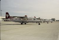
Mark Pasqualino
| FAA Information Effective | 2026-07-09 |
| Airport Identifier | SPI |
| Airport Status | Operational |
| Longitude/Latitude |
89°40'39.2000"
W /
39°50'40.6000"
N -89.677556 / 39.844611 (Estimated) |
| Elevation | 597.90 ft / 182.24 m (Surveyed) |
| Land | 2300 acres |
| From nearest city | 3 nautical miles NW of Springfield, IL |
| Location | Sangamon County, IL |
| Magnetic Variation | 01W (2005) |
| Airport Use | Open to public |
| Wind indicator | Yes |
| Segmented Circle | No |
| Control Tower | ATCT |
| Lighting Schedule | SEE RMK |
| Beacon Color | White-Green (lighted land airport) |
| Landing fee charge | No |
| Sectional chart | ST LOUIS |
| Region | AGL - Great Lakes |
| Responsible ARTCC | ZKC - KANSAS CITY |
| Tie-in FSS | STL - SAINT LOUIS |
| FSS on Airport | No |
| FSS Toll Free | 1-800-WX-BRIEF |
| NOTAMs Facility | SPI (NOTAM-d service available) |
| Certification type/date | 1973/05 |
Runway 04/22
| Dimensions | 8001 x 150 ft (2439 x 46 m) |
| Surface | CONC (FAIR) |
| Surface treatment | Saw-cut or plastic Grooved |
| Edge lights | High |
| 04 | 22 | |
|---|---|---|
| Alignment | 42° | 222° |
| Physical elevation | 587.50 ft | 597.70 ft |
| Coordinates | 39.836897 / -89.686442 | 39.853316 / -89.667514 |
| Traffic pattern | Left | Left |
| Runway marking | Precision instrument , Good Condition | Precision instrument , Good Condition |
| ILS type | ILS | ILS |
| VGSI | 4-box on left | 4-box on left |
| RVR equipment | touchdown | rollout |
| Approach light | MALSR | MALSR |
| Runway end lights | No | No |
| CL lights | No | No |
| TDZ lights | No | No |
Runway 13/31
| Dimensions | 7399 x 150 ft (2255 x 46 m) |
| Surface | ASPH (FAIR) |
| Surface treatment | Saw-cut or plastic Grooved |
| Edge lights | High |
| 13 | 31 | |
|---|---|---|
| Alignment | 127° | 307° |
| Physical elevation | 588.00 ft | 583.10 ft |
| Coordinates | 39.850137 / -89.688737 | 39.838024 / -89.667585 |
| Traffic pattern | Left | Left |
| Runway marking | Precision instrument , Good Condition | Precision instrument , Good Condition |
| ILS type | ILS | |
| VGSI | 4-light PAPI on right | 4-box on left |
| Approach light | MALSR | |
| Runway end lights | Yes | |
| CL lights | No | No |
| TDZ lights | No | No |
- GENERAL AVIATION ACCESS TO & PARKING ON THE ACR RAMP IS PROHIBITED.
- WX SVC AVBL H24.
- DURING SNOW REMOVAL OPS EQUIPMENT OPERATORS WILL MONITOR CTAF WHEN THE TWR IS CLSD.
- DASSP GATEWAY ARPT CALL 217-788-1080.
- FOR CD IF UNA TO CTC ON FSS FREQ, CTC ST LOUIS APCH AT 314-890-1017.
- 100LL SELF SERVE AVBL 24HRS.
- TWY Y1, TWY Y2, AND TWY Y BTN TWY Y1 AND TWY A NOT AVBL FOR AIR CARRIER OPS WITH MORE THAN 9 PAX SEATS.
- 150 FT WIDTH.