St Cloud Sky Central Airport (STC)
St Cloud Sky Central Airport (STC)
STC
St Cloud Sky Central Airport (STC)
St Cloud, MN
Latest photos of St Cloud Sky Central Airport (STC)
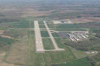
Kreg Anderson
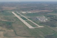
Kreg Anderson
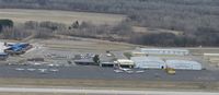
Kreg Anderson
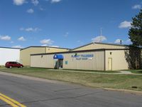
Kreg Anderson
| FAA Information Effective | 2026-07-09 |
| Airport Identifier | STC |
| Airport Status | Operational |
| Longitude/Latitude |
94°3'33.8000"
W /
45°32'46.4000"
N -94.059389 / 45.546222 (Estimated) |
| Elevation | 1030.50 ft / 314.10 m (Estimated) |
| Land | 1414 acres |
| From nearest city | 4 nautical miles E of St Cloud, MN |
| Location | Sherburne County, MN |
| Magnetic Variation | 03E (1995) |
| Airport Use | Open to public |
| Wind indicator | Yes |
| Segmented Circle | Yes |
| Control Tower | ATCT |
| Lighting Schedule | SEE RMK |
| Beacon Color | White-Green (lighted land airport) |
| Landing fee charge | No |
| Sectional chart | TWIN CITIES |
| Region | AGL - Great Lakes |
| Responsible ARTCC | ZMP - MINNEAPOLIS |
| Tie-in FSS | PNM - PRINCETON |
| FSS on Airport | No |
| FSS Toll Free | 1-800-WX-BRIEF |
| NOTAMs Facility | STC (NOTAM-d service available) |
| Certification type/date | 1975/11 |
Runway 05/23
| Dimensions | 3000 x 75 ft (914 x 23 m) |
| Surface | ASPH (GOOD) |
| Surface treatment | |
| Edge lights | Medium |
| 05 | 23 | |
|---|---|---|
| Alignment | 59° | 239° |
| Physical elevation | 1021.10 ft | 1022.00 ft |
| Coordinates | 45.543336 / -94.064986 | 45.547536 / -94.054920 |
| Traffic pattern | Left | Left |
| Runway marking | Basic , Good Condition | Basic , Good Condition |
| VGSI | 4-light PAPI on right | 4-light PAPI on left |
Runway 13/31
| Dimensions | 7500 x 150 ft (2286 x 46 m) |
| Surface | CONC (GOOD) |
| Surface treatment | Saw-cut or plastic Grooved |
| Edge lights | High |
| 13 | 31 | |
|---|---|---|
| Alignment | 136° | 316° |
| Physical elevation | 1030.50 ft | 1015.90 ft |
| Coordinates | 45.553938 / -94.069337 | 45.539144 / -94.049003 |
| Traffic pattern | Left | Left |
| Runway marking | Precision instrument , Fair Condition | Precision instrument , Fair Condition |
| ILS type | ILS | ILS |
| VGSI | 4-light PAPI on right | 4-light PAPI on left |
| Approach light | MALSR | MALSR |
| Runway end lights | No |
- RY 31 CALM WIND RY.
- DEER, MIGRATORY WATERFOWL, AND OTHER WILDLIFE ON & INVOF ARPT.
- FLIGHT TRAINING ON & INVOF ARPT.
- CROP DUSTING OPERATIONS ON AND IN VICINITY OF AIRPORT DURING SUMMER MONTHS.
- HELIPAD NOT VISIBLE FROM ATCT AND APPROACH SURFACES.
- LINE OF SIGHT VISIBILITY IS RESTRICTED FROM THE 13 & 23 APPROACH AND RUNWAY 13 & 5 APPROACH
- FOR CD WHEN ATCT IS CLSD CTC FSS VIA RCO, IF UNA CTC MINNEAPOLIS ARTCC AT 651-463-5588.