St Paul Downtown Holman Fld Airport (STP)
St Paul Downtown Holman Fld Airport (STP)
STP
St Paul Downtown Holman Fld Airport (STP)
St Paul, MN
Latest photos of St Paul Downtown Holman Fld Airport (STP)
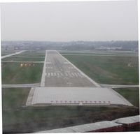
Kreg Anderson
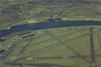
GatewayN727
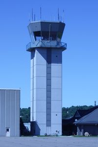
Timothy Aanerud
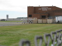
Doug Robertson
| FAA Information Effective | 2026-07-09 |
| Airport Identifier | STP |
| Airport Status | Operational |
| Longitude/Latitude |
93°3'37.2740"
W /
44°56'4.6150"
N -93.060354 / 44.934615 (Estimated) |
| Elevation | 705.00 ft / 214.88 m (Estimated) |
| Land | 540 acres |
| From nearest city | 1 nautical miles S of St Paul, MN |
| Location | Ramsey County, MN |
| Airport Use | Open to public |
| Wind indicator | Yes |
| Segmented Circle | No |
| Control Tower | ATCT |
| Lighting Schedule | SEE RMK |
| Beacon Color | White-Green (lighted land airport) |
| Landing fee charge | Yes |
| Sectional chart | TWIN CITIES |
| Region | AGL - Great Lakes |
| Traffic Pattern Alt | 1200 ft |
| Responsible ARTCC | ZMP - MINNEAPOLIS |
| Tie-in FSS | PNM - PRINCETON |
| FSS on Airport | No |
| FSS Toll Free | 1-800-WX-BRIEF |
| NOTAMs Facility | STP (NOTAM-d service available) |
Runway 09/27
| Dimensions | 3642 x 100 ft (1110 x 30 m) |
| Surface | ASPH (GOOD) |
| Surface treatment | |
| Edge lights | Medium |
| 09 | 27 | |
|---|---|---|
| Alignment | 91° | 271° |
| Physical elevation | 700.40 ft | 700.70 ft |
| Coordinates | 44.934865 / -93.068122 | 44.934747 / -93.054060 |
| Traffic pattern | Left | Right |
| Runway marking | Basic , Good Condition | Basic , Good Condition |
| VGSI | 4-light PAPI on right |
Runway 13/31
| Dimensions | 4004 x 150 ft (1220 x 46 m) |
| Surface | ASPH (GOOD) |
| Surface treatment | Saw-cut or plastic Grooved |
| Edge lights | High |
| 13 | 31 | |
|---|---|---|
| Alignment | 128° | 308° |
| Physical elevation | 704.50 ft | 700.90 ft |
| Coordinates | 44.939186 / -93.065066 | 44.932464 / -93.052840 |
| Traffic pattern | Left | Left |
| Runway marking | Non-precision instrument , Good Condition | Non-precision instrument , Good Condition |
| VGSI |
4-light PAPI on left *PAPI UNUSBL BYD 4 DEG RIGHT OF CNTRLN & UNUSBL INSIDE .5 NM. |
4-light PAPI on left |
| Runway end lights | Yes |
Runway 14/32
| Dimensions | 6491 x 150 ft (1978 x 46 m) |
| Surface | ASPH (GOOD) |
| Surface treatment | Saw-cut or plastic Grooved |
| Edge lights | High |
| 14 | 32 | |
|---|---|---|
| Alignment | 146° | 326° |
| Physical elevation | 704.00 ft | 704.40 ft |
| Coordinates | 44.941144 / -93.067807 | 44.926379 / -93.053805 |
| Traffic pattern | Left | Left |
| Runway marking | Precision instrument , Good Condition | Precision instrument , Good Condition |
| ILS type | ILS/DME | ILS/DME |
| VGSI |
4-light PAPI on right *PAPI UNUSBL BYD 8 DEG LEFT OF CNTRLN. |
4-light PAPI on left |
| RVR equipment | touchdown, rollout | touchdown, rollout |
| Approach light | MALSR | |
| Runway end lights | No | Yes |
- BIRD ROOSTING & FEEDING AREAS ALONG RIVER BANKS.
- VOLUNTARY NOISE ABATEMENT PROCS IN EFCT. SEE ARPT WEBSITE FOR MORE INFO.
- TWY A CLSD BTN A3 AND A4 EXC FOR WINGSPAN LESS THAN 101FT.
- TWY B CLSD BTN MN JET RAMP AND TWY A (SOUTHERN CORNER) EXC FOR WINGSPAN LESS THAN 72FT DUE TO FLOOD WALL OBSTACLE.
- RWY 14 IS CALM WIND RWY WHEN ATCT CLSD.
- EXPECT HELICOPTER OPERATIONS ON TWY 'A' IN THE VICINITY OF THE CONTROL TWR, NORTH TO THE APPROACH END OF RWY 14.
- COLD TEMPERATURE AIRPORT. ALTITUDE CORRECTION REQUIRED AT OR BELOW -30C.
- WHEN ATCT CLSD, FOR CD CTC MINNEAPOLIS APCH ON 121.675.
- WHEN USING RWYS 27 OR 31 HAZARDOUS RIVER TFC MAY EXIST.
- DEER, BIRDS & WILDLIFE ON & INVOF ARPT.
- SE ARR & DEP AVOID TFC PATTERN OPS AT SOUTH ST. PAUL ARPT 164 DEG 5 NM AT & BLO 1720 MSL.
- PPR ACFT OVER 100,000 LBS, CTC AMGR.
- COMPLEX AIRPORT GEOMETRY. VERIFY CORRECT COMPASS HEADING PRIOR TO DEPARTURE.
- SPB ESTABLISHED PRIOR TO 1959.