York Airport (THV)
York Airport (THV)
THV
York Airport (THV)
York, PA
Latest photos of York Airport (THV)
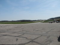
Sam Andrews
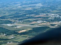
Herb Harris
| FAA Information Effective | 2026-07-09 |
| Airport Identifier | THV |
| Airport Status | Operational |
| Longitude/Latitude |
76°52'22.9000"
W /
39°55'1.2000"
N -76.873028 / 39.917000 (Estimated) |
| Elevation | 494.70 ft / 150.78 m (Surveyed) |
| Land | 66 acres |
| From nearest city | 7 nautical miles SW of York, PA |
| Location | York County, PA |
| Magnetic Variation | 11W (2000) |
| Airport Use | Open to public |
| Wind indicator | Yes |
| Segmented Circle | No |
| Control Tower | NON-ATCT |
| Lighting Schedule | SS-SR |
| Beacon Color | White-Green (lighted land airport) |
| Landing fee charge | Yes |
| Sectional chart | WASHINGTON |
| Region | AEA - Eastern |
| Responsible ARTCC | ZNY - NEW YORK |
| Tie-in FSS | IPT - WILLIAMSPORT |
| FSS on Airport | No |
| FSS Toll Free | 1-800-WX-BRIEF |
| NOTAMs Facility | THV (NOTAM-d service available) |
Runway 17/35
| Dimensions | 5188 x 100 ft (1581 x 30 m) |
| Surface | ASPH (GOOD) |
| Surface treatment | Saw-cut or plastic Grooved |
| Edge lights | Medium |
| 17 | 35 | |
|---|---|---|
| Alignment | 155° | 335° |
| Physical elevation | 475.80 ft | 494.70 ft |
| Coordinates | 39.923468 / -76.876883 | 39.910525 / -76.869167 |
| Traffic pattern | Left | Left |
| Runway marking | Non-precision instrument , Good Condition | Non-precision instrument , Good Condition |
| VGSI | 4-light PAPI on left | 4-light PAPI on left |
| Runway end lights | Yes | Yes |
- TREES WI PRIM SFC 83 FT IN FM THLD & 221 FT L OF RWY 17 CNTRLN; RAMP TIE-DOWN AREA, MEDIVAC PARKING PAD & TWY WI PRIM SFC ON R SIDE.
- TWY TO RWY 35 CLSD TO ACFT WITH WINGSPAN OVER 60 FT.
- RWY 17: TREES 1383 FT OUT, 121 FT RIGHT. APCH SLP 20:1 TO DTHR.
- RWY 35: TREES 2684 FT OUT, 425 FT RIGHT. APCH SLP 22:1 TO DTHR.
- FOR CD CTC HARRISBURG APCH AT 800-932-0712.