Southern California Logistics Airport (VCV)
Southern California Logistics Airport (VCV)
VCV
Southern California Logistics Airport (VCV)
Victorville, CA
Latest photos of Southern California Logistics Airport (VCV)
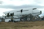
FerryPNL
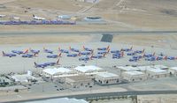
Mark Pasqualino
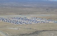
Mark Pasqualino

adenhart
| FAA Information Effective | 2026-07-09 |
| Airport Identifier | VCV |
| Airport Status | Operational |
| Longitude/Latitude |
117°22'57.5840"
W /
34°35'43.8940"
N -117.382662 / 34.595526 (Estimated) |
| Elevation | 2885.30 ft / 879.44 m (Surveyed) |
| Land | 2300 acres |
| From nearest city | 5 nautical miles NW of Victorville, CA |
| Location | San Bernardino County, CA |
| Magnetic Variation | 14E (1995) |
| Airport Use | Open to public |
| Wind indicator | Yes |
| Segmented Circle | Yes |
| Control Tower | ATCT |
| Lighting Schedule | SEE RMK |
| Beacon Color | White-Green (lighted land airport) |
| Landing fee charge | No |
| Sectional chart | LOS ANGELES |
| Region | AWP - Western-Pacific |
| Responsible ARTCC | ZLA - LOS ANGELES |
| Tie-in FSS | RAL - RIVERSIDE |
| FSS on Airport | No |
| FSS Toll Free | 1-800-WX-BRIEF |
| NOTAMs Facility | VCV (NOTAM-d service available) |
| Certification type/date | 1995/03 |
Runway 03/21
| Dimensions | 9138 x 150 ft (2785 x 46 m) |
| Surface | ASPH-CONC (GOOD) |
| Surface treatment | |
| Edge lights | High |
| 03 | 21 | |
|---|---|---|
| Alignment | 45° | 225° |
| Physical elevation | 2877.80 ft | 2844.20 ft |
| Coordinates | 34.582708 / -117.387754 | 34.600605 / -117.366466 |
| Traffic pattern | Right | Left |
| Runway marking | Non-precision instrument , Good Condition | Non-precision instrument , Good Condition |
| VGSI | 4-light PAPI on left | 4-light PAPI on left |
| Runway end lights | No | No |
| CL lights | No | No |
| TDZ lights | No | No |
Runway 17/35
| Dimensions | 13052 x 150 ft (3978 x 46 m) |
| Surface | ASPH-CONC (GOOD) |
| Surface treatment | Saw-cut or plastic Grooved |
| Edge lights | High |
| 17 | 35 | |
|---|---|---|
| Alignment | 180° | 360° |
| Physical elevation | 2821.50 ft | 2885.30 ft |
| Coordinates | 34.616162 / -117.386731 | 34.580308 / -117.386368 |
| Traffic pattern | Right | Left |
| Runway marking | Non-precision instrument , Good Condition | Precision instrument , Good Condition |
| ILS type | LOCALIZER | |
| VGSI | 4-light PAPI on left | 4-light PAPI on left |
| RVR equipment | touchdown | rollout |
| Runway end lights | Yes | Yes |
| CL lights | No | No |
| TDZ lights | No | No |
- AVOID OVERFLIGHT OF SILVER LAKES 10 MILES NORTH FOR NOISE ABATEMENT.
- PTN OF TWY A BTN TWY C AND RWY 21, PTN OF TWY C BTN TWY A AND TWY B, PTN OF TWY C BTN TWYS C1 AND C2, PTN OF TWY E BTN TWY E1 AND TWY D, RWY 17 THLD, AND RWY 35 THLD ARE NOT VISIBLE AREAS FROM THE ATCT. VCV ATCT UNA TO PRVD ATC SVCS TO ACFT IN THESE NON-VISIBLE AREAS.
- TWY U NOT AVBL FOR GA OR ACR USE. NOT LGTD.
- PTN OF RWY 17 NORTH 3000 FT ARE NOT VISIBLE AREAS FROM TOWER.
- WHEN ATCT CLSD, FOR CD CTC JOSHUA APCH AT 661-277-3843.
- FOR ACFT FUEL OR MAINT CALL (760) 246-7794 OR USE FREQ 131.975
- NO OBJECTION.