Cape May County Airport (WWD)
Cape May County Airport (WWD)
WWD
Cape May County Airport (WWD)
Wildwood, NJ
Latest photos of Cape May County Airport (WWD)
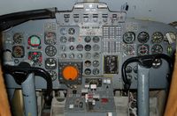
scotch-canadian
scotch-canadian
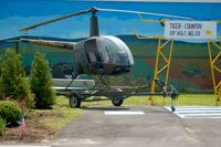
scotch-canadian
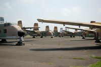
scotch-canadian
| FAA Information Effective | 2026-07-09 |
| Airport Identifier | WWD |
| Airport Status | Operational |
| Longitude/Latitude |
74°54'30.6320"
W /
39°0'30.1300"
N -74.908509 / 39.008369 (Estimated) |
| Elevation | 21.70 ft / 6.61 m (Surveyed) |
| Land | 996 acres |
| From nearest city | 4 nautical miles NW of Wildwood, NJ |
| Location | Cape May County, NJ |
| Magnetic Variation | 10W (1980) |
| Airport Use | Open to public |
| Wind indicator | Yes |
| Segmented Circle | No |
| Control Tower | NON-ATCT |
| Lighting Schedule | SEE RMK |
| Beacon Color | White-Green (lighted land airport) |
| Landing fee charge | No |
| Sectional chart | WASHINGTON |
| Region | AEA - Eastern |
| Responsible ARTCC | ZDC - WASHINGTON |
| Tie-in FSS | MIV - MILLVILLE |
| FSS on Airport | No |
| FSS Toll Free | 1-800-WX-BRIEF |
| NOTAMs Facility | WWD (NOTAM-d service available) |
Runway 01/19
| Dimensions | 5252 x 150 ft (1601 x 46 m) |
| Surface | ASPH (GOOD) |
| Surface treatment | |
| Edge lights | High |
| PCN | 39 |
| 01 | 19 | |
|---|---|---|
| Alignment | 360° | 180° |
| Physical elevation | 21.70 ft | 15.20 ft |
| Coordinates | 39.002279 / -74.905627 | 39.016698 / -74.905749 |
| Traffic pattern | Left | Left |
| Runway marking | Non-precision instrument , Good Condition | Non-precision instrument , Good Condition |
| ILS type | LOCALIZER | |
| VGSI | 4-light PAPI on left | 4-light PAPI on left |
Runway 10/28
| Dimensions | 5000 x 150 ft (1524 x 46 m) |
| Surface | ASPH (GOOD) |
| Surface treatment | |
| Edge lights | Medium |
| 10 | 28 | |
|---|---|---|
| Alignment | 90° | 270° |
| Physical elevation | 15.50 ft | 19.00 ft |
| Coordinates | 39.007148 / -74.920267 | 39.007240 / -74.902675 |
| Traffic pattern | Left | Left |
| Runway marking | Non-precision instrument , Good Condition | Non-precision instrument , Good Condition |
| VGSI | 4-light PAPI on left | 4-light PAPI on left |
- BIRDS ON & INVOF ARPT.
- PAEW WITHIN THE SAFETY AREAS OF ALL RYS AND TWYS DAILY MAY THRU OCT.
- TWY A WEST OF TWY F CAN ONLY BE USED BY ACFT WITH WINGSPANS LESS THAN 79 FT.
- UNMANNED AIRCRAFT SYSTEMS (UAS) ACTIVITY ON AND AROUND AIRFIELD.
- ALL ULTRALIGHT ACFT, GLIDER OPS AND FORMATION FLTS PPR. CALL (609) 886-8652 MON-FRI 0800-1600.
- FOR CD CTC ATLANTIC CITY APCH AT 609-485-6192.
- TWY C IS AN FAA RESEARCH TWY AND IS RSTRD TO ACFT WITH WT LMT OF 28,000 LB AND SHOULD NOT BE USED BY ACFT GTR THAN 28,000 LB.
- ARPT SFC CONDS NOT RPRTD 0800-1600.
- TWY B SOUTH OF TWY A CAN ONLY BE USED BY ACFT WITH WINGSPANS LESS THAN 79 FT.
- EXISTED BEFORE FAR 157 RQRMT.