Willow Run Airport (YIP)
Willow Run Airport (YIP)
YIP
Willow Run Airport (YIP)
Detroit, MI
Latest photos of Willow Run Airport (YIP)
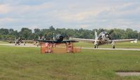
Florida Metal
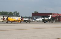
Florida Metal
Florida Metal
Florida Metal
| FAA Information Effective | 2026-07-09 |
| Airport Identifier | YIP |
| Airport Status | Operational |
| Longitude/Latitude |
83°31'53.2600"
W /
42°14'24.9860"
N -83.531461 / 42.240274 (Estimated) |
| Elevation | 715.90 ft / 218.21 m (Surveyed) |
| Land | 2392 acres |
| From nearest city | 24 nautical miles SW of Detroit, MI |
| Location | Wayne County, MI |
| Magnetic Variation | 06W (1995) |
| Airport Use | Open to public |
| Wind indicator | Yes |
| Segmented Circle | No |
| Control Tower | ATCT |
| Beacon Color | White-Green (lighted land airport) |
| Landing fee charge | Yes |
| Sectional chart | DETROIT |
| Region | AGL - Great Lakes |
| Responsible ARTCC | ZOB - CLEVELAND |
| Tie-in FSS | LAN - LANSING |
| FSS on Airport | No |
| FSS Toll Free | 1-800-WX-BRIEF |
| NOTAMs Facility | YIP (NOTAM-d service available) |
| Certification type/date | 1974/10 |
Runway 05/23
| Dimensions | 7543 x 150 ft (2299 x 46 m) |
| Surface | CONC (GOOD) |
| Surface treatment | Saw-cut or plastic Grooved |
| Edge lights | High |
| 05 | 23 | |
|---|---|---|
| Alignment | 47° | 227° |
| Physical elevation | 714.30 ft | 701.50 ft |
| Coordinates | 42.230625 / -83.539850 | 42.244816 / -83.519576 |
| Traffic pattern | Left | Left |
| Runway marking | Precision instrument , Good Condition | Precision instrument , Good Condition |
| ILS type | ILS/DME | ILS/DME |
| VGSI | 4-light PAPI on left | 4-light PAPI on left |
| RVR equipment | touchdown | rollout |
| Approach light | MALSR | MALSR |
| Runway end lights | No | No |
| CL lights | Yes | Yes |
| TDZ lights | Yes | No |
Runway 09/27
| Dimensions | 5001 x 100 ft (1524 x 30 m) |
| Surface | ASPH (EXCELLENT) |
| Surface treatment | Saw-cut or plastic Grooved |
| Edge lights | Medium |
| 09 | 27 | |
|---|---|---|
| Alignment | 89° | 269° |
| Physical elevation | 715.90 ft | 706.90 ft |
| Coordinates | 42.243951 / -83.543328 | 42.244296 / -83.524864 |
| Traffic pattern | Left | Left |
| Runway marking | Non-precision instrument , Good Condition | Non-precision instrument , Good Condition |
| VGSI | 4-light PAPI on left | |
| Runway end lights | No | No |
| CL lights | No | No |
| TDZ lights | No | No |
- BIRDS ON & INVOF ARPT.
- CLSD TO SKEDD ACR OPS GTR THAN 9 PSGR SEATS. 72 HRS PPR FOR UNSKED ACR OPS WITH MORE THAN 30 PSGR SEATS CALL ARPT OPS MGR 734-485-6670.
- LRA ARPT; ADCUS 734-942-9000.
- CUST AVBL 24 HRS, MON - FRI AND ON CALL FROM DTW ON WKEND.
- HELICOPTER TKOFS & LDGS ON THE SOUTH RAMP PROHIBITED, TAXI ONLY.
- CONDS NOT MNT OUTSIDE M-F, 0800-1600,DTW AIRFIELD OPS (734-942-3685) PROVIDES DLY INSPECTIONS AND IS ON CALL FOR WX OR INCIDENTS OFF HRS.
- WRONG SFC ARR RISK ARPT, CLOSELY ALIGNED PAVEMENT TXY G & RWY 09/27.