Ancien Aérodrome de Brive-La Roche, Brive-la-Gaillarde, France (LFBV / BVE)
Ancien Aérodrome de Brive-La Roche
LFBV/BVE
Ancien Aérodrome de Brive-La Roche
Brive-la-Gaillarde, France
Latest photos of Ancien Aérodrome de Brive-La Roche, Brive-la-Gaillarde, France
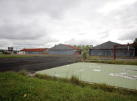
Shunn311
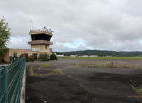
Shunn311
Ancien Aérodrome de Brive-La Roche (LFBV/BVE) is a closed airfield located in Brive-la-Gaillarde, France. The airfield is situated at an elevation of 379 feet (116 meters) above sea level. Operations are conducted on 1 runway. The facility operates 1 published communication frequency. The gallery features 2 photos documenting air traffic and facilities at the airport.
Runway 14/32
| Dimensions | 4,593 x 98 ft (1400 x 30 m) |
| Surface | Asphalt |
| Lighted | Yes |
| Status | Open |
| 14 | 32 | |
| Heading (True) | 136° | 316° |
| Latitude |
45.155399 N 45° 09' 19.44" |
45.146400 N 45° 08' 47.04" |
| Longitude |
1.462220 E 1° 27' 43.99" |
1.474720 E 1° 28' 28.99" |
| Elevation | 346 ft | 374 ft |
| Displaced Threshold | 656 ft | 492 ft |