Aircraft N135EV Data
1
aircraft record found
N135EV
2009 Bombardier CRJ-900ER (CL-600-2D24), c/n 15225
Latest photos of N135EV
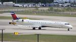
FloridaMetal
@ KDTW
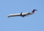
FloridaMetal
@ KDTW
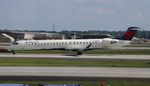
Florida Metal
@ KATL

Florida Metal
@ KDTW
Recent Routes
IN FLIGHT
EDV5121
| Time | Callsign | FL | Speed | Heading | Route |
|---|---|---|---|---|---|
| 2026-10-23 23:02 UTC | EDV5121 | FL117 | 377 kt | 208° | — |
| 2026-10-23 20:24 UTC | EDV4680 | FL1 | 131 kt | 329° | — |
| 2026-10-23 16:58 UTC | EDV5135 | — | 1 kt | 211° | — |
| 2026-10-22 21:48 UTC | EDV4693 | — | 1 kt | 228° | — |
| 2026-10-22 18:10 UTC | EDV5435 | FL5 | 127 kt | 330° | — |
| 2026-10-22 15:08 UTC | EDV5214 | — | 2 kt | 270° | — |
| 2026-10-22 00:22 UTC | EDV5115 | — | 0 kt | 304° | — |
| 2026-10-21 19:56 UTC | EDV5468 | — | 3 kt | 259° | — |
| 2026-10-21 15:42 UTC | EDV5142 | — | 0 kt | 270° | — |
| 2026-10-21 11:30 UTC | EDV5349 | — | 6 kt | 174° | — |
| 2026-10-21 03:32 UTC | EDV5206 | FL40 | 214 kt | 302° | — |
| 2026-10-21 00:36 UTC | EDV4633 | — | 0 kt | 248° | — |
| 2026-10-20 18:14 UTC | EDV4644 | — | 8 kt | 177° | — |
| 2026-10-20 12:22 UTC | EDV4927 | — | 4 kt | 87° | — |
| 2026-10-20 02:44 UTC | EDV5074 | FL110 | 341 kt | 253° | — |
| 2026-10-20 00:22 UTC | EDV5185 | — | 18 kt | 90° |
ATL → 9LS1
ATL
→
9LS1
Hartsfield/jackson Atlanta International Airport → Bayou Meadows Airport |
| 2026-10-19 20:06 UTC | EDV4925 | — | 1 kt | 270° | — |
| 2026-10-19 16:28 UTC | EDV5339 | — | 13 kt | 177° | — |
| 2026-10-19 10:22 UTC | EDV5291 | — | 4 kt | 42° | — |
| 2026-10-19 01:16 UTC | EDV5246 | FL-2 | 138 kt | 348° | — |
| 2026-10-18 23:00 UTC | EDV5528 | — | 8 kt | 17° | — |
| 2026-10-18 18:26 UTC | EDV5425 | — | 2 kt | 270° | — |
| 2026-10-18 14:46 UTC | EDV5475 | — | 0 kt | 295° | — |
| 2026-10-18 02:38 UTC | EDV5182 | FL61 | 276 kt | 316° | — |
| 2026-10-17 23:22 UTC | EDV5377 | — | 0 kt | 295° | — |
| 2026-10-17 19:30 UTC | EDV5157 | — | 17 kt | 90° |
ATL → 9LS1
ATL
→
9LS1
Hartsfield/jackson Atlanta International Airport → Bayou Meadows Airport |
| 2026-10-17 14:48 UTC | EDV5309 | — | 5 kt | 180° | — |
| 2026-10-16 11:02 UTC | EDV5255 | — | 8 kt | 0° | — |
| 2026-10-16 02:04 UTC | EDV5443 | FL18 | 175 kt | 171° | — |
| 2026-10-15 18:28 UTC | EDV5526 | — | 15 kt | 0° | — |
| 2026-10-15 12:58 UTC | EDV5383 | — | 13 kt | 180° |
BMI → ATL
BMI
→
ATL
Central Il Rgnl/bloomington-normal Airport → Hartsfield/jackson Atlanta International Airport |
| 2026-10-15 03:24 UTC | EDV5410 | — | 4 kt | 276° |
ATL → BMI
ATL
→
BMI
Hartsfield/jackson Atlanta International Airport → Central Il Rgnl/bloomington-normal Airport |
| 2026-10-15 00:06 UTC | EDV4993 | — | 0 kt | 270° | — |
| 2026-10-14 19:54 UTC | EDV5298 | — | 16 kt | 180° |
ROC → LGA
ROC
→
LGA
Frederick Douglass/greater Rochester International Airport → Laguardia Airport |
| 2026-10-14 17:12 UTC | EDV5323 | FL52 | 249 kt | 282° | — |
| 2026-10-14 15:06 UTC | EDV5366 | — | 1 kt | 129° | — |
| 2026-10-14 10:30 UTC | EDV5454 | — | 0 kt | 312° | — |
| 2026-10-14 03:20 UTC | EDV5493 | FL6 | 134 kt | 179° | — |
| 2026-10-14 01:54 UTC | EDV5231 | — | 0 kt | 132° | — |
| 2026-10-13 23:44 UTC | EDV4954 | FL10 | 137 kt | 230° | — |
| 2026-10-13 22:12 UTC | EDV5021 | FL11 | 124 kt | 209° | — |
| 2026-10-13 18:06 UTC | EDV5266 | FL6 | 139 kt | 181° |
ATL → HSV
ATL
→
HSV
Hartsfield/jackson Atlanta International Airport → Huntsville Intl-carl T Jones Fld Airport |
| 2026-10-12 01:16 UTC | EDV5105 | — | 6 kt | 267° | — |
| 2026-10-11 20:26 UTC | EDV4663 | — | 10 kt | 357° | — |
| 2026-10-11 16:20 UTC | EDV5304 | — | 0 kt | 270° | — |
| 2026-10-11 12:08 UTC | EDV4691 | — | 0 kt | 278° |
ABY → ATL
ABY
→
ATL
Southwest Georgia Regional Airport → Hartsfield/jackson Atlanta International Airport |
| 2026-10-11 00:44 UTC | EDV5129 | — | 0 kt | 233° |
ATL → ABY
ATL
→
ABY
Hartsfield/jackson Atlanta International Airport → Southwest Georgia Regional Airport |
| 2026-10-10 23:06 UTC | EDV5389 | — | 0 kt | 273° |
ATL → BMI
ATL
→
BMI
Hartsfield/jackson Atlanta International Airport → Central Il Rgnl/bloomington-normal Airport |
| 2026-10-10 16:40 UTC | EDV5352 | — | 4 kt | 290° | — |
| 2026-10-10 13:30 UTC | EDV5162 | — | 3 kt | 90° | — |
| 2026-10-10 02:24 UTC | EDV5168 | FL25 | 231 kt | 240° | — |
| 2026-10-10 00:06 UTC | EDV5529 | — | 3 kt | 90° | — |
| 2026-10-09 18:40 UTC | EDV4991 | — | 4 kt | 87° |
ATL → LS46
ATL
→
LS46
Hartsfield/jackson Atlanta International Airport → Wc Fld Airport |
| 2026-10-09 13:32 UTC | EDV5234 | — | 0 kt | 270° | — |
| 2026-10-09 02:44 UTC | EDV5258 | FL11 | 134 kt | 45° | — |
| 2026-10-08 23:22 UTC | EDV5374 | — | 0 kt | 270° | — |
| 2026-10-08 01:12 UTC | EDV5002 | — | 3 kt | 214° |
LGA → BNA
LGA
→
BNA
Laguardia Airport → Nashville International Airport |
| 2026-10-07 21:36 UTC | EDV4647 | FL19 | 143 kt | 55° | — |
| 2026-10-07 18:58 UTC | EDV4941 | FL10 | 129 kt | 209° | — |
| 2026-10-07 12:52 UTC | EDV5232 | FL9 | 133 kt | 209° | — |
| 2026-10-07 00:22 UTC | EDV5249 | FL54 | 237 kt | 264° | — |
| 2026-10-06 21:36 UTC | EDV5397 | FL7 | 132 kt | 209° | — |
| 2026-10-06 20:02 UTC | EDV5242 | FL7 | 138 kt | 230° |
LGA → CLE
LGA
→
CLE
Laguardia Airport → Cleveland-hopkins International Airport |
| 2026-10-06 17:26 UTC | EDV5361 | — | 4 kt | 222° | — |
| 2026-10-06 12:00 UTC | EDV5457 | — | 6 kt | 152° | — |
| 2026-10-06 01:40 UTC | EDV5398 | FL10 | 128 kt | 90° | — |
| 2026-10-05 21:40 UTC | EDV4923 | — | 8 kt | 222° | — |
| 2026-10-05 14:58 UTC | EDV4631 | — | 0 kt | 138° | — |
| 2026-10-05 00:56 UTC | EDV4630 | FL11 | 131 kt | 3° | — |
| 2026-10-04 19:10 UTC | EDV4945 | — | 10 kt | 186° | — |
| 2026-10-03 00:18 UTC | EDV4904 | FL7 | 139 kt | 54° |
LGA → DSM
LGA
→
DSM
Laguardia Airport → Des Moines International Airport |
| 2026-10-02 20:14 UTC | EDV4922 | — | 6 kt | 149° |
LGA → STL
LGA
→
STL
Laguardia Airport → St Louis Lambert International Airport |
| 2026-10-02 13:14 UTC | EDV5050 | — | 13 kt | 121° | — |
| 2026-10-02 03:38 UTC | EDV4918 | FL10 | 135 kt | 222° | — |
| 2026-10-01 23:48 UTC | EDV5104 | — | 9 kt | 217° | — |
| 2026-10-01 18:22 UTC | EDV5267 | — | 10 kt | 169° | — |
| 2026-10-01 11:48 UTC | EDV5171 | — | 12 kt | 93° | — |
| 2026-10-01 01:54 UTC | EDV5034 | FL8 | 140 kt | 212° |
LGA → GSP
LGA
→
GSP
Laguardia Airport → Greenville Spartanburg International Airport |
| 2026-09-30 20:14 UTC | EDV5415 | — | 4 kt | 233° | — |
| 2026-09-30 12:32 UTC | EDV5237 | — | 10 kt | 222° | — |
| 2026-09-30 01:58 UTC | EDV5204 | FL8 | 127 kt | 229° | — |
| 2026-09-29 23:50 UTC | EDV5010 | — | 5 kt | 222° |
LGA → BGR
LGA
→
BGR
Laguardia Airport → Bangor International Airport |
| 2026-09-29 18:50 UTC | EDV5025 | — | 3 kt | 253° | — |
| 2026-09-29 12:30 UTC | EDV4951 | — | 0 kt | 141° | — |
| 2026-09-29 02:44 UTC | EDV4928 | FL2 | 139 kt | 71° | — |
| 2026-09-28 23:06 UTC | EDV5306 | — | 1 kt | 293° |
YYZ → LGA
YYZ
→
LGA
Lester B Pearson International Airport → Laguardia Airport |
| 2026-09-28 20:34 UTC | EDV5233 | — | 0 kt | 90° |
LGA → YYZ
LGA
→
YYZ
Laguardia Airport → Lester B Pearson International Airport |
| 2026-09-28 17:22 UTC | EDV5041 | — | 2 kt | 158° |
STL → LGA
STL
→
LGA
St Louis Lambert International Airport → Laguardia Airport |
| 2026-09-28 13:20 UTC | EDV5286 | — | 9 kt | 121° |
MSP → STL
MSP
→
STL
Minneapolis-st Paul Intl/wold-chamberlain Airport → St Louis Lambert International Airport |
| 2026-09-27 23:20 UTC | EDV4700 | — | 0 kt | 231° | — |
| 2026-09-27 19:24 UTC | EDV5350 | — | 5 kt | 217° | — |
| 2026-09-27 15:56 UTC | EDV5357 | FL5 | 138 kt | 311° | — |
| 2026-09-27 13:22 UTC | EDV5093 | — | 8 kt | 222° | — |
| 2026-09-27 01:06 UTC | EDV5293 | FL6 | 130 kt | 328° | — |
| 2026-09-26 22:04 UTC | EDV5289 | FL3 | 125 kt | 31° |
ROC → JFK
ROC
→
JFK
Frederick Douglass/greater Rochester International Airport → John F Kennedy International Airport |
| 2026-09-26 19:38 UTC | EDV5211 | — | 0 kt | 59° | — |
| 2026-09-26 17:42 UTC | EDV5270 | FL5 | 138 kt | 29° | — |
| 2026-09-26 13:48 UTC | EDV5347 | FL15 | 153 kt | 225° | — |
| 2026-09-26 11:02 UTC | EDV5307 | FL5 | 129 kt | 29° | — |
| 2026-09-26 02:52 UTC | EDV5478 | FL8 | 134 kt | 0° | — |
| 2026-09-26 00:10 UTC | EDV5144 | FL4 | 137 kt | 28° | — |
| 2026-09-25 21:36 UTC | EDV4913 | FL7 | 135 kt | 54° | — |
| 2026-09-25 13:32 UTC | EDV4977 | — | 4 kt | 135° | — |
| 2026-09-25 03:24 UTC | EDV4938 | FL19 | 173 kt | 55° | — |
Live location data from OpenSky Network
Airframe Info
| Manufacturer | Bombardier |
| Model | CRJ-900ER (CL-600-2D24) Search all Bombardier CRJ-900ER (CL-600-2D24) |
| Year built | 2009 |
| Construction Number (C/N) | 15225 |
| Aircraft Type | Fixed wing multi engine |
| Number of Seats | 22 |
| Number of Engines | 2 |
| Engine Type | Turbofan |
Aircraft
| Registration Number | N135EV |
| Mode S (ICAO24) Code | a08e3c |
| Certification Class | Standard |
| Certification Issued | 2009-04-30 |
| Air Worthiness Test | 2009-04-30 |
| Last Action Taken | 2023-10-13 |
| Current Status | Valid |
Owner
| Registration Type | Corporation |
| Owner | DELTA AIR LINES INC |
| Address |
Dept 595 Aircraft Registrations Atlanta, GA 303543743 United States |
| Region | Southern |