N14174 — 2004 Embraer ERJ-145XR (EMB-145XR) Data
2
aircraft records found
N14174
2004 Embraer ERJ-145XR (EMB-145XR), c/n 14500876
N14174 is a 2004 Embraer ERJ-145XR (EMB-145XR) (serial number 14500876). It is configured with 2 engines and 55 seats. Registration status is listed as Valid, with ownership recorded under UNITED AIRLINES INC in Chicago, IL, United States. The profile includes 12 photos documenting this aircraft.
Latest photos of N14174
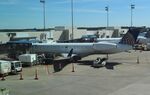
Mark Pasqualino
@ KIAH
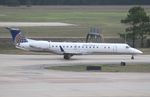
Mark Pasqualino
@ KIAH

Dariusz Jezewski www.FotoDj.com
@ KEWR

Dariusz Jezewski www.FotoDj.com
@ KEWR
Recent Routes
NO LIVE DATA
CommutAir
| Time | Callsign | FL | Speed | Heading | Route |
|---|---|---|---|---|---|
| 2026-10-30 03:52 UTC | UCA4270 / C54270 | FL4 | 118 kt | 156° |
IAD → ROC
IAD
→
ROC
Washington Dulles International Airport → Frederick Douglass/greater Rochester International Airport |
| 2026-10-30 01:24 UTC | UCA4316 / C54316 | — | 23 kt | 11° | — |
| 2026-10-29 23:22 UTC | UCA4249 / C54249 | FL4 | 138 kt | 148° | — |
| 2026-10-29 19:30 UTC | UCA4268 / C54268 | — | 3 kt | 323° | — |
| 2026-10-29 17:44 UTC | UCA4372 / C54372 | FL3 | 141 kt | 118° | — |
| 2026-10-29 15:36 UTC | UCA4308 / C54308 | — | 15 kt | 101° | — |
| 2026-10-29 13:22 UTC | UCA4861 / C54861 | FL30 | 192 kt | 133° | — |
| 2026-10-29 03:32 UTC | UCA4950 / C54950 | FL29 | 154 kt | 133° | — |
| 2026-10-29 01:14 UTC | UCA4259 / C54259 | — | 6 kt | 273° | — |
| 2026-10-28 22:54 UTC | UCA4364 / C54364 | FL15 | 127 kt | 105° | — |
| 2026-10-28 20:12 UTC | UCA4314 / C54314 | — | 1 kt | 11° | — |
| 2026-10-28 16:22 UTC | UCA4369 / C54369 | FL4 | 147 kt | 323° | — |
| 2026-10-28 13:26 UTC | UCA4346 / C54346 | FL4 | 153 kt | 270° | — |
| 2026-10-28 00:30 UTC | UCA4832 / C54832 | FL67 | 264 kt | 218° | — |
| 2026-10-27 22:10 UTC | UCA4309 / C54309 | FL2 | 130 kt | 90° | — |
| 2026-10-27 20:06 UTC | UCA4279 / C54279 | FL130 | 392 kt | 87° | — |
| 2026-10-27 17:54 UTC | UCA4910 / C54910 | FL1 | 134 kt | 90° | — |
| 2026-10-27 16:08 UTC | UCA4894 / C54894 | FL1 | 136 kt | 358° | — |
| 2026-10-27 13:00 UTC | UCA4301 / C54301 | FL58 | 276 kt | 270° | — |
| 2026-10-27 02:00 UTC | UCA4283 / C54283 | FL18 | 179 kt | 155° | — |
| 2026-10-26 22:36 UTC | UCA4365 / C54365 | FL1 | 133 kt | 90° | — |
| 2026-10-26 20:34 UTC | UCA4929 / C54929 | FL60 | 261 kt | 219° | — |
| 2026-10-26 18:00 UTC | UCA4305 / C54305 | FL1 | 132 kt | 90° | — |
| 2026-10-26 15:52 UTC | UCA4290 / C54290 | FL40 | 239 kt | 208° | — |
| 2026-10-26 13:32 UTC | UCA4226 / C54226 | FL2 | 126 kt | 91° | — |
| 2026-10-26 02:40 UTC | UCA4842 / C54842 | — | 3 kt | 107° | — |
| 2026-10-25 21:08 UTC | UCA4902 / C54902 | FL15 | 153 kt | 341° | — |
| 2026-10-25 18:36 UTC | UCA4245 / C54245 | FL2 | 135 kt | 90° | — |
| 2026-10-25 15:56 UTC | UCA4347 / C54347 | FL132 | 381 kt | 75° |
IAH → VKS
IAH
→
VKS
George Bush Intcntl/houston Airport → Vicksburg Municipal Airport |
| 2026-10-25 13:06 UTC | UCA4318 / C54318 | FL3 | 123 kt | 90° | — |
| 2026-10-24 20:44 UTC | UCA4814 / C54814 | FL146 | 356 kt | 24° |
IAH → MS45
IAH
→
MS45
George Bush Intcntl/houston Airport → Bhllc Airport |
| 2026-10-24 18:30 UTC | UCA4851 / C54851 | FL2 | 138 kt | 90° | — |
| 2026-10-24 16:00 UTC | UCA4225 / C54225 | FL11 | 149 kt | 1° | — |
| 2026-10-24 13:20 UTC | UCA4232 / C54232 | FL1 | 148 kt | 270° | — |
| 2026-10-23 20:32 UTC | UCA4344 / C54344 | FL39 | 255 kt | 221° | — |
| 2026-10-23 18:10 UTC | UCA4329 / C54329 | FL3 | 149 kt | 270° | — |
| 2026-10-23 16:04 UTC | UCA4813 / C54813 | FL139 | 348 kt | 220° | — |
| 2026-10-22 17:52 UTC | UCA4909 / C54909 | FL3 | 134 kt | 90° | — |
| 2026-10-22 15:02 UTC | UCA4262 / C54262 | FL5 | 146 kt | 181° | — |
| 2026-10-22 11:20 UTC | UCA4922 / C54922 | — | 3 kt | 17° |
ROA → IAD
ROA
→
IAD
Roanoke/blacksburg Regional (woodrum Fld) Airport → Washington Dulles International Airport |
| 2026-10-22 03:36 UTC | UCA4897 / C54897 | — | 15 kt | 158° |
IAD → ROA
IAD
→
ROA
Washington Dulles International Airport → Roanoke/blacksburg Regional (woodrum Fld) Airport |
| 2026-10-22 00:58 UTC | UCA4235 / C54235 | — | 5 kt | 343° | — |
| 2026-10-21 13:58 UTC | UCA4812 / C54812 | FL4 | 125 kt | 358° | — |
| 2026-10-21 11:14 UTC | UCA4970 / C54970 | — | 10 kt | 287° | — |
| 2026-10-21 03:24 UTC | UCA4321 / C54321 | FL4 | 128 kt | 358° | — |
| 2026-10-21 01:08 UTC | UCA4312 / C54312 | — | 0 kt | 346° | — |
| 2026-10-20 22:56 UTC | UCA4250 / C54250 | FL42 | 192 kt | 46° | — |
| 2026-10-20 20:10 UTC | UCA4819 / C54819 | — | 18 kt | 101° | — |
| 2026-10-20 18:02 UTC | UCA4349 / C54349 | FL24 | 158 kt | 44° | — |
| 2026-10-20 15:18 UTC | UCA4281 / C54281 | — | 12 kt | 295° | — |
| 2026-10-20 13:22 UTC | UCA4333 / C54333 | FL51 | 263 kt | 205° | — |
| 2026-10-20 11:22 UTC | UCA4251 / C54251 | — | 8 kt | 101° | — |
| 2026-10-20 03:20 UTC | UCA4849 / C54849 | FL22 | 164 kt | 44° | — |
| 2026-10-20 01:04 UTC | UCA4267 / C54267 | — | 6 kt | 191° | — |
| 2026-10-19 22:44 UTC | UCA4274 / C54274 | FL7 | 138 kt | 179° | — |
| 2026-10-19 20:16 UTC | UCA4824 / C54824 | — | 1 kt | 53° | — |
| 2026-10-19 17:58 UTC | UCA4241 / C54241 | FL7 | 140 kt | 236° | — |
| 2026-10-19 13:26 UTC | UCA4818 / C54818 | FL16 | 124 kt | 103° | — |
| 2026-10-18 23:26 UTC | UCA4282 / C54282 | FL2 | 120 kt | 129° | — |
| 2026-10-18 13:30 UTC | UCA4844 / C54844 | FL-1 | 135 kt | 91° | — |
| 2026-10-17 23:12 UTC | UCA4323 / C54323 | FL4 | 127 kt | 324° | — |
| 2026-10-17 21:00 UTC | UCA4313 / C54313 | FL2 | 151 kt | 270° | — |
| 2026-10-17 19:04 UTC | UCA4340 / C54340 | FL38 | 152 kt | 357° | — |
| 2026-10-17 04:34 UTC | UCA4295 / C54295 | FL4 | 131 kt | 325° | — |
| 2026-10-14 01:48 UTC | UCA4874 / C54874 | — | 1 kt | 346° |
ROC → IAD
ROC
→
IAD
Frederick Douglass/greater Rochester International Airport → Washington Dulles International Airport |
| 2026-10-14 00:16 UTC | UCA4871 / C54871 | — | 0 kt | 301° |
IAD → ROC
IAD
→
ROC
Washington Dulles International Airport → Frederick Douglass/greater Rochester International Airport |
| 2026-10-13 20:12 UTC | UCA3262 / C53262 | — | 0 kt | 191° | — |
| 2026-10-11 23:42 UTC | UCA4255 / C54255 | FL5 | 132 kt | 147° | — |
| 2026-10-11 13:18 UTC | UCA4837 / C54837 | FL3 | 136 kt | 270° | — |
| 2026-10-11 00:22 UTC | UCA5004 / C55004 | FL26 | 206 kt | 62° | — |
| 2026-10-08 20:26 UTC | UCA4277 / C54277 | FL4 | 135 kt | 90° | — |
| 2026-10-08 17:20 UTC | UCA4276 / C54276 | — | 4 kt | 335° | — |
| 2026-10-08 13:04 UTC | UCA4248 / C54248 | FL5 | 133 kt | 91° | — |
| 2026-10-08 02:36 UTC | UCA4247 / C54247 | FL13 | 137 kt | 200° | — |
| 2026-10-07 15:18 UTC | UCA4357 / C54357 | FL3 | 134 kt | 90° | — |
| 2026-10-07 01:12 UTC | UCA4936 / C54936 | — | 0 kt | 124° | — |
| 2026-10-02 23:36 UTC | UCA4893 / C54893 | FL3 | 132 kt | 90° | — |
| 2026-10-02 19:40 UTC | UCA4315 / C54315 | FL8 | 138 kt | 181° | — |
| 2026-10-02 16:48 UTC | UCA4236 / C54236 | FL5 | 143 kt | 90° | — |
| 2026-10-02 00:46 UTC | UCA4334 / C54334 | FL119 | 343 kt | 67° | — |
| 2026-10-01 22:56 UTC | UCA4984 / C54984 | FL5 | 138 kt | 90° | — |
| 2026-10-01 21:20 UTC | UCA4375 / C54375 | FL99 | 303 kt | 69° |
IAH → KORG
IAH
→
KORG
George Bush Intcntl/houston Airport → Orange County Airport |
| 2026-10-01 19:58 UTC | UCA4924 / C54924 | FL5 | 134 kt | 90° | — |
| 2026-10-01 17:16 UTC | UCA4916 / C54916 | FL47 | 233 kt | 240° | — |
| 2026-09-30 20:40 UTC | UCA4285 / C54285 | — | 6 kt | 276° | — |
| 2026-09-30 18:10 UTC | UCA4303 / C54303 | FL0 | 136 kt | 37° | — |
| 2026-09-30 15:40 UTC | UCA4264 / C54264 | — | 12 kt | 298° | — |
| 2026-09-30 13:28 UTC | UCA4233 / C54233 | FL65 | 276 kt | 252° |
IAD → NC43
IAD
→
NC43
Washington Dulles International Airport → Bear Pen Airport |
Live location data from OpenSky Network
Airframe Info
| Manufacturer | Embraer |
| Model | ERJ-145XR (EMB-145XR) Search all Embraer ERJ-145XR (EMB-145XR) |
| Year built | 2004 |
| Construction Number (C/N) | 14500876 |
| Aircraft Type | Fixed wing multi engine |
| Number of Seats | 55 |
| Number of Engines | 2 |
| Engine Type | Turbofan |
| Engine Manufacturer and Model | Rolls-Royce AE3007 SER |
Aircraft
| Registration Number | N14174 |
| Mode S (ICAO24) Code | a0a9d1 |
| Certification Class | Standard |
| Certification Issued | 2020-06-04 |
| Air Worthiness Test | 2004-12-10 |
| Last Action Taken | 2023-01-22 |
| Current Status | Valid |
Owner
| Registration Type | Corporation |
| Owner | UNITED AIRLINES INC |
| Address |
Chicago, IL 606067147 United States |
| Region | Great Lakes |