N1439A — 1997 Boeing 767-33A/ER Data
5
aircraft records found
N1439A
1997 Boeing 767-33A/ER, c/n 28495 l/n 643
N1439A is a 1997 Boeing 767-33A/ER (serial number 28495, line number 643). It is powered by 2 engines. Registration status is listed as Valid, with ownership recorded under ANDROMEDA LEASING I LLC in Purchase, NY, United States. The profile includes 9 photos documenting this aircraft.
Latest photos of N1439A
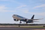
Mark Pasqualino
@ KRFD
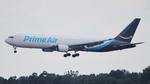
AviationLover50
@ KATL
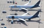
Mark Pasqualino
@ KRFD

Florida Metal
@ KTPA
Recent Routes
NO LIVE DATA
Air Transport International
| Time | Callsign | FL | Speed | Heading | Route |
|---|---|---|---|---|---|
| 2026-10-29 14:06 UTC | ATN3388 / 8C3388 | FL2 | 140 kt | 90° | — |
| 2026-10-29 08:58 UTC | ATN3330 / 8C3330 | FL17 | 151 kt | 269° | — |
| 2026-10-28 22:52 UTC | ATN3332 / 8C3332 | FL11 | 142 kt | 217° | — |
| 2026-10-28 19:34 UTC | ATN | FL32 | 191 kt | 197° | — |
| 2026-10-28 10:20 UTC | ATN3381 / 8C3381 | — | 72 kt | 45° |
AUS → BDL
AUS
→
BDL
Austin-bergstrom International Airport → Bradley International Airport |
| 2026-10-28 05:10 UTC | ATN3319 / 8C3319 | — | 25 kt | 346° |
PHX → AUS
PHX
→
AUS
Phoenix Sky Harbor International Airport → Austin-bergstrom International Airport |
| 2026-10-28 00:34 UTC | ATN3339 / 8C3339 | FL13 | 139 kt | 270° |
AUS → PHX
AUS
→
PHX
Austin-bergstrom International Airport → Phoenix Sky Harbor International Airport |
| 2026-10-27 13:00 UTC | ATN3342 / 8C3342 | FL360 | 396 kt | 247° | — |
| 2026-10-27 06:04 UTC | ATN3390 / 8C3390 | FL2 | 162 kt | 223° | — |
| 2026-10-23 19:28 UTC | ATN3394 / 8C3394 | FL12 | 141 kt | 35° | — |
| 2026-10-23 08:20 UTC | ATN3367 / 8C3367 | FL16 | 144 kt | 270° |
SMF → PHX
SMF
→
PHX
Sacramento International Airport → Phoenix Sky Harbor International Airport |
| 2026-10-23 02:20 UTC | ATN3318 / 8C3318 | FL4 | 130 kt | 180° |
PHX → SMF
PHX
→
SMF
Phoenix Sky Harbor International Airport → Sacramento International Airport |
| 2026-10-22 23:00 UTC | ATN3398 / 8C3398 | — | 20 kt | 270° | — |
| 2026-10-22 12:30 UTC | ATN3311 / 8C3311 | FL8 | 145 kt | 0° |
DEN → CVG
DEN
→
CVG
Denver International Airport → Cincinnati/northern Kentucky International Airport |
| 2026-10-22 07:20 UTC | ATN3321 / 8C3321 | — | 26 kt | 270° | — |
| 2026-10-21 18:14 UTC | ATN3346 / 8C3346 | FL12 | 153 kt | 37° | — |
| 2026-10-21 08:16 UTC | ATN3300 / 8C3300 | — | 54 kt | 298° |
AFW → SFO
AFW
→
SFO
Perot Fld/fort Worth Alliance Airport → San Francisco International Airport |
| 2026-10-21 02:40 UTC | ATN3353 / 8C3353 | FL7 | 139 kt | 171° | — |
| 2026-10-20 21:44 UTC | ATN3304 / 8C3304 | FL12 | 148 kt | 271° | — |
| 2026-10-20 08:12 UTC | ATN3344 / 8C3344 | FL5 | 138 kt | 170° |
ABE → AFW
ABE
→
AFW
Lehigh Valley International Airport → Perot Fld/fort Worth Alliance Airport |
| 2026-10-20 03:06 UTC | ATN3305 / 8C3305 | — | 21 kt | 231° | — |
| 2026-10-19 22:38 UTC | ATN3310 / 8C3310 | FL7 | 143 kt | 170° | — |
| 2026-10-19 16:46 UTC | ATN3384 / 8C3384 | FL6 | 140 kt | 0° | — |
| 2026-10-19 05:32 UTC | ATN3374 / 8C3374 | FL-1 | 134 kt | 90° | — |
| 2026-10-19 00:46 UTC | ATN3301 / 8C3301 | FL6 | 132 kt | 90° | — |
| 2026-10-18 16:44 UTC | ATN3370 / 8C3370 | FL2 | 143 kt | 90° | — |
| 2026-10-18 11:38 UTC | ATN3393 / 8C3393 | — | 25 kt | 270° |
SBD → DEN
SBD
→
DEN
San Bernardino International Airport → Denver International Airport |
| 2026-10-18 05:48 UTC | ATN3364 / 8C3364 | — | 58 kt | 70° | — |
| 2026-10-17 23:28 UTC | ATN3324 / 8C3324 | FL22 | 152 kt | 246° | — |
| 2026-10-17 20:12 UTC | ATN3357 / 8C3357 | — | 25 kt | 231° | — |
| 2026-10-17 11:40 UTC | ATN3359 / 8C3359 | FL6 | 134 kt | 0° |
JFK → CVG
JFK
→
CVG
John F Kennedy International Airport → Cincinnati/northern Kentucky International Airport |
| 2026-10-17 06:18 UTC | ATN3345 / 8C3345 | FL2 | 138 kt | 301° | — |
| 2026-10-12 20:44 UTC | ATN3343 / 8C3343 | FL14 | 145 kt | 218° | — |
| 2026-10-11 18:30 UTC | ATN3369 / 8C3369 | FL12 | 128 kt | 270° | — |
| 2026-10-11 10:18 UTC | ATN3349 / 8C3349 | FL3 | 144 kt | 53° | — |
| 2026-10-10 14:20 UTC | ATN3434 / 8C3434 | — | 20 kt | 152° | — |
| 2026-10-10 06:40 UTC | ATN33808 | FL138 | 342 kt | 296° | — |
| 2026-10-10 04:14 UTC | ATN3382 / 8C3382 | FL4 | 151 kt | 51° | — |
| 2026-10-08 07:00 UTC | ATN3308 / 8C3308 | FL140 | 356 kt | 295° | — |
| 2026-10-06 15:24 UTC | ATN9983 / 8C9983 | FL11 | 143 kt | 270° | — |
| 2026-10-06 07:28 UTC | ATN3383 / 8C3383 | FL5 | 134 kt | 53° | — |
| 2026-10-04 09:16 UTC | ATN3451 / 8C3451 | FL8 | 139 kt | 0° | — |
| 2026-10-04 02:52 UTC | ATN3450 / 8C3450 | FL3 | 149 kt | 90° | — |
| 2026-10-03 18:12 UTC | ATN3392 / 8C3392 | — | 27 kt | 62° | — |
| 2026-10-03 13:42 UTC | ATN3456 / 8C3456 | FL2 | 153 kt | 90° | — |
| 2026-10-03 06:50 UTC | ATN3421 / 8C3421 | — | 44 kt | 87° | — |
| 2026-10-02 20:52 UTC | ATN3537 / 8C3537 | FL9 | 137 kt | 0° | — |
| 2026-10-02 12:14 UTC | ATN3313 / 8C3313 | — | 22 kt | 273° |
KOA → ONT
KOA
→
ONT
Ellison Onizuka Kona International Airport at Keāhole → Ontario International Airport |
| 2026-10-02 04:12 UTC | ATN3307 / 8C3307 | — | 23 kt | 186° | — |
| 2026-10-02 01:52 UTC | ATN3371 / 8C3371 | FL21 | 161 kt | 34° | — |
| 2026-10-01 08:50 UTC | ATN3536 / 8C3536 | FL11 | 153 kt | 270° | — |
Live location data from OpenSky Network
Airframe Info
| Manufacturer | Boeing |
| Model | 767-33A/ER Search all Boeing 767-33A/ER |
| Year built | 1997 |
| Construction Number (C/N) | 28495 |
| Line Number (L/N) | 643 |
| Aircraft Type | Fixed wing multi engine |
| Number of Engines | 2 |
| Engine Type | Turbofan |
| Engine Manufacturer and Model | General Electric CF6-80C2B6F |
| Also Registered As |
Aircraft
| Registration Number | N1439A |
| Mode S (ICAO24) Code | a0b169 |
| Certification Class | Standard |
| Certification Issued | 2018-10-11 |
| Air Worthiness Test | 2018-05-27 |
| Last Action Taken | 2023-06-16 |
| Current Status | Valid |
| Delivery Date | 2017-11-07 |
Owner
| Address |
Purchase, NY 105772530 United States |
| Region | Eastern |