N153PQ — 2007 Bombardier CRJ-900ER (CL-600-2D24) Data
1
aircraft record found
N153PQ
2007 Bombardier CRJ-900ER (CL-600-2D24), c/n 15153
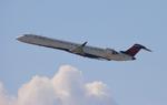
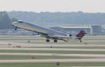
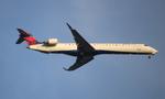
N153PQ is a 2007 Bombardier CRJ-900ER (CL-600-2D24) (serial number 15153). It is configured with 2 engines and 22 seats. Registration status is listed as Valid, with ownership recorded under DELTA AIR LINES INC in Atlanta, GA, United States. The profile includes 22 photos documenting this aircraft.
Latest photos of N153PQ

FloridaMetal
@ KDTW
FloridaMetal
@ KDTW
FloridaMetal
@ KDTW
FloridaMetal
@ KDTW
Recent Routes
NO LIVE DATA
| Time | Callsign | FL | Speed | Heading | Route |
|---|---|---|---|---|---|
| 2026-11-13 21:32 UTC | EDV5391 | — | 0 kt | 309° | — |
| 2026-11-13 18:28 UTC | EDV5423 | FL65 | 190 kt | 51° | — |
| 2026-11-13 16:22 UTC | EDV5111 | FL11 | 23 kt | 267° | — |
| 2026-11-13 11:40 UTC | EDV5403 | — | 2 kt | 270° |
CSG → ATL
CSG
→
ATL
Columbus Airport → Hartsfield/jackson Atlanta International Airport |
| 2026-11-13 02:36 UTC | EDV5429 | FL10 | 134 kt | 53° | — |
| 2026-11-13 00:22 UTC | EDV5374 | — | 2 kt | 267° | — |
| 2026-11-12 21:06 UTC | EDV5302 | — | 3 kt | 267° | — |
| 2026-11-12 16:22 UTC | EDV4666 | FL13 | 131 kt | 270° | — |
| 2026-11-12 12:56 UTC | EDV5317 | — | 4 kt | 267° | — |
| 2026-11-12 00:50 UTC | EDV5203 | FL16 | 135 kt | 225° | — |
| 2026-11-11 21:54 UTC | EDV5466 | — | 3 kt | 267° | — |
| 2026-11-11 17:32 UTC | EDV5432 | — | 1 kt | 267° |
ROA → ATL
ROA
→
ATL
Roanoke/blacksburg Regional (woodrum Fld) Airport → Hartsfield/jackson Atlanta International Airport |
| 2026-11-11 13:10 UTC | EDV4691 | — | 1 kt | 267° |
ABY → ATL
ABY
→
ATL
Southwest Georgia Regional Airport → Hartsfield/jackson Atlanta International Airport |
| 2026-11-11 01:52 UTC | EDV5129 | — | 0 kt | 233° |
ATL → ABY
ATL
→
ABY
Hartsfield/jackson Atlanta International Airport → Southwest Georgia Regional Airport |
| 2026-11-11 00:14 UTC | EDV5389 | — | 0 kt | 110° |
ATL → BMI
ATL
→
BMI
Hartsfield/jackson Atlanta International Airport → Central Il Rgnl/bloomington-normal Airport |
| 2026-11-10 18:38 UTC | EDV4686 | — | 4 kt | 270° | — |
| 2026-11-10 14:24 UTC | EDV4654 | — | 3 kt | 267° | — |
| 2026-11-10 02:36 UTC | EDV5272 | FL16 | 141 kt | 225° | — |
| 2026-11-09 18:52 UTC | EDV4644 | — | 2 kt | 90° | — |
| 2026-11-09 13:10 UTC | EDV4673 | — | 7 kt | 31° | — |
| 2026-11-09 02:28 UTC | EDV4692 | FL9 | 138 kt | 65° | — |
| 2026-11-08 18:36 UTC | EDV5420 | FL1 | 134 kt | 44° | — |
| 2026-11-08 16:18 UTC | EDV5214 | — | 0 kt | 107° | — |
| 2026-11-07 23:42 UTC | EDV5227 | — | 3 kt | 87° |
ATL → ROA
ATL
→
ROA
Hartsfield/jackson Atlanta International Airport → Roanoke/blacksburg Regional (woodrum Fld) Airport |
| 2026-11-07 20:08 UTC | EDV5387 | — | 1 kt | 267° |
ABE → ATL
ABE
→
ATL
Lehigh Valley International Airport → Hartsfield/jackson Atlanta International Airport |
| 2026-11-07 16:52 UTC | EDV5442 | — | 5 kt | 45° |
ATL → ABE
ATL
→
ABE
Hartsfield/jackson Atlanta International Airport → Lehigh Valley International Airport |
| 2026-11-07 13:42 UTC | EDV5383 | — | 6 kt | 101° |
BMI → ATL
BMI
→
ATL
Central Il Rgnl/bloomington-normal Airport → Hartsfield/jackson Atlanta International Airport |
| 2026-11-07 04:20 UTC | EDV5410 | — | 6 kt | 284° |
ATL → BMI
ATL
→
BMI
Hartsfield/jackson Atlanta International Airport → Central Il Rgnl/bloomington-normal Airport |
| 2026-11-07 01:26 UTC | EDV5185 | — | 8 kt | 87° |
ATL → 9LS1
ATL
→
9LS1
Hartsfield/jackson Atlanta International Airport → Bayou Meadows Airport |
| 2026-11-06 20:22 UTC | EDV4955 | — | 15 kt | 87° | — |
| 2026-11-06 16:04 UTC | EDV5309 | — | 10 kt | 180° | — |
| 2026-11-06 12:18 UTC | EDV4661 | — | 9 kt | 177° | — |
| 2026-11-06 03:02 UTC | EDV4669 | FL12 | 145 kt | 46° | — |
| 2026-11-05 20:46 UTC | EDV5157 | — | 0 kt | 293° |
ATL → 9LS1
ATL
→
9LS1
Hartsfield/jackson Atlanta International Airport → Bayou Meadows Airport |
| 2026-11-05 11:48 UTC | EDV4694 | — | 10 kt | 295° |
ABY → ATL
ABY
→
ATL
Southwest Georgia Regional Airport → Hartsfield/jackson Atlanta International Airport |
| 2026-11-04 20:28 UTC | EDV4649 | — | 12 kt | 177° |
ROA → ATL
ROA
→
ATL
Roanoke/blacksburg Regional (woodrum Fld) Airport → Hartsfield/jackson Atlanta International Airport |
| 2026-11-04 17:52 UTC | EDV4628 | — | 12 kt | 231° |
ATL → ROA
ATL
→
ROA
Hartsfield/jackson Atlanta International Airport → Roanoke/blacksburg Regional (woodrum Fld) Airport |
| 2026-11-04 14:00 UTC | EDV4940 | — | 1 kt | 281° | — |
| 2026-11-04 04:02 UTC | EDV5452 | FL92 | 326 kt | 36° | — |
| 2026-11-04 00:18 UTC | EDV5360 | — | 7 kt | 141° | — |
| 2026-11-03 19:42 UTC | EDV5425 | — | 1 kt | 267° | — |
| 2026-11-03 14:04 UTC | EDV5525 | — | 8 kt | 357° | — |
| 2026-11-03 03:48 UTC | EDV5535 | FL26 | 143 kt | 220° | — |
| 2026-11-03 00:42 UTC | EDV4633 | — | 6 kt | 90° | — |
| 2026-11-02 18:50 UTC | EDV5142 | — | 20 kt | 267° | — |
| 2026-11-02 12:28 UTC | EDV5349 | — | 6 kt | 98° | — |
| 2026-11-02 03:08 UTC | EDV5320 | FL35 | 276 kt | 232° | — |
| 2026-11-02 01:08 UTC | EDV5439 | — | 2 kt | 127° | — |
| 2026-11-01 22:16 UTC | EDV5512 | FL20 | 144 kt | 45° | — |
| 2026-11-01 18:54 UTC | EDV4645 | FL5 | 145 kt | 209° | — |
| 2026-11-01 14:02 UTC | EDV5479 | FL4 | 146 kt | 209° | — |
| 2026-11-01 02:12 UTC | EDV5478 | FL6 | 137 kt | 180° | — |
| 2026-10-31 23:42 UTC | EDV5033 | FL3 | 134 kt | 209° | — |
| 2026-10-31 18:44 UTC | EDV5500 | FL3 | 141 kt | 209° | — |
| 2026-10-31 15:56 UTC | EDV5506 | FL-1 | 124 kt | 321° | — |
| 2026-10-31 12:42 UTC | EDV4887 | FL3 | 142 kt | 209° | — |
| 2026-10-31 00:58 UTC | EDV5180 | FL5 | 136 kt | 351° | — |
| 2026-10-30 23:14 UTC | EDV4966 | FL4 | 133 kt | 29° |
BNA → LGA
BNA
→
LGA
Nashville International Airport → Laguardia Airport |
| 2026-10-30 17:44 UTC | EDV4655 | FL4 | 140 kt | 29° | — |
| 2026-10-30 15:32 UTC | EDV5340 | — | 0 kt | 73° |
LGA → ROC
LGA
→
ROC
Laguardia Airport → Frederick Douglass/greater Rochester International Airport |
| 2026-10-30 13:44 UTC | EDV5295 | — | 10 kt | 222° | — |
| 2026-10-30 03:50 UTC | EDV4900 | FL12 | 136 kt | 145° | — |
| 2026-10-29 23:06 UTC | EDV5104 | — | 1 kt | 309° | — |
| 2026-10-29 17:42 UTC | EDV4924 | — | 4 kt | 146° |
BMI → ATL
BMI
→
ATL
Central Il Rgnl/bloomington-normal Airport → Hartsfield/jackson Atlanta International Airport |
| 2026-10-29 11:28 UTC | EDV5177 | — | 3 kt | 309° | — |
| 2026-10-29 00:44 UTC | EDV5071 | FL6 | 146 kt | 229° | — |
| 2026-10-28 22:42 UTC | EDV4643 | FL6 | 133 kt | 209° | — |
| 2026-10-28 20:22 UTC | EDV4680 | FL2 | 135 kt | 150° | — |
| 2026-10-28 16:08 UTC | EDV5325 | — | 7 kt | 219° |
STL → MSP
STL
→
MSP
St Louis Lambert International Airport → Minneapolis-st Paul Intl/wold-chamberlain Airport |
| 2026-10-28 13:02 UTC | EDV4939 | — | 6 kt | 124° |
LGA → STL
LGA
→
STL
Laguardia Airport → St Louis Lambert International Airport |
| 2026-10-28 01:08 UTC | EDV4928 | — | 0 kt | 326° | — |
| 2026-10-27 18:40 UTC | EDV5267 | — | 0 kt | 132° | — |
| 2026-10-27 12:20 UTC | EDV5419 | — | 0 kt | 312° | — |
| 2026-10-26 19:00 UTC | EDV5533 | FL5 | 139 kt | 28° | — |
| 2026-10-26 14:36 UTC | EDV5213 | FL4 | 138 kt | 209° | — |
| 2026-10-26 00:40 UTC | EDV5514 | FL4 | 133 kt | 209° | — |
| 2026-10-25 22:04 UTC | EDV5107 | FL19 | 139 kt | 46° | — |
| 2026-10-25 19:26 UTC | EDV5482 | — | 10 kt | 183° | — |
| 2026-10-24 22:46 UTC | EDV5194 | FL4 | 136 kt | 50° | — |
| 2026-10-24 19:56 UTC | EDV4719 | — | 11 kt | 219° |
YUL → LGA
YUL
→
LGA
Montreal / Pierre Elliott Trudeau International Airport → Laguardia Airport |
| 2026-10-24 17:10 UTC | EDV4751 | — | 13 kt | 149° |
LGA → YUL
LGA
→
YUL
Laguardia Airport → Montreal / Pierre Elliott Trudeau International Airport |
| 2026-10-24 14:36 UTC | EDV5457 | — | 6 kt | 281° | — |
| 2026-10-24 01:20 UTC | EDV5398 | FL2 | 137 kt | 0° | — |
| 2026-10-23 22:34 UTC | EDV5010 | — | 3 kt | 146° |
LGA → BGR
LGA
→
BGR
Laguardia Airport → Bangor International Airport |
| 2026-10-23 18:04 UTC | EDV5025 | — | 2 kt | 138° | — |
| 2026-10-23 12:24 UTC | EDV4933 | — | 10 kt | 222° | — |
| 2026-10-23 02:12 UTC | EDV4915 | FL1 | 133 kt | 70° | — |
| 2026-10-22 23:10 UTC | EDV5388 | — | 10 kt | 222° | — |
| 2026-10-22 19:28 UTC | EDV5357 | — | 10 kt | 217° | — |
| 2026-10-22 14:28 UTC | EDV4981 | — | 8 kt | 231° |
STL → LGA
STL
→
LGA
St Louis Lambert International Airport → Laguardia Airport |
| 2026-10-22 01:18 UTC | EDV4926 | — | 6 kt | 124° |
LGA → STL
LGA
→
STL
Laguardia Airport → St Louis Lambert International Airport |
| 2026-10-21 21:34 UTC | EDV5463 | — | 0 kt | 312° |
LGA → GSP
LGA
→
GSP
Laguardia Airport → Greenville Spartanburg International Airport |
| 2026-10-21 15:56 UTC | EDV5447 | — | 2 kt | 135° |
YYZ → LGA
YYZ
→
LGA
Lester B Pearson International Airport → Laguardia Airport |
| 2026-10-21 13:32 UTC | EDV5187 | FL2 | 0 kt | 87° |
LGA → YYZ
LGA
→
YYZ
Laguardia Airport → Lester B Pearson International Airport |
| 2026-10-21 01:16 UTC | EDV5449 | — | 3 kt | 309° |
YUL → LGA
YUL
→
LGA
Montreal / Pierre Elliott Trudeau International Airport → Laguardia Airport |
| 2026-10-20 22:52 UTC | EDV5197 | — | 4 kt | 166° |
LGA → YUL
LGA
→
YUL
Laguardia Airport → Montreal / Pierre Elliott Trudeau International Airport |
| 2026-10-20 20:02 UTC | EDV5166 | — | 0 kt | 155° |
YYZ → LGA
YYZ
→
LGA
Lester B Pearson International Airport → Laguardia Airport |
| 2026-10-20 17:22 UTC | EDV5094 | — | 0 kt | 113° |
LGA → YYZ
LGA
→
YYZ
Laguardia Airport → Lester B Pearson International Airport |
| 2026-10-20 14:56 UTC | EDV4631 | — | 0 kt | 129° | — |
| 2026-10-20 00:20 UTC | EDV4630 | FL5 | 134 kt | 183° | — |
| 2026-10-19 14:58 UTC | EDV5139 | — | 1 kt | 298° |
YUL → LGA
YUL
→
LGA
Montreal / Pierre Elliott Trudeau International Airport → Laguardia Airport |
| 2026-10-19 12:40 UTC | EDV4963 | — | 12 kt | 124° |
LGA → YUL
LGA
→
YUL
Laguardia Airport → Montreal / Pierre Elliott Trudeau International Airport |
| 2026-10-18 01:46 UTC | EDV5206 | FL46 | 215 kt | 52° | — |
| 2026-10-17 22:48 UTC | EDV4993 | — | 11 kt | 87° | — |
| 2026-10-17 17:36 UTC | EDV5001 | — | 0 kt | 107° | — |
| 2026-10-17 11:44 UTC | EDV4632 | — | 1 kt | 309° | — |
| 2026-10-17 03:36 UTC | EDV4657 | FL62 | 244 kt | 356° | — |
| 2026-10-16 22:04 UTC | EDV5308 | — | 0 kt | 278° | — |
| 2026-10-16 17:00 UTC | EDV5352 | — | 6 kt | 270° | — |
| 2026-10-16 00:30 UTC | EDV5508 | — | 0 kt | 270° | — |
| 2026-10-15 20:22 UTC | EDV4953 | — | 0 kt | 270° |
ATL → KM95
ATL
→
KM95
Hartsfield/jackson Atlanta International Airport → Richard Arthur Fld Airport |
| 2026-10-15 16:38 UTC | EDV4930 | — | 3 kt | 264° | — |
| 2026-10-15 09:42 UTC | EDV5282 | — | 2 kt | 284° | — |
Live location data from OpenSky Network
Airframe Info
| Manufacturer | Bombardier |
| Model | CRJ-900ER (CL-600-2D24) Search all Bombardier CRJ-900ER (CL-600-2D24) |
| Year built | 2007 |
| Construction Number (C/N) | 15153 |
| Aircraft Type | Fixed wing multi engine |
| Number of Seats | 22 |
| Number of Engines | 2 |
| Engine Type | Turbofan |
| Engine Manufacturer and Model | Ge CF34-8C5 |
Aircraft
| Registration Number | N153PQ |
| Mode S (ICAO24) Code | a0d6a8 |
| Certification Class | Standard |
| Certification Issued | 2013-12-24 |
| Air Worthiness Test | 2007-12-19 |
| Last Action Taken | 2023-09-22 |
| Current Status | Valid |
Owner
| Registration Type | Corporation |
| Owner | DELTA AIR LINES INC |
| Address |
Dept 595 Aircraft Registrations Atlanta, GA 30354 United States |
| Region | Southern |