N16151 — 2003 Embraer ERJ-145XR (EMB-145XR) Data
2
aircraft records found
N16151
2003 Embraer ERJ-145XR (EMB-145XR), c/n 145758
N16151 is a 2003 Embraer ERJ-145XR (EMB-145XR) (serial number 145758). It is configured with 2 engines and 55 seats. Registration status is listed as Valid, with ownership recorded under UNITED AIRLINES INC in Chicago, IL, United States. The profile includes 6 photos documenting this aircraft.
Latest photos of N16151
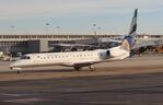
Mark Pasqualino
@ KIAD
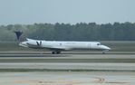
Mark Pasqualino
@ KIAH

Mark Pasqualino
@ KORD

Mark Pasqualino
@ KORD
Recent Routes
NO LIVE DATA
CommutAir
| Time | Callsign | FL | Speed | Heading | Route |
|---|---|---|---|---|---|
| 2026-10-21 20:18 UTC | UCA4356 / C54356 | FL2 | 143 kt | 89° | — |
| 2026-10-21 18:10 UTC | UCA4238 / C54238 | FL4 | 134 kt | 39° |
IAH → 12LS
IAH
→
12LS
George Bush Intcntl/houston Airport → Hains Airstrip Airport |
| 2026-10-21 14:56 UTC | UCA4863 / C54863 | FL2 | 128 kt | 90° | — |
| 2026-10-21 02:42 UTC | UCA4306 / C54306 | FL46 | 145 kt | 180° | — |
| 2026-10-20 21:42 UTC | UCA4996 / C54996 | FL2 | 128 kt | 90° | — |
| 2026-10-20 19:00 UTC | UCA4343 / C54343 | FL10 | 129 kt | 142° | — |
| 2026-10-20 15:16 UTC | UCA4357 / C54357 | FL1 | 130 kt | 90° | — |
| 2026-10-20 00:50 UTC | UCA4941 / C54941 | FL2 | 117 kt | 90° | — |
| 2026-10-19 22:24 UTC | UCA4290 / C54290 | FL0 | 134 kt | 44° | — |
| 2026-10-19 19:54 UTC | UCA4980 / C54980 | FL2 | 139 kt | 90° | — |
| 2026-10-19 17:50 UTC | UCA4287 / C54287 | FL65 | 275 kt | 212° | — |
| 2026-10-19 15:48 UTC | UCA4358 / C54358 | FL1 | 136 kt | 90° | — |
| 2026-10-19 13:34 UTC | UCA4324 / C54324 | FL38 | 235 kt | 209° | — |
| 2026-10-18 23:30 UTC | UCA4348 / C54348 | FL2 | 130 kt | 90° | — |
| 2026-10-18 20:42 UTC | UCA4814 / C54814 | FL146 | 396 kt | 74° |
IAH → VKS
IAH
→
VKS
George Bush Intcntl/houston Airport → Vicksburg Municipal Airport |
| 2026-10-18 18:12 UTC | UCA4928 / C54928 | FL1 | 138 kt | 90° | — |
| 2026-10-18 16:04 UTC | UCA4918 / C54918 | FL48 | 229 kt | 219° | — |
| 2026-10-18 13:18 UTC | UCA4318 / C54318 | FL1 | 124 kt | 90° | — |
| 2026-10-18 00:32 UTC | UCA4334 / C54334 | FL107 | 354 kt | 73° | — |
| 2026-10-17 21:26 UTC | UCA4352 / C54352 | FL3 | 144 kt | 271° | — |
| 2026-10-17 19:08 UTC | UCA4969 / C54969 | FL13 | 143 kt | 339° | — |
| 2026-10-17 15:44 UTC | UCA4236 / C54236 | FL-1 | 142 kt | 90° | — |
| 2026-10-16 21:32 UTC | UCA4256 / C54256 | FL2 | 157 kt | 270° | — |
| 2026-10-16 18:30 UTC | UCA4249 / C54249 | FL9 | 125 kt | 339° | — |
| 2026-10-15 22:40 UTC | UCA4997 / C54997 | FL4 | 127 kt | 90° | — |
| 2026-10-15 20:56 UTC | UCA4836 / C54836 | FL1 | 132 kt | 43° | — |
| 2026-10-15 19:16 UTC | UCA4953 / C54953 | FL4 | 134 kt | 90° | — |
| 2026-10-15 17:28 UTC | UCA4826 / C54826 | FL28 | 258 kt | 10° | — |
| 2026-10-15 15:36 UTC | UCA4346 / C54346 | FL4 | 142 kt | 89° | — |
| 2026-10-15 02:24 UTC | UCA4309 / C54309 | FL61 | 258 kt | 216° | — |
| 2026-10-14 23:26 UTC | UCA4305 / C54305 | FL4 | 128 kt | 90° | — |
| 2026-10-14 20:52 UTC | UCA4322 / C54322 | FL41 | 252 kt | 246° | — |
| 2026-10-14 13:20 UTC | UCA4275 / C54275 | FL3 | 133 kt | 90° | — |
| 2026-10-14 02:54 UTC | UCA4856 / C54856 | FL6 | 123 kt | 136° | — |
| 2026-10-13 17:10 UTC | UCA4878 / C54878 | FL4 | 145 kt | 90° | — |
| 2026-10-12 23:14 UTC | UCA4323 / C54323 | FL6 | 146 kt | 324° | — |
| 2026-10-12 20:16 UTC | UCA4243 / C54243 | FL4 | 131 kt | 90° | — |
| 2026-10-12 18:00 UTC | UCA4272 / C54272 | FL8 | 134 kt | 136° | — |
| 2026-10-12 15:22 UTC | UCA4224 / C54224 | FL3 | 128 kt | 90° | — |
| 2026-10-12 03:02 UTC | UCA4839 / C54839 | FL156 | 338 kt | 315° | — |
| 2026-10-11 18:28 UTC | UCA4851 / C54851 | FL3 | 139 kt | 90° | — |
| 2026-10-11 15:48 UTC | UCA4225 / C54225 | FL10 | 127 kt | 340° | — |
| 2026-10-11 13:08 UTC | UCA4330 / C54330 | FL4 | 135 kt | 270° | — |
| 2026-10-11 01:46 UTC | UCA4985 / C54985 | FL79 | 278 kt | 74° | — |
| 2026-10-10 18:14 UTC | UCA4291 / C54291 | FL3 | 130 kt | 90° | — |
| 2026-10-10 15:48 UTC | UCA4278 / C54278 | FL13 | 135 kt | 160° | — |
| 2026-10-10 01:00 UTC | UCA3263 / C53263 | FL4 | 117 kt | 90° | — |
| 2026-10-09 18:56 UTC | UCA4848 / C54848 | — | 5 kt | 245° | — |
| 2026-10-09 14:30 UTC | UCA4257 / C54257 | FL10 | 130 kt | 45° | — |
| 2026-10-09 11:22 UTC | UCA4922 / C54922 | — | 10 kt | 11° |
ROA → IAD
ROA
→
IAD
Roanoke/blacksburg Regional (woodrum Fld) Airport → Washington Dulles International Airport |
| 2026-10-09 03:34 UTC | UCA4897 / C54897 | FL10 | 120 kt | 230° |
IAD → ROA
IAD
→
ROA
Washington Dulles International Airport → Roanoke/blacksburg Regional (woodrum Fld) Airport |
| 2026-10-09 00:42 UTC | UCA4975 / C54975 | — | 1 kt | 346° | — |
| 2026-10-08 22:34 UTC | UCA4847 / C54847 | FL19 | 135 kt | 232° | — |
| 2026-10-08 20:46 UTC | UCA4819 / C54819 | — | 6 kt | 343° | — |
| 2026-10-08 17:56 UTC | UCA4349 / C54349 | FL32 | 247 kt | 226° | — |
| 2026-10-08 15:42 UTC | UCA4296 / C54296 | — | 12 kt | 101° | — |
| 2026-10-08 13:48 UTC | UCA4327 / C54327 | FL10 | 130 kt | 236° | — |
| 2026-10-08 11:02 UTC | UCA4251 / C54251 | — | 8 kt | 281° | — |
| 2026-10-08 03:24 UTC | UCA4849 / C54849 | FL22 | 144 kt | 230° | — |
| 2026-10-08 01:06 UTC | UCA4242 / C54242 | — | 1 kt | 354° | — |
| 2026-10-07 22:38 UTC | UCA4963 / C54963 | FL10 | 137 kt | 212° | — |
| 2026-10-06 20:12 UTC | UCA4285 / C54285 | — | 0 kt | 53° | — |
| 2026-10-06 17:58 UTC | UCA4303 / C54303 | FL0 | 138 kt | 39° | — |
| 2026-10-06 15:46 UTC | UCA4332 / C54332 | — | 4 kt | 37° |
ROA → IAD
ROA
→
IAD
Roanoke/blacksburg Regional (woodrum Fld) Airport → Washington Dulles International Airport |
| 2026-10-06 01:30 UTC | UCA4235 / C54235 | — | 11 kt | 304° | — |
| 2026-10-05 14:18 UTC | UCA4812 / C54812 | FL6 | 130 kt | 267° | — |
| 2026-10-05 00:28 UTC | UCA4940 / C54940 | — | 0 kt | 346° | — |
| 2026-10-04 22:08 UTC | UCA4266 / C54266 | FL39 | 229 kt | 200° | — |
| 2026-10-04 16:30 UTC | UCA4264 / C54264 | — | 3 kt | 262° | — |
| 2026-10-04 13:30 UTC | UCA4233 / C54233 | FL71 | 269 kt | 194° |
IAD → K60J
IAD
→
K60J
Washington Dulles International Airport → Odell Williamson Municipal Airport |
| 2026-10-04 11:26 UTC | UCA4939 / C54939 | — | 10 kt | 191° | — |
| 2026-10-04 03:20 UTC | UCA4950 / C54950 | FL52 | 285 kt | 35° | — |
| 2026-10-04 01:00 UTC | UCA4954 / C54954 | — | 10 kt | 343° | — |
| 2026-10-03 22:44 UTC | UCA4945 / C54945 | FL52 | 244 kt | 56° | — |
| 2026-10-03 19:22 UTC | UCA4938 / C54938 | — | 12 kt | 357° | — |
| 2026-10-03 17:40 UTC | UCA4253 / C54253 | FL13 | 133 kt | 53° | — |
| 2026-10-02 00:54 UTC | UCA4351 / C54351 | — | 12 kt | 101° | — |
| 2026-10-01 21:34 UTC | UCA4946 / C54946 | FL6 | 137 kt | 181° | — |
| 2026-09-30 22:24 UTC | UCA4377 / C54377 | FL6 | 141 kt | 90° | — |
| 2026-09-30 20:10 UTC | UCA4825 / C54825 | FL8 | 141 kt | 136° | — |
| 2026-09-30 00:26 UTC | UCA4295 / C54295 | FL32 | 242 kt | 245° | — |
| 2026-09-28 13:42 UTC | EPJ | FL122 | 302 kt | 345° | — |
| 2026-09-28 10:52 UTC | UCA4359 / C54359 | — | 14 kt | 301° | — |
| 2026-09-28 03:34 UTC | UCA4252 / C54252 | FL18 | 145 kt | 234° | — |
| 2026-09-27 15:42 UTC | UCA4227 / C54227 | — | 1 kt | 346° | — |
| 2026-09-27 13:28 UTC | UCA4239 / C54239 | FL29 | 111 kt | 34° | — |
| 2026-09-26 01:50 UTC | UCA4874 / C54874 | — | 16 kt | 11° |
ROC → IAD
ROC
→
IAD
Frederick Douglass/greater Rochester International Airport → Washington Dulles International Airport |
| 2026-09-25 23:10 UTC | UCA4871 / C54871 | — | 0 kt | 335° |
IAD → ROC
IAD
→
ROC
Washington Dulles International Airport → Frederick Douglass/greater Rochester International Airport |
| 2026-09-25 20:28 UTC | UCA4942 / C54942 | — | 0 kt | 11° | — |
Live location data from OpenSky Network
Airframe Info
| Manufacturer | Embraer |
| Model | ERJ-145XR (EMB-145XR) Search all Embraer ERJ-145XR (EMB-145XR) |
| Year built | 2003 |
| Construction Number (C/N) | 145758 |
| Aircraft Type | Fixed wing multi engine |
| Number of Seats | 55 |
| Number of Engines | 2 |
| Engine Type | Turbofan |
| Engine Manufacturer and Model | Rolls-Royce Ae3007A1E |
| Also Registered As |
PT-SJQ
Manufacturer's registration
|
Aircraft
| Registration Number | N16151 |
| Mode S (ICAO24) Code | a0f886 |
| Certification Class | Standard |
| Certification Issued | 2019-04-26 |
| Air Worthiness Test | 2003-11-14 |
| Last Action Taken | 2025-05-12 |
| Current Status | Valid |
Owner
| Registration Type | Corporation |
| Owner | UNITED AIRLINES INC |
| Address |
Chicago, IL 606067147 United States |
| Region | Great Lakes |