Aircraft N300PQ Data
1
aircraft record found
N300PQ
2013 Bombardier CRJ-900LR (CL-600-2D24), c/n 15300
Latest photos of N300PQ
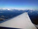
MichaLueck

Todd Royer
@ KMSP

Todd Royer
@ KMSP
Recent Routes
NO LIVE DATA
| Time | Callsign | FL | Speed | Heading | Route |
|---|---|---|---|---|---|
| 2026-10-23 22:40 UTC | EDV5178 | FL3 | 134 kt | 91° | — |
| 2026-10-23 19:40 UTC | EDV4956 | — | 0 kt | 132° |
LGA → RDU
LGA
→
RDU
Laguardia Airport → Raleigh-durham International Airport |
| 2026-10-23 16:16 UTC | EDV5300 | FL2 | 134 kt | 45° | — |
| 2026-10-23 13:44 UTC | EDV5440 | — | 10 kt | 155° |
LGA → BNA
LGA
→
BNA
Laguardia Airport → Nashville International Airport |
| 2026-10-23 03:18 UTC | EDV5091 | — | 10 kt | 219° | — |
| 2026-10-22 21:02 UTC | EDV5165 | FL5 | 138 kt | 345° | — |
| 2026-10-22 18:28 UTC | EDV5499 | FL5 | 142 kt | 29° | — |
| 2026-10-22 15:54 UTC | EDV5509 | FL11 | 128 kt | 328° | — |
| 2026-10-22 12:54 UTC | EDV5232 | — | 19 kt | 208° | — |
| 2026-10-22 00:24 UTC | EDV5249 | FL58 | 272 kt | 240° | — |
| 2026-10-21 22:40 UTC | EDV5385 | FL5 | 141 kt | 29° | — |
| 2026-10-21 17:52 UTC | EDV4645 | FL5 | 137 kt | 28° | — |
| 2026-10-21 00:38 UTC | EDV5532 | FL4 | 134 kt | 209° | — |
| 2026-10-20 21:56 UTC | EDV5534 | FL7 | 141 kt | 359° | — |
| 2026-10-20 19:12 UTC | EDV5257 | FL5 | 144 kt | 210° | — |
| 2026-10-20 15:16 UTC | EDV5263 | FL3 | 150 kt | 209° | — |
| 2026-10-20 11:22 UTC | EDV5088 | FL3 | 150 kt | 209° | — |
| 2026-10-20 01:32 UTC | EDV5407 | FL22 | 126 kt | 46° | — |
| 2026-10-19 23:00 UTC | EDV5367 | FL4 | 134 kt | 208° |
YUL → DTW
YUL
→
DTW
Montreal / Pierre Elliott Trudeau International Airport → Detroit Metro Wayne County Airport |
| 2026-10-19 20:42 UTC | EDV4816 | — | 8 kt | 166° | — |
| 2026-10-19 17:14 UTC | EDV5505 | FL4 | 140 kt | 209° | — |
| 2026-10-19 14:30 UTC | EDV5502 | FL17 | 127 kt | 56° | — |
| 2026-10-19 11:36 UTC | EDV4652 | FL3 | 134 kt | 209° | — |
| 2026-10-19 01:46 UTC | EDV4894 | FL9 | 135 kt | 18° | — |
| 2026-10-18 22:56 UTC | EDV4935 | — | 17 kt | 276° | — |
| 2026-10-18 17:20 UTC | EDV5287 | FL3 | 134 kt | 209° | — |
| 2026-10-18 14:42 UTC | EDV5453 | FL11 | 130 kt | 46° | — |
| 2026-10-18 11:34 UTC | EDV5311 | — | 4 kt | 298° |
ROC → LGA
ROC
→
LGA
Frederick Douglass/greater Rochester International Airport → Laguardia Airport |
| 2026-10-18 00:58 UTC | EDV5343 | — | 0 kt | 59° |
LGA → ROC
LGA
→
ROC
Laguardia Airport → Frederick Douglass/greater Rochester International Airport |
| 2026-10-17 22:34 UTC | EDV4961 | — | 7 kt | 222° | — |
| 2026-10-17 15:28 UTC | EDV5026 | FL7 | 130 kt | 359° | — |
| 2026-10-17 12:38 UTC | EDV5120 | — | 13 kt | 276° | — |
| 2026-10-17 03:20 UTC | EDV4648 | FL6 | 131 kt | 225° | — |
| 2026-10-17 00:10 UTC | EDV5408 | FL15 | 121 kt | 13° |
JFK → 21MO
JFK
→
21MO
John F Kennedy International Airport → Baker Farm Airport |
| 2026-10-16 19:24 UTC | EDV5009 | FL2 | 129 kt | 210° | — |
| 2026-10-16 16:24 UTC | EDV5042 | — | 88 kt | 222° |
LGA → RDU
LGA
→
RDU
Laguardia Airport → Raleigh-durham International Airport |
| 2026-10-16 13:34 UTC | EDV5295 | — | 2 kt | 298° | — |
| 2026-10-16 04:38 UTC | EDV4900 | FL14 | 125 kt | 324° | — |
| 2026-10-16 00:34 UTC | EDV5231 | — | 12 kt | 219° | — |
| 2026-10-15 22:20 UTC | EDV4954 | FL8 | 140 kt | 50° | — |
| 2026-10-15 20:34 UTC | EDV5021 | FL7 | 143 kt | 28° | — |
| 2026-10-15 18:08 UTC | EDV5266 | FL7 | 143 kt | 181° |
ATL → HSV
ATL
→
HSV
Hartsfield/jackson Atlanta International Airport → Huntsville Intl-carl T Jones Fld Airport |
| 2026-10-15 15:40 UTC | EDV5111 | — | 6 kt | 73° | — |
| 2026-10-15 11:56 UTC | EDV4912 | — | 1 kt | 87° |
DHN → ATL
DHN
→
ATL
Dothan Regional Airport → Hartsfield/jackson Atlanta International Airport |
| 2026-10-15 01:32 UTC | EDV4910 | — | 7 kt | 82° |
ATL → DHN
ATL
→
DHN
Hartsfield/jackson Atlanta International Airport → Dothan Regional Airport |
| 2026-10-14 23:58 UTC | EDV5374 | — | 1 kt | 287° | — |
| 2026-10-14 21:00 UTC | EDV5468 | — | 0 kt | 293° | — |
| 2026-10-14 15:46 UTC | EDV5142 | — | 0 kt | 107° | — |
| 2026-10-14 11:14 UTC | EDV5349 | — | 1 kt | 267° | — |
| 2026-10-14 03:32 UTC | EDV5206 | FL38 | 225 kt | 202° | — |
| 2026-10-13 23:30 UTC | EDV4633 | — | 8 kt | 143° | — |
| 2026-10-13 18:14 UTC | EDV4955 | — | 3 kt | 65° | — |
| 2026-10-13 14:52 UTC | EDV5309 | — | 5 kt | 129° | — |
| 2026-10-13 11:18 UTC | EDV4661 | — | 4 kt | 124° | — |
| 2026-10-13 03:18 UTC | EDV4669 | FL12 | 162 kt | 48° | — |
| 2026-10-13 00:16 UTC | EDV5508 | — | 0 kt | 107° | — |
| 2026-10-12 20:22 UTC | EDV5379 | — | 1 kt | 270° | — |
| 2026-10-12 17:20 UTC | EDV5001 | — | 2 kt | 87° | — |
| 2026-10-11 23:06 UTC | EDV4694 | — | 0 kt | 276° |
ATL → ABY
ATL
→
ABY
Hartsfield/jackson Atlanta International Airport → Southwest Georgia Regional Airport |
| 2026-10-11 18:58 UTC | EDV5387 | — | 0 kt | 87° |
ABE → ATL
ABE
→
ATL
Lehigh Valley International Airport → Hartsfield/jackson Atlanta International Airport |
| 2026-10-11 15:48 UTC | EDV5442 | — | 15 kt | 228° |
ATL → ABE
ATL
→
ABE
Hartsfield/jackson Atlanta International Airport → Lehigh Valley International Airport |
| 2026-10-11 12:16 UTC | EDV4632 | — | 0 kt | 290° | — |
| 2026-10-11 03:24 UTC | EDV4657 | FL60 | 264 kt | 352° | — |
| 2026-10-11 00:24 UTC | EDV5275 | — | 8 kt | 357° | — |
| 2026-10-10 21:38 UTC | EDV48B9 | FL14 | 144 kt | 160° | — |
| 2026-10-10 18:38 UTC | EDV5278 | FL5 | 135 kt | 209° | — |
| 2026-10-10 16:18 UTC | EDV4904 | FL10 | 141 kt | 133° |
LGA → DSM
LGA
→
DSM
Laguardia Airport → Des Moines International Airport |
| 2026-10-10 11:20 UTC | EDV5355 | — | 1 kt | 293° | — |
| 2026-10-10 02:44 UTC | EDV5524 | FL75 | 262 kt | 3° | — |
| 2026-10-10 00:32 UTC | EDV5102 | — | 4 kt | 191° | — |
| 2026-10-09 17:18 UTC | EDV4983 | — | 9 kt | 208° | — |
| 2026-10-09 14:26 UTC | EDV5347 | FL15 | 129 kt | 45° | — |
| 2026-10-09 12:14 UTC | EDV5470 | FL5 | 136 kt | 209° | — |
| 2026-10-09 03:40 UTC | EDV5209 | — | 20 kt | 222° | — |
| 2026-10-09 00:38 UTC | EDV5514 | FL7 | 143 kt | 209° | — |
| 2026-10-08 22:00 UTC | EDV5107 | FL29 | 195 kt | 227° | — |
| 2026-10-08 19:44 UTC | EDV5329 | — | 16 kt | 34° | — |
| 2026-10-08 15:10 UTC | EDV5333 | — | 0 kt | 290° | — |
| 2026-10-08 11:00 UTC | EDV5137 | — | 1 kt | 132° |
BGR → LGA
BGR
→
LGA
Bangor International Airport → Laguardia Airport |
| 2026-10-08 03:12 UTC | EDV5396 | — | 6 kt | 14° |
LGA → BGR
LGA
→
BGR
Laguardia Airport → Bangor International Airport |
| 2026-10-07 16:32 UTC | EDV5372 | — | 2 kt | 87° | — |
| 2026-10-07 11:58 UTC | EDV5225 | — | 1 kt | 267° | — |
| 2026-10-07 03:38 UTC | EDV5358 | FL1 | 128 kt | 348° | — |
| 2026-10-07 00:06 UTC | EDV5105 | — | 1 kt | 267° | — |
| 2026-10-06 19:52 UTC | EDV5288 | — | 0 kt | 267° | — |
| 2026-10-06 00:56 UTC | EDV5236 | FL1 | 139 kt | 348° | — |
| 2026-10-05 22:50 UTC | EDV5076 | — | 12 kt | 177° | — |
| 2026-10-05 19:22 UTC | EDV4658 | FL5 | 133 kt | 330° | — |
| 2026-10-05 16:42 UTC | EDV5058 | FL5 | 141 kt | 29° | — |
| 2026-10-05 02:16 UTC | EDV5276 | FL13 | 138 kt | 17° | — |
| 2026-10-04 22:44 UTC | EDV5048 | — | 0 kt | 290° |
LGA → CLT
LGA
→
CLT
Laguardia Airport → Charlotte/douglas International Airport |
| 2026-10-04 17:04 UTC | EDV4962 | — | 0 kt | 132° | — |
| 2026-10-04 11:20 UTC | EDV5177 | — | 0 kt | 138° | — |
| 2026-10-03 22:38 UTC | EDV5194 | FL6 | 128 kt | 49° | — |
| 2026-10-03 20:16 UTC | EDV5156 | — | 0 kt | 141° | — |
| 2026-10-03 01:38 UTC | EDV5101 | — | 3 kt | 312° |
LGA → RDU
LGA
→
RDU
Laguardia Airport → Raleigh-durham International Airport |
| 2026-10-02 20:08 UTC | EDV5415 | — | 2 kt | 309° | — |
| 2026-10-02 12:38 UTC | EDV5237 | — | 6 kt | 219° | — |
| 2026-10-02 02:54 UTC | EDV5204 | FL7 | 134 kt | 228° | — |
| 2026-10-02 00:28 UTC | EDV5089 | — | 0 kt | 326° | — |
| 2026-10-01 17:48 UTC | EDV4924 | — | 14 kt | 98° | — |
| 2026-10-01 11:38 UTC | EDV5292 | — | 12 kt | 163° | — |
| 2026-10-01 01:44 UTC | EDV5118 | FL28 | 142 kt | 226° | — |
| 2026-09-30 17:04 UTC | EDV5186 | — | 10 kt | 211° | — |
| 2026-09-30 11:38 UTC | EDV4948 | — | 10 kt | 219° | — |
| 2026-09-30 00:06 UTC | EDV4999 | FL9 | 137 kt | 180° | — |
| 2026-09-29 20:44 UTC | EDV5166 | — | 5 kt | 152° |
YYZ → LGA
YYZ
→
LGA
Lester B Pearson International Airport → Laguardia Airport |
| 2026-09-29 18:28 UTC | EDV5094 | — | 0 kt | 90° |
LGA → YYZ
LGA
→
YYZ
Laguardia Airport → Lester B Pearson International Airport |
| 2026-09-29 16:10 UTC | EDV5068 | — | 2 kt | 293° | — |
| 2026-09-29 03:40 UTC | EDV5297 | — | 0 kt | 59° |
JFK → ROC
JFK
→
ROC
John F Kennedy International Airport → Frederick Douglass/greater Rochester International Airport |
| 2026-09-29 01:12 UTC | EDV5250 | FL2 | 139 kt | 301° | — |
| 2026-09-28 16:58 UTC | EDV5017 | FL5 | 141 kt | 225° |
BNA → LGA
BNA
→
LGA
Nashville International Airport → Laguardia Airport |
| 2026-09-28 14:18 UTC | EDV5210 | — | 11 kt | 214° | — |
| 2026-09-27 20:30 UTC | EDV5496 | FL6 | 126 kt | 1° |
LGA → HSV
LGA
→
HSV
Laguardia Airport → Huntsville Intl-carl T Jones Fld Airport |
| 2026-09-27 13:14 UTC | EDV5321 | — | 3 kt | 309° |
ROA → LGA
ROA
→
LGA
Roanoke/blacksburg Regional (woodrum Fld) Airport → Laguardia Airport |
| 2026-09-26 20:40 UTC | EDV5155 | — | 8 kt | 53° |
LGA → ROA
LGA
→
ROA
Laguardia Airport → Roanoke/blacksburg Regional (woodrum Fld) Airport |
| 2026-09-26 18:12 UTC | EDV5075 | — | 10 kt | 219° | — |
| 2026-09-26 03:38 UTC | EDV4967 | — | 14 kt | 309° |
AUS → RDU
AUS
→
RDU
Austin-bergstrom International Airport → Raleigh-durham International Airport |
| 2026-09-25 20:24 UTC | EDV5108 | — | 8 kt | 312° |
LGA → RDU
LGA
→
RDU
Laguardia Airport → Raleigh-durham International Airport |
| 2026-09-25 17:50 UTC | EDV5153 | — | 0 kt | 135° |
LGA → K60J
LGA
→
K60J
Laguardia Airport → Odell Williamson Municipal Airport |
| 2026-09-25 11:36 UTC | EDV5334 | — | 2 kt | 298° | — |
| 2026-09-25 03:26 UTC | EDV5518 | FL1 | 128 kt | 37° | — |
| 2026-09-24 21:38 UTC | EDV4693 | — | 0 kt | 228° | — |
| 2026-09-24 18:06 UTC | EDV5435 | FL1 | 135 kt | 330° | — |
| 2026-09-24 15:12 UTC | EDV5202 | — | 0 kt | 267° | — |
| 2026-09-24 11:16 UTC | EDV5462 | — | 0 kt | 309° | — |
| 2026-09-24 02:34 UTC | EDV5515 | FL2 | 132 kt | 32° | — |
Live location data from OpenSky Network
Airframe Info
| Manufacturer | Bombardier |
| Model | CRJ-900LR (CL-600-2D24) Search all Bombardier CRJ-900LR (CL-600-2D24) |
| Year built | 2013 |
| Construction Number (C/N) | 15300 |
| Aircraft Type | Fixed wing multi engine |
| Number of Seats | 95 |
| Number of Engines | 2 |
| Engine Type | Turbofan |
| Engine Manufacturer and Model | GE CF34-8C5 |
Aircraft
| Registration Number | N300PQ |
| Mode S (ICAO24) Code | a320a6 |
| Certification Class | Standard |
| Certification Issued | 2013-12-23 |
| Air Worthiness Test | 2013-12-23 |
| Last Action Taken | 2023-09-22 |
| Current Status | Valid |
Owner
| Registration Type | Corporation |
| Owner | DELTA AIR LINES INC |
| Address |
Dept 595 Aircraft Registrations Atlanta, GA 30354 United States |
| Region | Southern |