N513AE — 2003 Bombardier CRJ-701 (CL-600-2C10) Regional Jet Data
1
aircraft record found
N513AE
2003 Bombardier CRJ-701 (CL-600-2C10) Regional Jet, c/n 10114
N513AE is a 2003 Bombardier CRJ-701 (CL-600-2C10) Regional Jet (serial number 10114). It is configured with 2 engines and 22 seats. Registration status is listed as Valid, with ownership recorded under AMERICAN AIRLINES INC in Fort Worth, TX, United States. The profile includes 19 photos documenting this aircraft.
Latest photos of N513AE

Mark Pasqualino
@ KORD
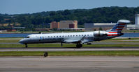
Ronald Barker
@ KDCA
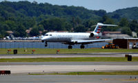
Ronald Barker
@ KDCA
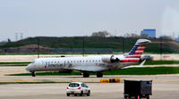
Ronald Barker
@ KORD
Recent Routes
| Time | Callsign | FL | Speed | Heading | Route |
|---|---|---|---|---|---|
| 2026-10-30 10:54 UTC | JIA5261 | FL93 | 319 kt | 108° | — |
| 2026-10-30 01:48 UTC | JIA5473 | FL8 | 126 kt | 235° | — |
| 2026-10-30 00:04 UTC | JIA5172 | — | 10 kt | 335° | — |
| 2026-10-29 20:02 UTC | JIA5268 | FL9 | 140 kt | 181° | — |
| 2026-10-29 10:32 UTC | JIA5507 | — | 10 kt | 312° | — |
| 2026-10-29 02:54 UTC | JIA5376 | FL7 | 126 kt | 171° | — |
| 2026-10-29 00:28 UTC | JIA5147 | — | 13 kt | 357° | — |
| 2026-10-28 21:20 UTC | JIA5610 | FL18 | 141 kt | 55° | — |
| 2026-10-28 18:34 UTC | JIA5024 | — | 8 kt | 34° | — |
| 2026-10-28 11:54 UTC | JIA5542 | — | 10 kt | 312° | — |
| 2026-10-28 03:18 UTC | JIA5275 | FL11 | 122 kt | 177° | — |
| 2026-10-28 01:26 UTC | JIA5117 | — | 7 kt | 301° | — |
| 2026-10-27 20:24 UTC | JIA5649 | — | 0 kt | 70° | — |
| 2026-10-27 18:36 UTC | JIA5372 | FL2 | 141 kt | 143° | — |
| 2026-10-27 16:34 UTC | JIA5173 | — | 21 kt | 276° | — |
| 2026-10-27 03:02 UTC | JIA5391 | FL0 | 133 kt | 90° |
MSP → DCA
MSP
→
DCA
Minneapolis-st Paul Intl/wold-chamberlain Airport → Ronald Reagan Washington Ntl Airport |
| 2026-10-26 22:14 UTC | JIA5300 | — | 9 kt | 321° | — |
| 2026-10-26 18:10 UTC | JIA5366 | — | 10 kt | 315° | — |
| 2026-10-26 13:48 UTC | JIA5231 | — | 2 kt | 259° | — |
| 2026-10-26 03:34 UTC | JIA5230 | FL-1 | 135 kt | 44° |
DCA → BTR
DCA
→
BTR
Ronald Reagan Washington Ntl Airport → Baton Rouge Metro, Ryan Fld Airport |
| 2026-10-26 00:22 UTC | JIA5095 | — | 14 kt | 318° | — |
| 2026-10-25 21:16 UTC | JIA5059 | FL104 | 319 kt | 221° | — |
| 2026-10-25 20:22 UTC | JIA5454 | — | 19 kt | 318° | — |
| 2026-10-25 17:54 UTC | JIA5026 | FL2 | 136 kt | 357° | — |
| 2026-10-25 15:08 UTC | JIA5072 | — | 10 kt | 318° | — |
| 2026-10-25 00:10 UTC | JIA5410 | — | 9 kt | 321° | — |
| 2026-10-24 16:04 UTC | JIA5282 | — | 12 kt | 321° | — |
| 2026-10-24 12:22 UTC | JIA5270 | — | 2 kt | 250° |
TLH → DCA
TLH
→
DCA
Tallahassee International Airport → Ronald Reagan Washington Ntl Airport |
| 2026-10-24 02:16 UTC | JIA5078 | FL8 | 128 kt | 359° | — |
| 2026-10-23 23:28 UTC | JIA5436 | — | 10 kt | 203° | — |
| 2026-10-23 21:12 UTC | JIA5161 | FL12 | 135 kt | 44° | — |
| 2026-10-23 18:14 UTC | JIA5032 | — | 8 kt | 301° | — |
| 2026-10-23 13:32 UTC | JIA5409 | — | 3 kt | 281° | — |
| 2026-10-23 02:58 UTC | JIA5387 | FL7 | 130 kt | 359° | — |
| 2026-10-22 23:58 UTC | JIA5216 | — | 14 kt | 335° | — |
| 2026-10-22 20:50 UTC | JIA5133 | — | 0 kt | 295° | — |
| 2026-10-22 17:10 UTC | JIA5298 | — | 3 kt | 298° | — |
| 2026-10-22 11:42 UTC | JIA5088 | — | 6 kt | 295° | — |
| 2026-10-22 01:32 UTC | JIA5550 | FL1 | 132 kt | 37° | — |
| 2026-10-21 23:18 UTC | JIA5134 | — | 6 kt | 270° |
BGR → PHL
BGR
→
PHL
Bangor International Airport → Philadelphia International Airport |
| 2026-10-21 18:24 UTC | JIA5286 | — | 6 kt | 290° | — |
| 2026-10-21 15:48 UTC | JIA5247 | FL2 | 133 kt | 310° | — |
| 2026-10-20 13:14 UTC | JIA5442 | — | 6 kt | 264° |
YUL → PHL
YUL
→
PHL
Montreal / Pierre Elliott Trudeau International Airport → Philadelphia International Airport |
| 2026-10-20 02:34 UTC | JIA5576 | — | 7 kt | 124° |
PHL → YUL
PHL
→
YUL
Philadelphia International Airport → Montreal / Pierre Elliott Trudeau International Airport |
| 2026-10-18 18:20 UTC | JIA5615 | — | 10 kt | 270° |
PHL → YUL
PHL
→
YUL
Philadelphia International Airport → Montreal / Pierre Elliott Trudeau International Airport |
| 2026-10-18 00:34 UTC | JIA5153 | — | 3 kt | 281° | — |
| 2026-10-17 20:30 UTC | JIA5040 | — | 2 kt | 250° | — |
| 2026-10-17 13:28 UTC | JIA5369 | — | 3 kt | 293° | — |
| 2026-10-17 04:04 UTC | JIA5478 | FL4 | 119 kt | 54° | — |
| 2026-10-17 00:22 UTC | JIA5427 | — | 4 kt | 295° | — |
| 2026-10-16 21:54 UTC | JIA5618 | FL11 | 129 kt | 213° | — |
| 2026-10-15 18:08 UTC | JIA5525 | — | 6 kt | 214° |
YYZ → PHL
YYZ
→
PHL
Lester B Pearson International Airport → Philadelphia International Airport |
| 2026-10-15 16:08 UTC | JIA5665 | FL3 | 0 kt | 104° |
DCA → YYZ
DCA
→
YYZ
Ronald Reagan Washington Ntl Airport → Lester B Pearson International Airport |
| 2026-10-15 13:08 UTC | JIA5424 | — | 0 kt | 197° | — |
| 2026-10-15 02:00 UTC | JIA5544 | FL1 | 136 kt | 167° |
DCA → PNS
DCA
→
PNS
Ronald Reagan Washington Ntl Airport → Pensacola International Airport |
| 2026-10-14 23:12 UTC | JIA5601 | — | 0 kt | 315° | — |
| 2026-10-14 19:18 UTC | JIA5647 | — | 6 kt | 312° | — |
| 2026-10-14 16:36 UTC | JIA5373 | FL9 | 132 kt | 2° |
DCA → MSN
DCA
→
MSN
Ronald Reagan Washington Ntl Airport → Dane County Rgnl/truax Fld Airport |
| 2026-10-14 13:48 UTC | JIA5485 | — | 0 kt | 312° |
MSP → DCA
MSP
→
DCA
Minneapolis-st Paul Intl/wold-chamberlain Airport → Ronald Reagan Washington Ntl Airport |
| 2026-10-14 03:08 UTC | JIA5496 | — | 1 kt | 124° |
DCA → MSP
DCA
→
MSP
Ronald Reagan Washington Ntl Airport → Minneapolis-st Paul Intl/wold-chamberlain Airport |
| 2026-10-13 23:12 UTC | JIA5500 | — | 0 kt | 194° | — |
| 2026-10-13 11:32 UTC | JIA5678 | — | 6 kt | 177° | — |
| 2026-10-13 03:10 UTC | JIA5289 | FL5 | 129 kt | 330° | — |
| 2026-10-13 00:38 UTC | JIA5501 | — | 7 kt | 284° | — |
| 2026-10-12 20:26 UTC | JIA5039 | — | 14 kt | 315° | — |
| 2026-10-12 14:44 UTC | JIA5023 | — | 0 kt | 281° | — |
| 2026-10-12 12:42 UTC | JIA5438 | FL5 | 124 kt | 317° | — |
| 2026-10-12 01:00 UTC | JIA5377 | — | 1 kt | 155° |
DCA → BDL
DCA
→
BDL
Ronald Reagan Washington Ntl Airport → Bradley International Airport |
| 2026-10-08 22:16 UTC | JIA5457 | — | 14 kt | 259° |
ROC → DCA
ROC
→
DCA
Frederick Douglass/greater Rochester International Airport → Ronald Reagan Washington Ntl Airport |
| 2026-10-07 22:24 UTC | JIA5208 | — | 1 kt | 163° | — |
| 2026-10-07 16:30 UTC | JIA5109 | — | 18 kt | 326° | — |
| 2026-10-07 11:30 UTC | JIA5169 | — | 12 kt | 315° | — |
| 2026-10-07 03:06 UTC | JIA5411 | FL1 | 131 kt | 348° | — |
| 2026-10-07 00:04 UTC | JIA5605 | — | 4 kt | 180° | — |
| 2026-10-06 20:56 UTC | JIA5621 | — | 10 kt | 248° | — |
| 2026-10-06 16:32 UTC | JIA5280 | — | 10 kt | 264° | — |
| 2026-10-06 12:36 UTC | JIA5157 | — | 0 kt | 28° | — |
| 2026-10-06 03:12 UTC | JIA5245 | FL8 | 132 kt | 55° |
DFW → DAY
DFW
→
DAY
Dallas-fort Worth International Airport → James M Cox Dayton International Airport |
| 2026-10-05 15:20 UTC | JIA5253 | FL4 | 134 kt | 90° | — |
| 2026-10-05 11:18 UTC | JIA5420 | — | 3 kt | 160° | — |
| 2026-10-05 06:48 UTC | JIA5422 | FL15 | 136 kt | 106° | — |
| 2026-10-03 14:26 UTC | JIA5402 | — | 11 kt | 318° | — |
| 2026-10-02 20:38 UTC | JIA5221 | — | 15 kt | 335° | — |
| 2026-10-02 12:08 UTC | JIA5177 | FL4 | 140 kt | 322° |
CAK → CLT
CAK
→
CLT
Akron-canton Regional Airport → Charlotte/douglas International Airport |
| 2026-10-01 22:00 UTC | JIA5143 | — | 0 kt | 321° | — |
| 2026-10-01 14:34 UTC | JIA5307 | — | 8 kt | 318° | — |
| 2026-09-30 18:48 UTC | JIA5521 | — | 12 kt | 343° |
DFW → KM80
DFW
→
KM80
Dallas-fort Worth International Airport → Scott Airport |
| 2026-09-30 14:16 UTC | JIA5294 | — | 11 kt | 37° | — |
Live location data from OpenSky Network
Airframe Info
| Manufacturer | Bombardier |
| Model | CRJ-701 (CL-600-2C10) Regional Jet Search all Bombardier CRJ-701 (CL-600-2C10) Regional Jet |
| Year built | 2003 |
| Construction Number (C/N) | 10114 |
| Aircraft Type | Fixed wing multi engine |
| Number of Seats | 22 |
| Number of Engines | 2 |
| Engine Type | Turbofan |
| Engine Manufacturer and Model | Ge CF34 SERIES |
Aircraft
| Registration Number | N513AE |
| Mode S (ICAO24) Code | a66c99 |
| Certification Class | Standard |
| Certification Issued | 2011-10-27 |
| Air Worthiness Test | 2003-09-04 |
| Last Action Taken | 2023-03-24 |
| Current Status | Valid |
Owner
| Registration Type | Corporation |
| Owner | AMERICAN AIRLINES INC |
| Address |
Md 8b369 Fort Worth, TX 76155 United States |
| Region | Southwestern |