Aircraft N538CA Data
1
aircraft record found
N538CA
2008 Bombardier CRJ-900ER (CL-600-2D24), c/n 15157
Latest photos of N538CA
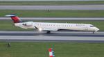
FloridaMetal
@ KATL
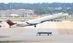
FloridaMetal
@ KATL
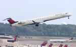
FloridaMetal
@ KATL

Ronald Barker
@ KATL
Recent Routes
NO LIVE DATA
| Time | Callsign | FL | Speed | Heading | Route |
|---|---|---|---|---|---|
| 2026-10-23 22:24 UTC | EDV4665 | FL23 | 141 kt | 160° | — |
| 2026-10-23 19:30 UTC | EDV5482 | — | 6 kt | 143° | — |
| 2026-10-23 11:56 UTC | EDV5171 | — | 7 kt | 219° | — |
| 2026-10-23 02:10 UTC | EDV4996 | FL9 | 128 kt | 32° | — |
| 2026-10-22 23:36 UTC | EDV5455 | — | 5 kt | 219° | — |
| 2026-10-22 17:02 UTC | EDV5024 | — | 1 kt | 129° |
LGA → RDU
LGA
→
RDU
Laguardia Airport → Raleigh-durham International Airport |
| 2026-10-22 11:28 UTC | EDV5177 | — | 0 kt | 129° | — |
| 2026-10-22 02:44 UTC | EDV4946 | — | 5 kt | 191° |
JFK → CLE
JFK
→
CLE
John F Kennedy International Airport → Cleveland-hopkins International Airport |
| 2026-10-21 22:32 UTC | EDV5029 | FL-1 | 128 kt | 31° | — |
| 2026-10-21 19:56 UTC | EDV4971 | FL12 | 141 kt | 316° | — |
| 2026-10-21 16:20 UTC | EDV5325 | — | 0 kt | 203° |
STL → MSP
STL
→
MSP
St Louis Lambert International Airport → Minneapolis-st Paul Intl/wold-chamberlain Airport |
| 2026-10-21 13:40 UTC | EDV5286 | — | 0 kt | 233° |
MSP → STL
MSP
→
STL
Minneapolis-st Paul Intl/wold-chamberlain Airport → St Louis Lambert International Airport |
| 2026-10-21 01:32 UTC | EDV5014 | — | 3 kt | 205° | — |
| 2026-10-20 22:50 UTC | EDV4949 | FL7 | 136 kt | 0° | — |
| 2026-10-20 19:58 UTC | EDV5362 | — | 0 kt | 141° | — |
| 2026-10-20 15:08 UTC | EDV5139 | — | 0 kt | 129° |
YUL → LGA
YUL
→
LGA
Montreal / Pierre Elliott Trudeau International Airport → Laguardia Airport |
| 2026-10-20 12:26 UTC | EDV4963 | — | 8 kt | 79° |
LGA → YUL
LGA
→
YUL
Laguardia Airport → Montreal / Pierre Elliott Trudeau International Airport |
| 2026-10-20 02:52 UTC | EDV5017 | — | 3 kt | 146° |
BNA → LGA
BNA
→
LGA
Nashville International Airport → Laguardia Airport |
| 2026-10-19 23:22 UTC | EDV5152 | — | 4 kt | 180° | — |
| 2026-10-19 20:52 UTC | EDV5281 | FL2 | 130 kt | 45° | — |
| 2026-10-19 18:06 UTC | EDV4641 | — | 17 kt | 42° | — |
| 2026-10-19 15:58 UTC | EDV4629 | FL3 | 141 kt | 209° | — |
| 2026-10-19 14:10 UTC | EDV4968 | FL5 | 137 kt | 180° | — |
| 2026-10-19 11:38 UTC | EDV5355 | — | 0 kt | 127° | — |
| 2026-10-19 03:24 UTC | EDV5524 | FL43 | 260 kt | 5° | — |
| 2026-10-19 01:12 UTC | EDV5038 | — | 5 kt | 270° | — |
| 2026-10-18 22:04 UTC | EDV5261 | FL43 | 163 kt | 339° | — |
| 2026-10-18 20:20 UTC | EDV4953 | — | 4 kt | 62° |
ATL → KM95
ATL
→
KM95
Hartsfield/jackson Atlanta International Airport → Richard Arthur Fld Airport |
| 2026-10-18 16:40 UTC | EDV4930 | — | 14 kt | 180° | — |
| 2026-10-18 09:08 UTC | EDV5466 | — | 8 kt | 23° | — |
| 2026-10-17 17:50 UTC | EDV4686 | — | 7 kt | 357° | — |
| 2026-10-17 13:22 UTC | EDV4940 | — | 2 kt | 267° | — |
| 2026-10-17 02:58 UTC | EDV5452 | FL124 | 352 kt | 244° | — |
| 2026-10-17 00:44 UTC | EDV5508 | — | 0 kt | 309° | — |
| 2026-10-16 20:34 UTC | EDV5379 | — | 0 kt | 278° | — |
| 2026-10-16 17:28 UTC | EDV5084 | — | 6 kt | 357° |
ATL → ABY
ATL
→
ABY
Hartsfield/jackson Atlanta International Airport → Southwest Georgia Regional Airport |
| 2026-10-16 00:36 UTC | EDV5161 | — | 12 kt | 87° | — |
| 2026-10-15 16:44 UTC | EDV5236 | — | 1 kt | 87° | — |
| 2026-10-15 12:26 UTC | EDV5181 | — | 2 kt | 87° | — |
| 2026-10-15 02:50 UTC | EDV5182 | FL60 | 277 kt | 39° | — |
| 2026-10-14 23:52 UTC | EDV5314 | — | 1 kt | 267° |
ATL → KL32
ATL
→
KL32
Hartsfield/jackson Atlanta International Airport → Jonesville Airport |
| 2026-10-14 18:22 UTC | EDV4955 | — | 0 kt | 278° | — |
| 2026-10-14 14:50 UTC | EDV5309 | — | 8 kt | 357° | — |
| 2026-10-13 12:50 UTC | EDV5162 | — | 7 kt | 23° | — |
| 2026-10-13 02:18 UTC | EDV5168 | FL17 | 159 kt | 239° | — |
| 2026-10-12 23:42 UTC | EDV4633 | — | 1 kt | 267° | — |
| 2026-10-12 18:12 UTC | EDV5526 | — | 0 kt | 267° | — |
| 2026-10-11 18:42 UTC | EDV4650 | — | 0 kt | 76° | — |
| 2026-10-10 14:30 UTC | EDV5282 | — | 0 kt | 309° | — |
| 2026-10-10 01:56 UTC | TUG21 | — | 10 kt | 149° | — |
| 2026-10-09 12:46 UTC | EDV4947 | — | 0 kt | 284° |
ABE → ATL
ABE
→
ATL
Lehigh Valley International Airport → Hartsfield/jackson Atlanta International Airport |
| 2026-10-09 02:04 UTC | EDV4970 | — | 6 kt | 90° |
ATL → ABE
ATL
→
ABE
Hartsfield/jackson Atlanta International Airport → Lehigh Valley International Airport |
| 2026-10-08 22:50 UTC | EDV4694 | — | 9 kt | 73° |
ATL → ABY
ATL
→
ABY
Hartsfield/jackson Atlanta International Airport → Southwest Georgia Regional Airport |
| 2026-10-08 19:04 UTC | EDV5387 | — | 12 kt | 177° |
ABE → ATL
ABE
→
ATL
Lehigh Valley International Airport → Hartsfield/jackson Atlanta International Airport |
| 2026-10-08 16:08 UTC | EDV5442 | — | 6 kt | 183° |
ATL → ABE
ATL
→
ABE
Hartsfield/jackson Atlanta International Airport → Lehigh Valley International Airport |
| 2026-10-08 12:16 UTC | EDV4673 | — | 1 kt | 278° | — |
| 2026-10-08 01:22 UTC | EDV4692 | FL11 | 118 kt | 66° | — |
| 2026-10-07 23:20 UTC | EDV5528 | — | 0 kt | 278° | — |
| 2026-10-07 14:30 UTC | EDV5554 | — | 0 kt | 267° | — |
| 2026-09-24 21:02 UTC | EDV5564 | FL19 | 125 kt | 48° | — |
| 2026-09-24 12:48 UTC | EDV4937 | — | 4 kt | 87° | — |
| 2026-09-24 03:22 UTC | EDV4950 | FL15 | 118 kt | 91° | — |
Live location data from OpenSky Network
Airframe Info
| Manufacturer | Bombardier |
| Model | CRJ-900ER (CL-600-2D24) Search all Bombardier CRJ-900ER (CL-600-2D24) |
| Year built | 2008 |
| Construction Number (C/N) | 15157 |
| Aircraft Type | Fixed wing multi engine |
| Number of Seats | 22 |
| Number of Engines | 2 |
| Engine Type | Turbofan |
| Engine Manufacturer and Model | Ge CF34-8C5 |
Aircraft
| Registration Number | N538CA |
| Mode S (ICAO24) Code | a6ce58 |
| Certification Class | Standard |
| Certification Issued | 2012-10-16 |
| Air Worthiness Test | 2008-01-11 |
| Last Action Taken | 2023-06-16 |
| Current Status | Valid |
Owner
| Registration Type | Corporation |
| Owner | DELTA AIR LINES INC |
| Address |
Dept 595 Aircraft Registrations Atlanta, GA 303543743 United States |
| Region | Southern |