N606LR — 2008 Bombardier CRJ-900ER (CL-600-2D24) Data
1
aircraft record found
N606LR
2008 Bombardier CRJ-900ER (CL-600-2D24), c/n 15173
N606LR is a 2008 Bombardier CRJ-900ER (CL-600-2D24) (serial number 15173). It is configured with 2 engines and 22 seats. Registration status is listed as Valid, with ownership recorded under DELTA AIR LINES INC in Atlanta, GA, United States. The profile includes 11 photos documenting this aircraft.
Latest photos of N606LR
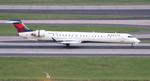
FloridaMetal
@ KATL
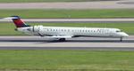
FloridaMetal
@ KATL

FloridaMetal
@ KATL
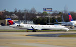
Ronald Barker
@ KATL
Recent Routes
NO LIVE DATA
| Time | Callsign | FL | Speed | Heading | Route |
|---|---|---|---|---|---|
| 2026-10-25 20:44 UTC | EDV5021 | FL4 | 136 kt | 209° | — |
| 2026-10-25 18:08 UTC | EDV5266 | FL4 | 146 kt | 181° |
ATL → HSV
ATL
→
HSV
Hartsfield/jackson Atlanta International Airport → Huntsville Intl-carl T Jones Fld Airport |
| 2026-10-25 16:20 UTC | EDV5062 | — | 0 kt | 293° | — |
| 2026-10-25 12:08 UTC | EDV5317 | — | 0 kt | 267° | — |
| 2026-10-24 23:54 UTC | EDV5203 | FL12 | 131 kt | 45° | — |
| 2026-10-24 22:22 UTC | EDV5161 | — | 14 kt | 273° | — |
| 2026-10-24 18:52 UTC | EDV5425 | — | 0 kt | 267° | — |
| 2026-10-24 15:28 UTC | EDV5111 | — | 8 kt | 31° | — |
| 2026-10-24 10:52 UTC | EDV5403 | — | 1 kt | 309° |
CSG → ATL
CSG
→
ATL
Columbus Airport → Hartsfield/jackson Atlanta International Airport |
| 2026-10-24 01:34 UTC | EDV5429 | FL4 | 122 kt | 54° | — |
| 2026-10-24 00:00 UTC | EDV4920 | — | 5 kt | 278° |
ATL → ROA
ATL
→
ROA
Hartsfield/jackson Atlanta International Airport → Roanoke/blacksburg Regional (woodrum Fld) Airport |
| 2026-10-23 19:26 UTC | EDV5157 | — | 12 kt | 357° |
ATL → 9LS1
ATL
→
9LS1
Hartsfield/jackson Atlanta International Airport → Bayou Meadows Airport |
| 2026-10-23 14:52 UTC | EDV5143 | — | 10 kt | 315° | — |
| 2026-10-23 11:12 UTC | EDV5255 | — | 1 kt | 270° | — |
| 2026-10-23 02:02 UTC | EDV5443 | FL21 | 165 kt | 49° | — |
| 2026-10-23 00:24 UTC | EDV5529 | — | 1 kt | 270° | — |
| 2026-10-22 18:32 UTC | EDV4991 | — | 13 kt | 0° |
ATL → LS46
ATL
→
LS46
Hartsfield/jackson Atlanta International Airport → Wc Fld Airport |
| 2026-10-22 13:34 UTC | EDV5234 | — | 6 kt | 177° | — |
| 2026-10-21 22:28 UTC | EDV5258 | FL15 | 148 kt | 224° | — |
| 2026-10-21 21:00 UTC | EDV5298 | — | 0 kt | 278° |
ROC → LGA
ROC
→
LGA
Frederick Douglass/greater Rochester International Airport → Laguardia Airport |
| 2026-10-21 18:12 UTC | EDV5323 | FL59 | 289 kt | 240° | — |
| 2026-10-21 16:08 UTC | EDV5366 | — | 0 kt | 301° | — |
| 2026-10-21 11:16 UTC | EDV5454 | — | 8 kt | 219° | — |
| 2026-10-21 02:50 UTC | EDV5493 | FL3 | 125 kt | 359° | — |
| 2026-10-21 01:08 UTC | EDV5002 | — | 6 kt | 219° |
LGA → BNA
LGA
→
BNA
Laguardia Airport → Nashville International Airport |
| 2026-10-20 21:44 UTC | EDV4647 | FL17 | 133 kt | 56° | — |
| 2026-10-20 18:50 UTC | EDV5500 | FL4 | 149 kt | 209° | — |
| 2026-10-20 16:12 UTC | EDV5506 | FL2 | 126 kt | 31° | — |
| 2026-10-20 13:02 UTC | EDV5163 | FL4 | 150 kt | 209° | — |
| 2026-10-20 02:30 UTC | EDV5145 | FL6 | 138 kt | 182° | — |
| 2026-10-20 00:22 UTC | EDV5033 | — | 19 kt | 25° | — |
| 2026-10-19 19:52 UTC | EDV4896 | FL4 | 136 kt | 209° | — |
| 2026-10-19 18:00 UTC | EDV4780 | FL5 | 143 kt | 224° | — |
| 2026-10-19 15:02 UTC | EDV5228 | FL1 | 127 kt | 45° |
EWR → RDU
EWR
→
RDU
Newark Liberty International Airport → Raleigh-durham International Airport |
| 2026-10-19 12:20 UTC | EDV5069 | — | 6 kt | 273° | — |
| 2026-10-19 06:12 UTC | EDV5478 | FL5 | 136 kt | 180° | — |
| 2026-10-19 03:36 UTC | EDV4895 | FL3 | 127 kt | 209° | — |
| 2026-10-18 22:22 UTC | EDV5128 | FL11 | 140 kt | 159° | — |
| 2026-10-17 21:10 UTC | EDV4953 | — | 0 kt | 87° |
ATL → KM95
ATL
→
KM95
Hartsfield/jackson Atlanta International Airport → Richard Arthur Fld Airport |
| 2026-10-17 17:10 UTC | EDV4649 | — | 0 kt | 267° |
ROA → ATL
ROA
→
ATL
Roanoke/blacksburg Regional (woodrum Fld) Airport → Hartsfield/jackson Atlanta International Airport |
| 2026-10-17 14:10 UTC | EDV4628 | — | 15 kt | 236° |
ATL → ROA
ATL
→
ROA
Hartsfield/jackson Atlanta International Airport → Roanoke/blacksburg Regional (woodrum Fld) Airport |
| 2026-10-17 00:04 UTC | EDV5314 | — | 13 kt | 267° | — |
| 2026-10-16 19:16 UTC | EDV4650 | — | 0 kt | 110° | — |
| 2026-10-16 13:00 UTC | EDV5162 | — | 3 kt | 90° | — |
| 2026-10-16 02:16 UTC | EDV5168 | FL3 | 130 kt | 144° | — |
| 2026-10-15 23:16 UTC | EDV5121 | — | 3 kt | 284° | — |
| 2026-10-15 20:10 UTC | EDV4658 | FL3 | 149 kt | 330° | — |
| 2026-10-15 17:06 UTC | EDV5058 | FL6 | 142 kt | 28° | — |
| 2026-10-15 11:18 UTC | EDV5031 | FL5 | 142 kt | 209° |
YYZ → DTW
YYZ
→
DTW
Lester B Pearson International Airport → Detroit Metro Wayne County Airport |
| 2026-10-15 04:02 UTC | EDV4943 | — | 0 kt | 104° | — |
| 2026-10-15 01:48 UTC | EDV5367 | FL6 | 123 kt | 29° |
YUL → DTW
YUL
→
DTW
Montreal / Pierre Elliott Trudeau International Airport → Detroit Metro Wayne County Airport |
| 2026-10-14 22:50 UTC | EDV4816 | — | 3 kt | 53° | — |
| 2026-10-14 20:04 UTC | EDV5505 | FL7 | 127 kt | 29° | — |
| 2026-10-14 14:56 UTC | EDV5502 | FL18 | 150 kt | 56° | — |
| 2026-10-14 11:54 UTC | EDV5470 | FL8 | 155 kt | 209° | — |
| 2026-10-14 03:56 UTC | EDV5209 | FL9 | 122 kt | 225° | — |
| 2026-10-14 00:48 UTC | EDV5514 | FL11 | 141 kt | 209° | — |
| 2026-10-13 22:16 UTC | EDV5107 | FL27 | 178 kt | 224° | — |
| 2026-10-13 19:50 UTC | EDV4719 | — | 7 kt | 231° |
YUL → LGA
YUL
→
LGA
Montreal / Pierre Elliott Trudeau International Airport → Laguardia Airport |
| 2026-10-13 17:16 UTC | EDV4751 | — | 15 kt | 169° |
LGA → YUL
LGA
→
YUL
Laguardia Airport → Montreal / Pierre Elliott Trudeau International Airport |
| 2026-10-13 15:04 UTC | EDV5139 | — | 0 kt | 158° |
YUL → LGA
YUL
→
LGA
Montreal / Pierre Elliott Trudeau International Airport → Laguardia Airport |
| 2026-10-13 12:24 UTC | EDV4963 | — | 10 kt | 141° |
LGA → YUL
LGA
→
YUL
Laguardia Airport → Montreal / Pierre Elliott Trudeau International Airport |
| 2026-10-13 02:04 UTC | EDV5449 | — | 8 kt | 174° |
YUL → LGA
YUL
→
LGA
Montreal / Pierre Elliott Trudeau International Airport → Laguardia Airport |
| 2026-10-12 23:56 UTC | EDV5197 | — | 6 kt | 149° |
LGA → YUL
LGA
→
YUL
Laguardia Airport → Montreal / Pierre Elliott Trudeau International Airport |
| 2026-10-12 21:30 UTC | EDV5166 | — | 8 kt | 219° |
YYZ → LGA
YYZ
→
LGA
Lester B Pearson International Airport → Laguardia Airport |
| 2026-10-12 19:08 UTC | EDV5094 | — | 0 kt | 87° |
LGA → YYZ
LGA
→
YYZ
Laguardia Airport → Lester B Pearson International Airport |
| 2026-10-12 16:38 UTC | EDV5177 | — | 3 kt | 309° | — |
| 2026-10-12 14:18 UTC | EDV4974 | FL8 | 131 kt | 230° |
LGA → CLE
LGA
→
CLE
Laguardia Airport → Cleveland-hopkins International Airport |
| 2026-10-09 00:52 UTC | EDV5231 | — | 6 kt | 208° | — |
| 2026-10-08 22:28 UTC | EDV4954 | FL8 | 143 kt | 230° | — |
| 2026-10-08 21:00 UTC | EDV5397 | FL8 | 136 kt | 209° | — |
| 2026-10-08 19:04 UTC | EDV5141 | FL8 | 142 kt | 230° | — |
| 2026-10-08 17:12 UTC | EDV5303 | FL8 | 144 kt | 208° | — |
| 2026-10-08 15:10 UTC | EDV5086 | FL14 | 141 kt | 316° | — |
| 2026-10-08 12:40 UTC | EDV5008 | — | 21 kt | 166° |
CLE → JFK
CLE
→
JFK
Cleveland-hopkins International Airport → John F Kennedy International Airport |
| 2026-10-08 01:28 UTC | EDV5071 | FL10 | 141 kt | 230° | — |
| 2026-10-07 22:52 UTC | EDV4966 | FL10 | 142 kt | 209° | — |
| 2026-10-07 17:36 UTC | EDV5327 | — | 13 kt | 118° | — |
| 2026-10-07 13:04 UTC | EDV5479 | FL9 | 132 kt | 209° | — |
| 2026-10-07 10:12 UTC | EDVMX173 | — | 10 kt | 87° | — |
| 2026-10-07 02:46 UTC | EDV5517 | FL9 | 129 kt | 180° | — |
| 2026-10-06 23:04 UTC | EDV5455 | — | 10 kt | 208° | — |
| 2026-10-06 16:30 UTC | EDV5024 | — | 3 kt | 309° |
LGA → RDU
LGA
→
RDU
Laguardia Airport → Raleigh-durham International Airport |
| 2026-10-06 11:24 UTC | EDV5292 | — | 6 kt | 211° | — |
| 2026-10-06 02:00 UTC | EDV5118 | FL24 | 164 kt | 43° | — |
| 2026-10-05 23:08 UTC | EDV4961 | — | 8 kt | 219° | — |
| 2026-10-03 00:30 UTC | EDV4999 | FL10 | 133 kt | 360° | — |
| 2026-10-02 21:28 UTC | EDV5424 | — | 11 kt | 90° |
ORH → LGA
ORH
→
LGA
Worcester Regional Airport → Laguardia Airport |
| 2026-10-02 18:00 UTC | EDV5254 | — | 6 kt | 312° |
BGR → LGA
BGR
→
LGA
Bangor International Airport → Laguardia Airport |
| 2026-10-02 12:52 UTC | EDV5131 | — | 10 kt | 219° | — |
| 2026-10-02 01:58 UTC | EDV5057 | FL14 | 140 kt | 105° | — |
| 2026-10-01 16:52 UTC | EDV5186 | — | 10 kt | 219° | — |
| 2026-10-01 11:42 UTC | EDV4948 | — | 6 kt | 219° | — |
| 2026-09-30 23:08 UTC | EDV5215 | FL9 | 136 kt | 180° | — |
| 2026-09-30 20:56 UTC | EDV5446 | FL8 | 139 kt | 208° | — |
| 2026-09-30 17:00 UTC | EDV5189 | — | 17 kt | 146° |
MSP → RST
MSP
→
RST
Minneapolis-st Paul Intl/wold-chamberlain Airport → Rochester International Airport |
| 2026-09-30 13:02 UTC | EDV5243 | FL8 | 134 kt | 208° |
MSP → STL
MSP
→
STL
Minneapolis-st Paul Intl/wold-chamberlain Airport → St Louis Lambert International Airport |
| 2026-09-29 21:52 UTC | EDV4693 | — | 0 kt | 211° | — |
| 2026-09-29 18:22 UTC | EDV5435 | FL4 | 131 kt | 331° | — |
| 2026-09-29 15:00 UTC | EDV5202 | — | 19 kt | 267° | — |
| 2026-09-28 22:52 UTC | EDV5528 | — | 12 kt | 343° | — |
| 2026-09-28 18:12 UTC | EDV4644 | — | 12 kt | 180° | — |
| 2026-09-28 12:20 UTC | EDV4673 | — | 12 kt | 357° | — |
| 2026-09-28 02:54 UTC | EDV4692 | FL2 | 137 kt | 65° | — |
| 2026-09-27 23:22 UTC | EDV5377 | — | 0 kt | 267° | — |
| 2026-09-27 19:46 UTC | EDV5288 | — | 0 kt | 293° | — |
| 2026-09-27 16:22 UTC | EDV5372 | — | 0 kt | 307° | — |
| 2026-09-27 11:54 UTC | EDV4912 | — | 4 kt | 267° |
DHN → ATL
DHN
→
ATL
Dothan Regional Airport → Hartsfield/jackson Atlanta International Airport |
| 2026-09-27 01:44 UTC | EDV4910 | FL5 | 136 kt | 315° |
ATL → DHN
ATL
→
DHN
Hartsfield/jackson Atlanta International Airport → Dothan Regional Airport |
| 2026-09-26 23:04 UTC | EDV5389 | — | 0 kt | 278° |
ATL → BMI
ATL
→
BMI
Hartsfield/jackson Atlanta International Airport → Central Il Rgnl/bloomington-normal Airport |
| 2026-09-26 17:32 UTC | EDV5142 | — | 0 kt | 278° | — |
| 2026-09-26 12:32 UTC | EDV4957 | — | 2 kt | 87° |
ABE → ATL
ABE
→
ATL
Lehigh Valley International Airport → Hartsfield/jackson Atlanta International Airport |
| 2026-09-26 02:32 UTC | EDV4995 | — | 8 kt | 138° |
ATL → ABE
ATL
→
ABE
Hartsfield/jackson Atlanta International Airport → Lehigh Valley International Airport |
Live location data from OpenSky Network
Airframe Info
| Manufacturer | Bombardier |
| Model | CRJ-900ER (CL-600-2D24) Search all Bombardier CRJ-900ER (CL-600-2D24) |
| Year built | 2008 |
| Construction Number (C/N) | 15173 |
| Aircraft Type | Fixed wing multi engine |
| Number of Seats | 22 |
| Number of Engines | 2 |
| Engine Type | Turbofan |
| Engine Manufacturer and Model | General Electric CF34-8C5 |
Aircraft
| Registration Number | N606LR |
| Mode S (ICAO24) Code | a7de93 |
| Certification Class | Standard |
| Certification Issued | 2008-04-25 |
| Air Worthiness Test | 2008-04-25 |
| Last Action Taken | 2023-10-13 |
| Current Status | Valid |
Owner
| Registration Type | Corporation |
| Owner | DELTA AIR LINES INC |
| Address |
Dept 595 Aircraft Registrations Atlanta, GA 303543743 United States |
| Region | Southern |