Aircraft N637AE Data
1
aircraft record found
N637AE
1999 Embraer ERJ-145LR (EMB-145LR), c/n 145170
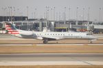
Latest photos of N637AE

Mark Kalfas
@ KORD
Mark Pasqualino
@ KORD

Arthur Tanyel
@ CLT
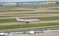
Ronald Barker
@ KDFW
Recent Routes
NO LIVE DATA
Piedmont Airlines (1948-1989)
| Time | Callsign | FL | Speed | Heading | Route |
|---|---|---|---|---|---|
| 2026-10-06 01:12 UTC | PDT5824 / PI5824 | FL8 | 127 kt | 299° | — |
| 2026-10-05 21:42 UTC | PDT5884 / PI5884 | FL-1 | 131 kt | 339° |
YYZ → PHL
YYZ
→
PHL
Lester B Pearson International Airport → Philadelphia International Airport |
| 2026-10-05 16:38 UTC | PDT6123 / PI6123 | — | 15 kt | 338° |
BGR → PHL
BGR
→
PHL
Bangor International Airport → Philadelphia International Airport |
| 2026-10-05 11:20 UTC | PDT6022 / PI6022 | — | 26 kt | 340° | — |
| 2026-10-05 03:26 UTC | PDT6020 / PI6020 | FL52 | 253 kt | 37° | — |
| 2026-10-05 01:34 UTC | PDT5935 / PI5935 | — | 12 kt | 340° | — |
| 2026-10-04 18:46 UTC | PDT5800 / PI5800 | — | 19 kt | 340° |
PHL → BUF
PHL
→
BUF
Philadelphia International Airport → Buffalo Niagara International Airport |
| 2026-10-04 12:38 UTC | PDT5830 / PI5830 | FL-3 | 131 kt | 339° |
ROA → PHL
ROA
→
PHL
Roanoke/blacksburg Regional (woodrum Fld) Airport → Philadelphia International Airport |
| 2026-10-04 01:38 UTC | PDT6058 / PI6058 | — | 10 kt | 194° | — |
| 2026-10-03 22:28 UTC | PDT5900 / PI5900 | FL7 | 129 kt | 356° |
CLT → KEBD
CLT
→
KEBD
Charlotte/douglas International Airport → Southern West Virginia Regional Airport |
| 2026-10-03 18:12 UTC | PDT5983 / PI5983 | FL8 | 138 kt | 356° | — |
| 2026-10-03 14:54 UTC | PDT5847 / PI5847 | FL6 | 127 kt | 176° | — |
| 2026-10-03 02:10 UTC | PDT5803 / PI5803 | FL2 | 128 kt | 133° | — |
| 2026-10-02 21:28 UTC | PDT6053 / PI6053 | FL7 | 144 kt | 176° | — |
| 2026-10-02 17:34 UTC | PDT6052 / PI6052 | — | 31 kt | 177° | — |
| 2026-10-02 12:56 UTC | PDT5850 / PI5850 | FL6 | 127 kt | 176° | — |
| 2026-10-02 00:38 UTC | PDT5875 / PI5875 | FL9 | 127 kt | 197° | — |
| 2026-10-01 20:44 UTC | PDT6097 / PI6097 | FL16 | 173 kt | 356° | — |
| 2026-10-01 17:02 UTC | PDT6035 / PI6035 | FL14 | 153 kt | 356° | — |
| 2026-10-01 12:42 UTC | PDT5846 / PI5846 | FL16 | 149 kt | 356° | — |
| 2026-10-01 02:34 UTC | PDT5913 / PI5913 | FL51 | 242 kt | 347° | — |
| 2026-10-01 00:06 UTC | PDT6005 / PI6005 | FL13 | 140 kt | 355° | — |
| 2026-09-30 18:54 UTC | PDT5851 / PI5851 | FL16 | 152 kt | 356° | — |
| 2026-09-30 15:00 UTC | PDT6048 / PI6048 | FL13 | 139 kt | 356° | — |
| 2026-09-30 13:28 UTC | PDT5958 / PI5958 | FL48 | 219 kt | 143° | — |
| 2026-09-30 11:16 UTC | PDT5834 / PI5834 | FL13 | 149 kt | 357° | — |
| 2026-09-29 23:12 UTC | PDT5909 / PI5909 | FL6 | 126 kt | 307° | — |
| 2026-09-29 20:28 UTC | PDT5994 / PI5994 | FL11 | 138 kt | 356° |
ROA → CLT
ROA
→
CLT
Roanoke/blacksburg Regional (woodrum Fld) Airport → Charlotte/douglas International Airport |
| 2026-09-29 18:38 UTC | PDT6066 / PI6066 | FL12 | 138 kt | 327° | — |
| 2026-09-29 16:00 UTC | PDT6018 / PI6018 | FL12 | 139 kt | 358° | — |
| 2026-09-29 10:52 UTC | PDT5793 / PI5793 | FL11 | 125 kt | 357° | — |
| 2026-09-29 02:36 UTC | PDT5902 / PI5902 | FL31 | 242 kt | 78° | — |
| 2026-09-29 00:08 UTC | PDT6086 / PI6086 | FL9 | 137 kt | 356° | — |
| 2026-09-28 19:18 UTC | PDT5826 / PI5826 | FL12 | 132 kt | 356° | — |
| 2026-09-28 15:24 UTC | PDT6087 / PI6087 | FL9 | 141 kt | 356° | — |
| 2026-09-28 00:44 UTC | PDT5981 / PI5981 | FL12 | 114 kt | 356° | — |
| 2026-09-27 21:14 UTC | PDT5986 / PI5986 | FL13 | 139 kt | 355° | — |
| 2026-09-27 17:30 UTC | PDT5849 / PI5849 | FL10 | 142 kt | 356° | — |
| 2026-09-27 13:58 UTC | PDT6093 / PI6093 | FL9 | 144 kt | 356° | — |
| 2026-09-27 09:46 UTC | PDT6121 / PI6121 | FL13 | 120 kt | 356° | — |
| 2026-09-27 02:10 UTC | PDT6113 / PI6113 | FL3 | 127 kt | 211° | — |
| 2026-09-27 00:14 UTC | PDT5929 / PI5929 | FL9 | 127 kt | 356° | — |
| 2026-09-26 18:26 UTC | PDT5997 / PI5997 | FL11 | 145 kt | 356° | — |
| 2026-09-25 21:40 UTC | PDT5841 / PI5841 | FL10 | 133 kt | 356° | — |
| 2026-09-25 15:58 UTC | PDT5873 / PI5873 | FL10 | 139 kt | 356° | — |
| 2026-09-25 00:40 UTC | PDT6068 / PI6068 | — | 20 kt | 242° | — |
| 2026-09-24 22:52 UTC | PDT6089 / PI6089 | FL14 | 129 kt | 356° | — |
| 2026-09-24 15:34 UTC | PDT5942 / PI5942 | FL13 | 130 kt | 356° | — |
| 2026-09-24 13:38 UTC | PDT5980 / PI5980 | FL25 | 137 kt | 46° | — |
| 2026-09-24 10:40 UTC | PDT6092 / PI6092 | FL14 | 137 kt | 356° | — |
| 2026-09-23 20:50 UTC | PDT6019 / PI6019 | FL14 | 127 kt | 356° | — |
| 2026-09-23 15:12 UTC | PDT5972 / PI5972 | FL15 | 136 kt | 356° | — |
| 2026-09-23 02:06 UTC | PDT5961 / PI5961 | FL31 | 213 kt | 182° | — |
| 2026-09-22 22:34 UTC | PDT5967 / PI5967 | FL10 | 137 kt | 357° | — |
| 2026-09-22 18:54 UTC | PDT6003 / PI6003 | FL8 | 144 kt | 356° | — |
| 2026-09-21 04:10 UTC | PDT5874 / PI5874 | FL9 | 136 kt | 197° | — |
| 2026-09-21 01:02 UTC | PDT5964 / PI5964 | FL7 | 147 kt | 356° | — |
| 2026-09-20 20:50 UTC | PDT5953 / PI5953 | — | 140 kt | 357° |
PHL → ROC
PHL
→
ROC
Philadelphia International Airport → Frederick Douglass/greater Rochester International Airport |
| 2026-09-20 18:40 UTC | PDT5948 / PI5948 | FL7 | 145 kt | 117° | — |
| 2026-09-20 16:14 UTC | PDT5956 / PI5956 | FL8 | 139 kt | 356° | — |
| 2026-09-20 12:42 UTC | PDT5835 / PI5835 | FL9 | 144 kt | 356° | — |
| 2026-09-20 00:58 UTC | PDT5910 / PI5910 | FL7 | 115 kt | 126° | — |
| 2026-09-19 18:44 UTC | PDT5975 / PI5975 | — | 15 kt | 177° | — |
| 2026-09-19 12:48 UTC | PDT5916 / PI5916 | FL7 | 144 kt | 357° | — |
| 2026-09-19 01:10 UTC | PDT5881 / PI5881 | FL38 | 221 kt | 9° | — |
| 2026-09-18 13:02 UTC | PDT5921 / PI5921 | FL5 | 141 kt | 356° | — |
| 2026-09-18 01:40 UTC | PDT5889 / PI5889 | FL60 | 211 kt | 299° | — |
| 2026-09-17 22:16 UTC | PDT6051 / PI6051 | FL7 | 141 kt | 356° | — |
| 2026-09-17 18:04 UTC | PDT6061 / PI6061 | FL7 | 145 kt | 356° | — |
| 2026-09-17 13:12 UTC | PDT6071 / PI6071 | FL4 | 140 kt | 356° | — |
| 2026-09-17 03:20 UTC | PDT5891 / PI5891 | FL4 | 139 kt | 181° | — |
| 2026-09-16 15:20 UTC | PDT5806 / PI5806 | FL3 | 140 kt | 356° | — |
| 2026-09-15 20:06 UTC | PDT6031 / PI6031 | — | 138 kt | 355° | — |
| 2026-09-15 10:56 UTC | PDT5920 / PI5920 | FL8 | 140 kt | 356° | — |
| 2026-09-15 02:42 UTC | PDT6101 / PI6101 | FL65 | 275 kt | 182° | — |
| 2026-09-15 00:10 UTC | PDT5959 / PI5959 | FL6 | 137 kt | 356° | — |
| 2026-09-14 19:48 UTC | PDT5963 / PI5963 | — | 17 kt | 177° |
CLT → II45
CLT
→
II45
Charlotte/douglas International Airport → II45 |
| 2026-09-14 15:00 UTC | PDT5982 / PI5982 | FL10 | 138 kt | 356° | — |
| 2026-09-13 23:32 UTC | PDT5995 / PI5995 | FL11 | 152 kt | 356° | — |
| 2026-09-13 19:46 UTC | PDT6057 / PI6057 | FL9 | 142 kt | 356° | — |
| 2026-09-12 15:20 UTC | PDT6094 / PI6094 | FL6 | 136 kt | 176° | — |
| 2026-09-12 11:02 UTC | PDT5917 / PI5917 | FL8 | 143 kt | 176° | — |
| 2026-09-12 03:12 UTC | PDT5903 / PI5903 | FL3 | 137 kt | 12° | — |
| 2026-09-12 00:54 UTC | PDT6118 / PI6118 | FL7 | 136 kt | 176° | — |
| 2026-09-11 19:38 UTC | PDT6016 / PI6016 | FL8 | 145 kt | 176° |
CLT → KM23
CLT
→
KM23
Charlotte/douglas International Airport → James H Easom Fld Airport |
| 2026-09-11 13:22 UTC | PDT5969 / PI5969 | FL9 | 139 kt | 176° |
ROA → CLT
ROA
→
CLT
Roanoke/blacksburg Regional (woodrum Fld) Airport → Charlotte/douglas International Airport |
| 2026-09-11 00:02 UTC | PDT5833 / PI5833 | — | 12 kt | 138° |
PHL → ROA
PHL
→
ROA
Philadelphia International Airport → Roanoke/blacksburg Regional (woodrum Fld) Airport |
| 2026-09-10 21:52 UTC | PDT5904 / PI5904 | — | 84 kt | 256° | — |
| 2026-09-10 17:48 UTC | PDT5864 / PI5864 | — | 13 kt | 20° | — |
| 2026-09-10 15:20 UTC | PDT5943 / PI5943 | FL26 | 149 kt | 158° | — |
| 2026-09-10 13:02 UTC | PDT5965 / PI5965 | FL8 | 137 kt | 177° | — |
| 2026-09-10 02:42 UTC | PDT5876 / PI5876 | FL41 | 208 kt | 131° | — |
| 2026-09-09 12:42 UTC | PDT5785 / PI5785 | FL15 | 143 kt | 356° | — |
| 2026-09-09 01:34 UTC | PDT6079 / PI6079 | FL2 | 132 kt | 103° | — |
| 2026-09-08 15:32 UTC | PDT6132 / PI6132 | FL15 | 160 kt | 104° | — |
| 2026-09-08 13:08 UTC | PDT6131 / PI6131 | — | 15 kt | 25° | — |
| 2026-09-08 01:42 UTC | PDT5822 / PI5822 | FL13 | 142 kt | 266° | — |
| 2026-09-07 13:14 UTC | PDT5813 / PI5813 | — | 21 kt | 340° |
ROC → PHL
ROC
→
PHL
Frederick Douglass/greater Rochester International Airport → Philadelphia International Airport |
| 2026-09-07 02:10 UTC | PDT5816 / PI5816 | — | 12 kt | 87° |
PHL → ROC
PHL
→
ROC
Philadelphia International Airport → Frederick Douglass/greater Rochester International Airport |
| 2026-09-06 23:14 UTC | PDT5818 / PI5818 | — | 7 kt | 219° | — |
Live location data from OpenSky Network
Airframe Info
| Manufacturer | Embraer |
| Model | ERJ-145LR (EMB-145LR) Search all Embraer ERJ-145LR (EMB-145LR) |
| Year built | 1999 |
| Construction Number (C/N) | 145170 |
| Aircraft Type | Fixed wing multi engine |
| Number of Seats | 55 |
| Number of Engines | 2 |
| Engine Type | Turbofan |
| Engine Manufacturer and Model | Allison AE3007C SER |
Aircraft
| Registration Number | N637AE |
| Mode S (ICAO24) Code | a857c2 |
| Certification Class | Standard |
| Certification Issued | 2011-09-14 |
| Air Worthiness Test | 1999-09-18 |
| Last Action Taken | 2023-03-17 |
| Current Status | Valid |
Owner
| Registration Type | Corporation |
| Owner | AMERICAN AIRLINES INC |
| Address |
Md 8b369 Fort Worth, TX 76155 United States |
| Region | Southwestern |