Aircraft N660CL Data
1
aircraft record found
N660CL
2003 Embraer ERJ-145LR (EMB-145LR), c/n 145764
Latest photos of N660CL
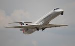
Florida Metal
@ KDTW

Florida Metal
@ KDTW

Florida Metal
@ DTW

klimchuk
@ KPHL
Recent Routes
| Time | Callsign | FL | Speed | Heading | Route |
|---|---|---|---|---|---|
| 2026-10-24 23:32 UTC | PDT5989 / PI5989 | FL320 | 399 kt | 324° | — |
| 2026-10-24 20:04 UTC | PDT5801 / PI5801 | FL5 | 138 kt | 356° | — |
| 2026-10-24 16:02 UTC | PDT6065 / PI6065 | — | 37 kt | 354° | — |
| 2026-10-24 11:20 UTC | PDT5915 / PI5915 | FL4 | 134 kt | 356° | — |
| 2026-10-24 03:02 UTC | PDT5879 / PI5879 | FL4 | 125 kt | 55° | — |
| 2026-10-24 00:28 UTC | PDT6053 / PI6053 | — | 47 kt | 357° | — |
| 2026-10-23 20:40 UTC | PDT6106 / PI6106 | FL8 | 134 kt | 357° | — |
| 2026-10-23 17:30 UTC | PDT6068 / PI6068 | FL3 | 136 kt | 116° | — |
| 2026-10-23 15:54 UTC | PDT6009 / PI6009 | — | 32 kt | 338° | — |
| 2026-10-23 12:48 UTC | PDT5818 / PI5818 | FL-4 | 121 kt | 339° | — |
| 2026-10-23 01:26 UTC | PDT5838 / PI5838 | FL3 | 128 kt | 32° | — |
| 2026-10-22 23:40 UTC | PDT5886 / PI5886 | — | 8 kt | 160° |
PHL → YYZ
PHL
→
YYZ
Philadelphia International Airport → Lester B Pearson International Airport |
| 2026-10-22 18:10 UTC | PDT6055 / PI6055 | — | 8 kt | 284° | — |
| 2026-10-22 12:14 UTC | PDT5789 / PI5789 | — | 8 kt | 233° | — |
| 2026-10-22 01:36 UTC | PDT5810 / PI5810 | FL2 | 131 kt | 43° | — |
| 2026-10-21 22:36 UTC | PDT6034 / PI6034 | — | 10 kt | 248° |
ORH → PHL
ORH
→
PHL
Worcester Regional Airport → Philadelphia International Airport |
| 2026-10-21 12:48 UTC | PDT5830 / PI5830 | FL-3 | 95 kt | 339° |
ROA → PHL
ROA
→
PHL
Roanoke/blacksburg Regional (woodrum Fld) Airport → Philadelphia International Airport |
| 2026-10-20 23:54 UTC | PDT5833 / PI5833 | — | 19 kt | 146° |
PHL → ROA
PHL
→
ROA
Philadelphia International Airport → Roanoke/blacksburg Regional (woodrum Fld) Airport |
| 2026-10-20 21:52 UTC | PDT5884 / PI5884 | — | 13 kt | 338° |
YYZ → PHL
YYZ
→
PHL
Lester B Pearson International Airport → Philadelphia International Airport |
| 2026-10-20 17:40 UTC | PDT6123 / PI6123 | — | 21 kt | 338° |
PHL → BGR
PHL
→
BGR
Philadelphia International Airport → Bangor International Airport |
| 2026-10-20 12:56 UTC | PDT5815 / PI5815 | — | 22 kt | 338° | — |
| 2026-10-19 23:36 UTC | PDT5812 / PI5812 | FL11 | 120 kt | 327° | — |
| 2026-10-19 20:08 UTC | PDT5923 / PI5923 | FL-4 | 128 kt | 339° | — |
| 2026-10-19 16:22 UTC | PDT5845 / PI5845 | FL-5 | 137 kt | 339° | — |
| 2026-10-19 13:48 UTC | PDT6002 / PI6002 | FL5 | 121 kt | 33° | — |
| 2026-10-19 11:38 UTC | PDT5916 / PI5916 | FL4 | 131 kt | 356° | — |
| 2026-10-19 02:14 UTC | PDT5881 / PI5881 | FL69 | 248 kt | 290° | — |
| 2026-10-18 23:50 UTC | PDT6099 / PI6099 | FL4 | 122 kt | 356° | — |
| 2026-10-18 17:22 UTC | PDT6016 / PI6016 | FL4 | 139 kt | 357° |
CLT → 14MS
CLT
→
14MS
Charlotte/douglas International Airport → Rose Fld Airport |
| 2026-10-18 11:16 UTC | PDT5799 / PI5799 | FL6 | 117 kt | 356° | — |
| 2026-10-18 03:58 UTC | PDT5894 / PI5894 | FL14 | 116 kt | 28° | — |
| 2026-10-18 00:46 UTC | PDT5947 / PI5947 | FL6 | 115 kt | 356° | — |
| 2026-10-17 21:14 UTC | PDT5932 / PI5932 | FL8 | 125 kt | 356° | — |
| 2026-10-17 19:20 UTC | PDT5841 / PI5841 | FL8 | 140 kt | 298° | — |
| 2026-10-17 16:54 UTC | PDT5795 / PI5795 | FL9 | 130 kt | 356° | — |
| 2026-10-17 09:38 UTC | PDT5920 / PI5920 | FL11 | 128 kt | 356° | — |
| 2026-10-17 03:24 UTC | PDT6101 / PI6101 | FL58 | 269 kt | 184° | — |
| 2026-10-17 01:56 UTC | PDT5950 / PI5950 | FL9 | 127 kt | 176° | — |
| 2026-10-16 20:44 UTC | PDT6050 / PI6050 | FL9 | 141 kt | 176° | — |
| 2026-10-16 18:34 UTC | PDT5908 / PI5908 | FL13 | 131 kt | 230° |
PHL → ROA
PHL
→
ROA
Philadelphia International Airport → Roanoke/blacksburg Regional (woodrum Fld) Airport |
| 2026-10-16 16:22 UTC | PDT6045 / PI6045 | — | 15 kt | 20° | — |
| 2026-10-16 01:44 UTC | PDT5805 / PI5805 | FL3 | 130 kt | 148° | — |
| 2026-10-15 18:18 UTC | PDT5800 / PI5800 | FL-2 | 133 kt | 339° | — |
| 2026-10-14 21:38 UTC | PDT5786 / PI5786 | — | 8 kt | 248° | — |
| 2026-10-14 16:34 UTC | PDT6107 / PI6107 | — | 8 kt | 253° |
PHL → K60J
PHL
→
K60J
Philadelphia International Airport → Odell Williamson Municipal Airport |
| 2026-10-14 11:42 UTC | PDT5887 / PI5887 | — | 10 kt | 340° |
YYZ → PHL
YYZ
→
PHL
Lester B Pearson International Airport → Philadelphia International Airport |
| 2026-10-14 03:48 UTC | PDT5919 / PI5919 | — | 15 kt | 318° |
PHL → YYZ
PHL
→
YYZ
Philadelphia International Airport → Lester B Pearson International Airport |
| 2026-10-14 00:56 UTC | PDT6039 / PI6039 | — | 13 kt | 338° | — |
| 2026-10-13 22:20 UTC | PDT6105 / PI6105 | FL80 | 269 kt | 226° |
PHL → K60J
PHL
→
K60J
Philadelphia International Airport → Odell Williamson Municipal Airport |
| 2026-10-13 20:14 UTC | PDT6054 / PI6054 | — | 15 kt | 250° |
ROC → PHL
ROC
→
PHL
Frederick Douglass/greater Rochester International Airport → Philadelphia International Airport |
| 2026-10-13 18:46 UTC | PDT5953 / PI5953 | — | 6 kt | 332° |
PHL → ROC
PHL
→
ROC
Philadelphia International Airport → Frederick Douglass/greater Rochester International Airport |
| 2026-10-13 16:50 UTC | PDT6100 / PI6100 | — | 21 kt | 340° | — |
| 2026-10-13 13:00 UTC | PDT5844 / PI5844 | — | 10 kt | 20° | — |
| 2026-10-13 03:00 UTC | PDT5796 / PI5796 | FL7 | 139 kt | 358° | — |
| 2026-10-13 01:02 UTC | PDT5811 / PI5811 | — | 13 kt | 20° | — |
| 2026-10-12 23:20 UTC | PDT6063 / PI6063 | FL6 | 141 kt | 225° |
PHL → BDL
PHL
→
BDL
Philadelphia International Airport → Bradley International Airport |
| 2026-10-12 20:34 UTC | PDT5804 / PI5804 | — | 12 kt | 20° | — |
| 2026-10-12 18:40 UTC | PDT5847 / PI5847 | FL9 | 138 kt | 225° | — |
| 2026-10-12 16:42 UTC | PDT5791 / PI5791 | FL1 | 134 kt | 339° | — |
| 2026-10-12 14:52 UTC | PDT6124 / PI6124 | FL15 | 133 kt | 275° | — |
| 2026-10-12 12:54 UTC | PDT6131 / PI6131 | — | 12 kt | 20° | — |
| 2026-10-12 07:06 UTC | PDT6117 / PI6117 | FL9 | 124 kt | 224° |
PHL → BUF
PHL
→
BUF
Philadelphia International Airport → Buffalo Niagara International Airport |
| 2026-10-11 11:24 UTC | PDT5890 / PI5890 | — | 24 kt | 338° | — |
| 2026-10-11 00:36 UTC | PDT6104 / PI6104 | FL6 | 130 kt | 88° | — |
| 2026-10-10 22:46 UTC | PDT5872 / PI5872 | — | 18 kt | 340° | — |
| 2026-10-10 11:06 UTC | PDT5854 / PI5854 | — | 7 kt | 236° | — |
| 2026-10-10 00:58 UTC | PDT5877 / PI5877 | FL5 | 145 kt | 358° | — |
| 2026-10-09 11:10 UTC | PDT5930 / PI5930 | — | 8 kt | 253° |
ROC → PHL
ROC
→
PHL
Frederick Douglass/greater Rochester International Airport → Philadelphia International Airport |
| 2026-10-09 04:06 UTC | PDT5817 / PI5817 | — | 52 kt | 31° |
PHL → ROC
PHL
→
ROC
Philadelphia International Airport → Frederick Douglass/greater Rochester International Airport |
| 2026-10-09 02:26 UTC | PDT6082 / PI6082 | — | 13 kt | 20° | — |
| 2026-10-06 11:18 UTC | PDT5936 / PI5936 | — | 15 kt | 290° | — |
| 2026-10-06 02:48 UTC | PDT5820 / PI5820 | FL18 | 137 kt | 234° | — |
| 2026-10-05 20:24 UTC | PDT6133 / PI6133 | FL-1 | 117 kt | 340° | — |
| 2026-10-05 15:40 UTC | PDT5868 / PI5868 | — | 8 kt | 284° | — |
| 2026-10-04 22:12 UTC | PDT5831 / PI5831 | — | 8 kt | 250° |
ROA → PHL
ROA
→
PHL
Roanoke/blacksburg Regional (woodrum Fld) Airport → Philadelphia International Airport |
| 2026-10-04 18:20 UTC | PDT6066 / PI6066 | — | 18 kt | 233° | — |
| 2026-10-04 16:06 UTC | PDT6094 / PI6094 | FL7 | 134 kt | 356° | — |
| 2026-10-04 11:10 UTC | PDT5814 / PI5814 | — | 36 kt | 354° | — |
| 2026-10-04 02:48 UTC | PDT5913 / PI5913 | FL26 | 139 kt | 43° | — |
| 2026-10-03 22:18 UTC | PDT6043 / PI6043 | FL10 | 130 kt | 357° | — |
| 2026-10-03 18:58 UTC | PDT5899 / PI5899 | FL8 | 141 kt | 356° | — |
| 2026-10-03 15:46 UTC | PDT6040 / PI6040 | FL6 | 132 kt | 177° | — |
| 2026-10-03 12:40 UTC | PDT5927 / PI5927 | — | 27 kt | 177° | — |
| 2026-10-03 00:28 UTC | PDT5893 / PI5893 | FL21 | 130 kt | 208° | — |
| 2026-10-02 22:36 UTC | PDT6067 / PI6067 | FL8 | 132 kt | 176° | — |
| 2026-10-02 18:22 UTC | PDT5997 / PI5997 | — | 72 kt | 174° | — |
| 2026-10-02 15:42 UTC | PDT6127 / PI6127 | — | 13 kt | 357° | — |
| 2026-10-02 11:12 UTC | PDT5792 / PI5792 | — | 19 kt | 357° | — |
| 2026-10-02 00:20 UTC | PDT5959 / PI5959 | FL13 | 137 kt | 176° | — |
| 2026-10-01 18:54 UTC | PDT5851 / PI5851 | FL16 | 151 kt | 357° | — |
| 2026-10-01 15:14 UTC | PDT5962 / PI5962 | FL15 | 148 kt | 355° | — |
| 2026-10-01 11:00 UTC | PDT5859 / PI5859 | FL12 | 144 kt | 356° | — |
| 2026-10-01 01:40 UTC | PDT5882 / PI5882 | FL20 | 140 kt | 105° | — |
| 2026-09-30 18:26 UTC | PDT5892 / PI5892 | — | 15 kt | 73° |
PHL → ROC
PHL
→
ROC
Philadelphia International Airport → Frederick Douglass/greater Rochester International Airport |
| 2026-09-30 11:14 UTC | PDT5837 / PI5837 | — | 8 kt | 248° | — |
| 2026-09-30 01:06 UTC | PDT5819 / PI5819 | FL6 | 132 kt | 217° | — |
| 2026-09-29 17:58 UTC | PDT6046 / PI6046 | — | 10 kt | 278° | — |
| 2026-09-28 18:04 UTC | PDT6062 / PI6062 | — | 11 kt | 245° | — |
| 2026-09-26 16:30 UTC | PDT5823 / PI5823 | — | 12 kt | 250° | — |
| 2026-09-25 22:28 UTC | PDT5866 / PI5866 | — | 12 kt | 160° |
ORH → PHL
ORH
→
PHL
Worcester Regional Airport → Philadelphia International Airport |
| 2026-09-25 18:06 UTC | PDT6076 / PI6076 | — | 6 kt | 338° | — |
| 2026-09-25 01:08 UTC | PDT6098 / PI6098 | — | 8 kt | 295° | — |
Live location data from OpenSky Network
Airframe Info
| Manufacturer | Embraer |
| Model | ERJ-145LR (EMB-145LR) Search all Embraer ERJ-145LR (EMB-145LR) |
| Year built | 2003 |
| Construction Number (C/N) | 145764 |
| Aircraft Type | Fixed wing multi engine |
| Number of Seats | 55 |
| Number of Engines | 2 |
| Engine Type | Turbofan |
| Engine Manufacturer and Model | Rolls-royc AE3007 SER |
Aircraft
| Registration Number | N660CL |
| Mode S (ICAO24) Code | a8b476 |
| Certification Class | Standard |
| Certification Issued | 2011-09-30 |
| Air Worthiness Test | 2003-12-10 |
| Last Action Taken | 2023-03-17 |
| Current Status | Valid |
Owner
| Registration Type | Corporation |
| Owner | AMERICAN AIRLINES INC |
| Address |
Md 8b369 Fort Worth, TX 76155 United States |
| Region | Southwestern |