Aircraft N687JS Data
1
aircraft record found
N687JS
2004 Embraer ERJ-145LR (EMB-145LR), c/n 14500846
Latest photos of N687JS

Florida Metal
@ KORD
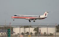
Florida Metal
@ KMIA
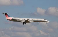
Mark Pasqualino
@ KDFW

Mark Pasqualino
@ KORD
Recent Routes
NO LIVE DATA
Piedmont Airlines (1948-1989)
| Time | Callsign | FL | Speed | Heading | Route |
|---|---|---|---|---|---|
| 2026-10-24 19:26 UTC | PDT5998 / PI5998 | FL4 | 140 kt | 357° | — |
| 2026-10-24 15:58 UTC | PDT6094 / PI6094 | FL4 | 131 kt | 356° | — |
| 2026-10-24 14:30 UTC | PDT6093 / PI6093 | FL65 | 261 kt | 283° | — |
| 2026-10-24 11:30 UTC | PDT5792 / PI5792 | FL8 | 130 kt | 356° | — |
| 2026-10-24 02:12 UTC | PDT5822 / PI5822 | FL27 | 201 kt | 222° | — |
| 2026-10-23 23:30 UTC | PDT6043 / PI6043 | — | 45 kt | 354° | — |
| 2026-10-23 19:12 UTC | PDT6084 / PI6084 | FL6 | 139 kt | 356° | — |
| 2026-10-23 14:12 UTC | PDT6030 / PI6030 | — | 31 kt | 354° |
ROA → CLT
ROA
→
CLT
Roanoke/blacksburg Regional (woodrum Fld) Airport → Charlotte/douglas International Airport |
| 2026-10-23 10:06 UTC | PDT5814 / PI5814 | FL6 | 127 kt | 356° | — |
| 2026-10-23 02:08 UTC | PDT5912 / PI5912 | FL26 | 125 kt | 43° | — |
| 2026-10-23 00:36 UTC | PDT5985 / PI5985 | — | 36 kt | 354° | — |
| 2026-10-22 21:34 UTC | PDT6053 / PI6053 | FL15 | 132 kt | 357° | — |
| 2026-10-22 17:04 UTC | PDT5956 / PI5956 | FL16 | 129 kt | 356° | — |
| 2026-10-22 15:36 UTC | PDT5855 / PI5855 | FL19 | 158 kt | 150° | — |
| 2026-10-22 12:58 UTC | PDT5830 / PI5830 | — | 10 kt | 158° |
ROA → PHL
ROA
→
PHL
Roanoke/blacksburg Regional (woodrum Fld) Airport → Philadelphia International Airport |
| 2026-10-22 03:48 UTC | PDT5907 / PI5907 | — | 11 kt | 357° | — |
| 2026-10-22 01:00 UTC | PDT6026 / PI6026 | FL10 | 130 kt | 356° | — |
| 2026-10-21 21:16 UTC | PDT5986 / PI5986 | FL7 | 128 kt | 356° | — |
| 2026-10-21 16:10 UTC | PDT5891 / PI5891 | FL6 | 130 kt | 356° | — |
| 2026-10-21 14:28 UTC | PDT6127 / PI6127 | FL43 | 175 kt | 339° | — |
| 2026-10-21 11:44 UTC | PDT6022 / PI6022 | FL-3 | 95 kt | 340° | — |
| 2026-10-21 02:18 UTC | PDT6020 / PI6020 | FL36 | 182 kt | 102° | — |
| 2026-10-20 23:54 UTC | PDT6000 / PI6000 | — | 7 kt | 169° | — |
| 2026-10-20 21:42 UTC | PDT6120 / PI6120 | FL7 | 134 kt | 298° | — |
| 2026-10-20 18:24 UTC | PDT6046 / PI6046 | FL7 | 143 kt | 356° | — |
| 2026-10-20 12:30 UTC | PDT6113 / PI6113 | FL6 | 124 kt | 356° | — |
| 2026-10-20 01:58 UTC | PDT5899 / PI5899 | FL44 | 192 kt | 341° | — |
| 2026-10-19 21:08 UTC | PDT5867 / PI5867 | FL6 | 135 kt | 357° |
CLT → KNMM
CLT
→
KNMM
Charlotte/douglas International Airport → Meridian Nas (mc Cain Fld) Airport |
| 2026-10-19 15:58 UTC | PDT5961 / PI5961 | — | 15 kt | 149° | — |
| 2026-10-19 11:34 UTC | PDT5915 / PI5915 | — | 18 kt | 65° | — |
| 2026-10-19 02:56 UTC | PDT5879 / PI5879 | FL12 | 116 kt | 235° | — |
| 2026-10-18 23:36 UTC | PDT6067 / PI6067 | — | 38 kt | 357° | — |
| 2026-10-18 19:26 UTC | PDT6003 / PI6003 | FL4 | 136 kt | 356° | — |
| 2026-10-18 16:22 UTC | PDT6037 / PI6037 | FL4 | 147 kt | 356° | — |
| 2026-10-17 16:40 UTC | PDT6041 / PI6041 | FL58 | 239 kt | 172° | — |
| 2026-10-17 14:16 UTC | PDT5960 / PI5960 | FL7 | 117 kt | 356° | — |
| 2026-10-17 09:58 UTC | PDT5933 / PI5933 | — | 36 kt | 357° | — |
| 2026-10-17 03:30 UTC | PDT5856 / PI5856 | FL27 | 151 kt | 44° | — |
| 2026-10-17 01:52 UTC | PDT5900 / PI5900 | FL8 | 116 kt | 176° |
CLT → KEBD
CLT
→
KEBD
Charlotte/douglas International Airport → Southern West Virginia Regional Airport |
| 2026-10-16 16:38 UTC | PDT6119 / PI6119 | FL7 | 128 kt | 176° | — |
| 2026-10-16 14:58 UTC | PDT5925 / PI5925 | FL10 | 132 kt | 212° | — |
| 2026-10-16 12:54 UTC | PDT5854 / PI5854 | — | 12 kt | 248° | — |
| 2026-10-16 01:18 UTC | PDT5877 / PI5877 | FL5 | 140 kt | 358° | — |
| 2026-10-15 22:52 UTC | PDT6091 / PI6091 | — | 8 kt | 338° | — |
| 2026-10-15 19:22 UTC | PDT5951 / PI5951 | — | 12 kt | 273° | — |
| 2026-10-15 16:00 UTC | PDT6045 / PI6045 | — | 8 kt | 264° | — |
| 2026-10-15 12:34 UTC | PDT5895 / PI5895 | — | 10 kt | 160° | — |
| 2026-10-14 23:18 UTC | PDT5812 / PI5812 | FL5 | 141 kt | 148° | — |
| 2026-10-14 18:28 UTC | PDT5827 / PI5827 | FL1 | 130 kt | 339° | — |
| 2026-10-14 13:04 UTC | PDT5844 / PI5844 | FL0 | 126 kt | 339° | — |
| 2026-10-14 03:24 UTC | PDT5796 / PI5796 | FL6 | 125 kt | 178° | — |
| 2026-10-14 00:56 UTC | PDT5870 / PI5870 | — | 18 kt | 338° | — |
| 2026-10-13 20:52 UTC | PDT5831 / PI5831 | — | 8 kt | 236° |
ROA → PHL
ROA
→
PHL
Roanoke/blacksburg Regional (woodrum Fld) Airport → Philadelphia International Airport |
| 2026-10-13 17:48 UTC | PDT5908 / PI5908 | FL10 | 121 kt | 229° |
PHL → ROA
PHL
→
ROA
Philadelphia International Airport → Roanoke/blacksburg Regional (woodrum Fld) Airport |
| 2026-10-13 16:16 UTC | PDT6009 / PI6009 | — | 15 kt | 17° | — |
| 2026-10-13 13:44 UTC | PDT5837 / PI5837 | — | 12 kt | 158° | — |
| 2026-10-13 02:10 UTC | PDT5910 / PI5910 | FL4 | 147 kt | 127° | — |
| 2026-10-12 23:20 UTC | PDT5941 / PI5941 | FL11 | 126 kt | 356° | — |
| 2026-10-12 21:48 UTC | PDT5882 / PI5882 | FL31 | 211 kt | 184° | — |
| 2026-10-11 00:58 UTC | PDT5833 / PI5833 | — | 12 kt | 231° |
PHL → ROA
PHL
→
ROA
Philadelphia International Airport → Roanoke/blacksburg Regional (woodrum Fld) Airport |
| 2026-10-10 22:58 UTC | PDT5884 / PI5884 | — | 8 kt | 287° |
PHL → YYZ
PHL
→
YYZ
Philadelphia International Airport → Lester B Pearson International Airport |
| 2026-10-10 16:50 UTC | PDT6107 / PI6107 | — | 7 kt | 248° |
PHL → K60J
PHL
→
K60J
Philadelphia International Airport → Odell Williamson Municipal Airport |
| 2026-10-10 11:10 UTC | PDT5936 / PI5936 | — | 20 kt | 340° | — |
| 2026-10-10 02:34 UTC | PDT5820 / PI5820 | — | 10 kt | 53° | — |
| 2026-10-09 19:48 UTC | PDT5804 / PI5804 | FL-2 | 125 kt | 256° | — |
| 2026-10-09 17:54 UTC | PDT5847 / PI5847 | FL7 | 127 kt | 224° | — |
| 2026-10-09 15:46 UTC | PDT6122 / PI6122 | FL-2 | 142 kt | 339° | — |
| 2026-10-09 14:00 UTC | PDT6129 / PI6129 | FL-1 | 139 kt | 38° | — |
| 2026-10-09 00:20 UTC | PDT5840 / PI5840 | — | 12 kt | 160° | — |
| 2026-10-08 21:48 UTC | PDT6102 / PI6102 | FL49 | 164 kt | 337° | — |
| 2026-10-08 15:48 UTC | PDT6116 / PI6116 | — | 16 kt | 340° | — |
| 2026-10-08 14:02 UTC | PDT5839 / PI5839 | FL49 | 248 kt | 15° | — |
| 2026-10-07 13:50 UTC | PDT6115 / PI6115 | — | 8 kt | 20° | — |
| 2026-10-07 01:04 UTC | PDT5798 / PI5798 | FL2 | 134 kt | 223° |
PHL → BDL
PHL
→
BDL
Philadelphia International Airport → Bradley International Airport |
| 2026-10-06 22:34 UTC | PDT5872 / PI5872 | FL-1 | 123 kt | 340° | — |
| 2026-10-06 00:10 UTC | PDT6028 / PI6028 | FL13 | 131 kt | 328° | — |
| 2026-10-05 13:54 UTC | PDT5945 / PI5945 | FL7 | 137 kt | 356° | — |
| 2026-10-05 09:50 UTC | PDT5790 / PI5790 | FL10 | 137 kt | 357° | — |
| 2026-10-05 02:46 UTC | PDT5865 / PI5865 | FL7 | 130 kt | 32° | — |
| 2026-10-04 21:16 UTC | PDT6088 / PI6088 | FL8 | 139 kt | 355° | — |
| 2026-10-04 17:50 UTC | PDT5957 / PI5957 | FL7 | 140 kt | 356° | — |
| 2026-10-04 14:22 UTC | PDT6040 / PI6040 | FL6 | 130 kt | 357° | — |
| 2026-10-04 10:20 UTC | PDT5926 / PI5926 | FL7 | 131 kt | 357° | — |
| 2026-10-04 03:24 UTC | PDT5832 / PI5832 | FL82 | 277 kt | 335° | — |
| 2026-10-04 00:08 UTC | PDT6005 / PI6005 | FL7 | 135 kt | 357° | — |
| 2026-10-03 19:30 UTC | PDT5826 / PI5826 | FL7 | 148 kt | 356° |
ROA → CLT
ROA
→
CLT
Roanoke/blacksburg Regional (woodrum Fld) Airport → Charlotte/douglas International Airport |
| 2026-10-03 15:22 UTC | PDT5786 / PI5786 | FL6 | 131 kt | 176° | — |
| 2026-10-03 11:34 UTC | PDT6070 / PI6070 | FL6 | 127 kt | 176° | — |
| 2026-10-03 03:16 UTC | PDT5808 / PI5808 | FL7 | 124 kt | 297° | — |
| 2026-10-02 18:46 UTC | PDT6042 / PI6042 | — | 61 kt | 177° | — |
| 2026-10-02 15:10 UTC | PDT6117 / PI6117 | — | 43 kt | 177° |
PHL → BUF
PHL
→
BUF
Philadelphia International Airport → Buffalo Niagara International Airport |
| 2026-10-02 13:46 UTC | PDT5818 / PI5818 | FL9 | 130 kt | 211° | — |
| 2026-10-02 10:04 UTC | PDT5848 / PI5848 | — | 68 kt | 177° | — |
| 2026-10-02 00:24 UTC | PDT5918 / PI5918 | FL2 | 137 kt | 348° | — |
| 2026-10-01 21:52 UTC | PDT5992 / PI5992 | FL16 | 142 kt | 176° | — |
| 2026-10-01 16:56 UTC | PDT6015 / PI6015 | FL14 | 153 kt | 357° | — |
| 2026-10-01 13:24 UTC | PDT5787 / PI5787 | FL16 | 146 kt | 357° | — |
| 2026-10-01 01:48 UTC | PDT6074 / PI6074 | FL46 | 242 kt | 254° | — |
| 2026-09-30 21:38 UTC | PDT6085 / PI6085 | FL17 | 149 kt | 356° | — |
| 2026-09-30 17:18 UTC | PDT6061 / PI6061 | FL14 | 156 kt | 356° | — |
| 2026-09-30 13:04 UTC | PDT5965 / PI5965 | FL14 | 141 kt | 356° | — |
| 2026-09-30 02:28 UTC | PDT5876 / PI5876 | FL54 | 255 kt | 50° | — |
| 2026-09-29 20:00 UTC | PDT5953 / PI5953 | FL14 | 146 kt | 356° |
PHL → ROC
PHL
→
ROC
Philadelphia International Airport → Frederick Douglass/greater Rochester International Airport |
| 2026-09-29 10:24 UTC | PDT5934 / PI5934 | — | 7 kt | 141° | — |
| 2026-09-28 10:52 UTC | PDT5920 / PI5920 | FL11 | 129 kt | 356° | — |
| 2026-09-28 03:26 UTC | PDT6101 / PI6101 | FL41 | 266 kt | 177° | — |
| 2026-09-27 20:34 UTC | PDT6097 / PI6097 | FL11 | 137 kt | 356° | — |
| 2026-09-27 17:38 UTC | PDT5810 / PI5810 | FL10 | 143 kt | 356° | — |
| 2026-09-27 12:10 UTC | PDT5946 / PI5946 | FL9 | 133 kt | 356° | — |
| 2026-09-27 01:08 UTC | PDT6112 / PI6112 | FL36 | 166 kt | 340° | — |
| 2026-09-26 16:30 UTC | PDT5979 / PI5979 | FL12 | 134 kt | 356° | — |
| 2026-09-26 02:50 UTC | PDT5913 / PI5913 | FL26 | 132 kt | 43° | — |
| 2026-09-25 19:10 UTC | PDT5851 / PI5851 | FL7 | 137 kt | 356° | — |
| 2026-09-25 02:30 UTC | PDT5838 / PI5838 | FL58 | 219 kt | 127° | — |
| 2026-09-25 00:38 UTC | PDT6086 / PI6086 | FL16 | 127 kt | 357° | — |
Live location data from OpenSky Network
Airframe Info
| Manufacturer | Embraer |
| Model | ERJ-145LR (EMB-145LR) Search all Embraer ERJ-145LR (EMB-145LR) |
| Year built | 2004 |
| Construction Number (C/N) | 14500846 |
| Aircraft Type | Fixed wing multi engine |
| Number of Seats | 55 |
| Number of Engines | 2 |
| Engine Type | Turbofan |
| Engine Manufacturer and Model | Rolls-royc AE3007 SER |
| Also Registered As |
PT-SQQ
Test registered
|
Aircraft
| Registration Number | N687JS |
| Mode S (ICAO24) Code | a91e11 |
| Certification Class | Standard |
| Certification Issued | 2011-10-04 |
| Air Worthiness Test | 2004-09-17 |
| Last Action Taken | 2023-03-24 |
| Current Status | Valid |
Owner
| Registration Type | Corporation |
| Owner | AMERICAN AIRLINES INC |
| Address |
Md 8b369 Fort Worth, TX 76155 United States |
| Region | Southwestern |