Aircraft N697AB Data
1
aircraft record found
N697AB
2004 Embraer ERJ-145LR (EMB-145LR), c/n 14500875
Latest photos of N697AB

AviationLover50
@ KCLT
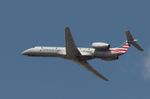
Mark Pasqualino
@ KORD
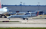
Ronald Barker
@ KORD
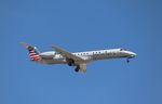
Mark Pasqualino
@ KORD
Recent Routes
NO LIVE DATA
Piedmont Airlines (1948-1989)
| Time | Callsign | FL | Speed | Heading | Route |
|---|---|---|---|---|---|
| 2026-10-24 22:20 UTC | PDT6034 / PI6034 | — | 10 kt | 281° |
ORH → PHL
ORH
→
PHL
Worcester Regional Airport → Philadelphia International Airport |
| 2026-10-24 18:08 UTC | PDT5827 / PI5827 | FL-6 | 103 kt | 338° | — |
| 2026-10-24 13:02 UTC | PDT6056 / PI6056 | — | 21 kt | 338° | — |
| 2026-10-24 03:54 UTC | PDT5808 / PI5808 | FL1 | 128 kt | 116° | — |
| 2026-10-24 02:30 UTC | PDT5929 / PI5929 | — | 18 kt | 259° | — |
| 2026-10-24 00:28 UTC | PDT5823 / PI5823 | FL3 | 121 kt | 358° | — |
| 2026-10-23 22:40 UTC | PDT5884 / PI5884 | — | 10 kt | 340° |
YYZ → PHL
YYZ
→
PHL
Lester B Pearson International Airport → Philadelphia International Airport |
| 2026-10-23 14:24 UTC | PDT6022 / PI6022 | — | 23 kt | 338° | — |
| 2026-10-23 02:10 UTC | PDT6020 / PI6020 | FL33 | 213 kt | 332° | — |
| 2026-10-22 23:42 UTC | PDT6000 / PI6000 | FL-1 | 111 kt | 339° | — |
| 2026-10-22 22:26 UTC | PDT6120 / PI6120 | FL7 | 124 kt | 296° | — |
| 2026-10-22 19:44 UTC | PDT5843 / PI5843 | FL17 | 134 kt | 357° | — |
| 2026-10-22 17:56 UTC | PDT6005 / PI6005 | FL6 | 137 kt | 1° | — |
| 2026-10-22 15:42 UTC | PDT6094 / PI6094 | FL17 | 131 kt | 356° | — |
| 2026-10-22 14:16 UTC | PDT6093 / PI6093 | FL14 | 129 kt | 44° | — |
| 2026-10-22 11:54 UTC | PDT5792 / PI5792 | FL12 | 132 kt | 355° | — |
| 2026-10-22 02:02 UTC | PDT5822 / PI5822 | FL45 | 238 kt | 110° | — |
| 2026-10-21 23:18 UTC | PDT5967 / PI5967 | — | 84 kt | 354° | — |
| 2026-10-21 19:20 UTC | PDT6050 / PI6050 | FL10 | 138 kt | 356° | — |
| 2026-10-21 17:40 UTC | PDT5908 / PI5908 | — | 13 kt | 245° |
PHL → ROA
PHL
→
ROA
Philadelphia International Airport → Roanoke/blacksburg Regional (woodrum Fld) Airport |
| 2026-10-21 15:18 UTC | PDT6009 / PI6009 | — | 26 kt | 338° | — |
| 2026-10-21 12:20 UTC | PDT6131 / PI6131 | — | 8 kt | 250° | — |
| 2026-10-21 03:12 UTC | PDT6117 / PI6117 | FL4 | 134 kt | 44° |
PHL → BUF
PHL
→
BUF
Philadelphia International Airport → Buffalo Niagara International Airport |
| 2026-10-20 20:58 UTC | PDT6059 / PI6059 | FL-2 | 116 kt | 339° | — |
| 2026-10-20 17:18 UTC | PDT5791 / PI5791 | — | 22 kt | 340° | — |
| 2026-10-20 14:48 UTC | PDT6124 / PI6124 | FL23 | 211 kt | 2° | — |
| 2026-10-20 12:24 UTC | PDT5830 / PI5830 | FL-3 | 119 kt | 338° |
ROA → PHL
ROA
→
PHL
Roanoke/blacksburg Regional (woodrum Fld) Airport → Philadelphia International Airport |
| 2026-10-20 00:20 UTC | PDT6028 / PI6028 | — | 18 kt | 149° | — |
| 2026-10-19 22:18 UTC | PDT5892 / PI5892 | FL9 | 124 kt | 356° |
PHL → ROC
PHL
→
ROC
Philadelphia International Airport → Frederick Douglass/greater Rochester International Airport |
| 2026-10-19 17:18 UTC | PDT5988 / PI5988 | FL6 | 127 kt | 356° | — |
| 2026-10-19 15:52 UTC | PDT6057 / PI6057 | FL5 | 126 kt | 32° | — |
| 2026-10-19 14:14 UTC | PDT6040 / PI6040 | FL6 | 129 kt | 356° | — |
| 2026-10-19 10:06 UTC | PDT5917 / PI5917 | FL7 | 125 kt | 356° | — |
| 2026-10-19 04:18 UTC | PDT5903 / PI5903 | FL-2 | 123 kt | 58° | — |
| 2026-10-19 00:38 UTC | PDT6026 / PI6026 | FL7 | 122 kt | 355° | — |
| 2026-10-18 21:28 UTC | PDT6066 / PI6066 | FL7 | 140 kt | 356° | — |
| 2026-10-18 17:08 UTC | PDT5883 / PI5883 | — | 48 kt | 357° | — |
| 2026-10-18 12:14 UTC | PDT6069 / PI6069 | FL3 | 116 kt | 356° | — |
| 2026-10-18 02:20 UTC | PDT5911 / PI5911 | FL6 | 113 kt | 359° | — |
| 2026-10-17 20:06 UTC | PDT5966 / PI5966 | FL9 | 128 kt | 356° | — |
| 2026-10-17 14:22 UTC | PDT6001 / PI6001 | FL7 | 139 kt | 356° | — |
| 2026-10-17 01:46 UTC | PDT6007 / PI6007 | FL8 | 126 kt | 176° | — |
| 2026-10-16 21:40 UTC | PDT5999 / PI5999 | — | 66 kt | 177° | — |
| 2026-10-16 17:56 UTC | PDT6109 / PI6109 | FL8 | 137 kt | 175° | — |
| 2026-10-16 16:24 UTC | PDT6095 / PI6095 | FL69 | 221 kt | 288° | — |
| 2026-10-16 14:00 UTC | PDT5982 / PI5982 | — | 94 kt | 174° | — |
| 2026-10-16 09:46 UTC | PDT5963 / PI5963 | FL7 | 128 kt | 176° | — |
| 2026-10-16 00:28 UTC | PDT5869 / PI5869 | FL1 | 142 kt | 348° | — |
| 2026-10-15 22:16 UTC | PDT5944 / PI5944 | FL7 | 142 kt | 176° | — |
| 2026-10-15 13:16 UTC | PDT5835 / PI5835 | FL7 | 148 kt | 356° | — |
| 2026-10-15 02:58 UTC | PDT5819 / PI5819 | FL8 | 148 kt | 126° | — |
| 2026-10-15 01:40 UTC | PDT6033 / PI6033 | — | 8 kt | 290° | — |
| 2026-10-14 21:48 UTC | PDT5949 / PI5949 | — | 10 kt | 233° | — |
| 2026-10-14 17:00 UTC | PDT6100 / PI6100 | — | 14 kt | 51° | — |
| 2026-10-14 15:20 UTC | PDT5848 / PI5848 | FL12 | 129 kt | 297° | — |
| 2026-10-14 12:00 UTC | PDT5921 / PI5921 | FL6 | 127 kt | 176° | — |
| 2026-10-14 01:14 UTC | PDT5889 / PI5889 | FL65 | 270 kt | 12° | — |
| 2026-10-13 22:16 UTC | PDT6017 / PI6017 | FL8 | 140 kt | 356° | — |
| 2026-10-13 18:10 UTC | PDT6008 / PI6008 | FL8 | 144 kt | 356° |
CLT → KEBD
CLT
→
KEBD
Charlotte/douglas International Airport → Southern West Virginia Regional Airport |
| 2026-10-13 14:32 UTC | PDT5972 / PI5972 | FL7 | 128 kt | 356° | — |
| 2026-10-13 02:56 UTC | PDT5828 / PI5828 | FL4 | 131 kt | 325° | — |
| 2026-10-12 19:52 UTC | PDT6016 / PI6016 | FL10 | 145 kt | 356° |
CLT → 14MS
CLT
→
14MS
Charlotte/douglas International Airport → Rose Fld Airport |
| 2026-10-12 14:12 UTC | PDT5814 / PI5814 | FL8 | 143 kt | 357° | — |
| 2026-10-12 12:40 UTC | PDT5912 / PI5912 | FL48 | 204 kt | 10° | — |
| 2026-10-12 11:06 UTC | PDT5849 / PI5849 | FL9 | 137 kt | 356° | — |
| 2026-10-12 03:42 UTC | PDT5836 / PI5836 | FL2 | 130 kt | 168° | — |
| 2026-10-12 01:32 UTC | PDT5959 / PI5959 | FL8 | 129 kt | 175° | — |
| 2026-10-11 19:04 UTC | PDT5975 / PI5975 | FL8 | 140 kt | 176° | — |
| 2026-10-11 13:16 UTC | PDT5852 / PI5852 | — | 74 kt | 174° | — |
| 2026-10-11 03:36 UTC | PDT5860 / PI5860 | FL51 | 247 kt | 43° | — |
| 2026-10-11 01:14 UTC | PDT6074 / PI6074 | FL7 | 136 kt | 176° | — |
| 2026-10-10 20:14 UTC | PDT5866 / PI5866 | FL8 | 164 kt | 357° |
ORH → PHL
ORH
→
PHL
Worcester Regional Airport → Philadelphia International Airport |
| 2026-10-10 17:36 UTC | PDT5997 / PI5997 | FL10 | 142 kt | 356° | — |
| 2026-10-10 14:08 UTC | PDT5960 / PI5960 | FL7 | 142 kt | 357° | — |
| 2026-10-10 06:24 UTC | PDT5913 / PI5913 | FL58 | 276 kt | 344° | — |
| 2026-10-10 00:42 UTC | PDT5900 / PI5900 | FL7 | 119 kt | 356° |
CLT → KEBD
CLT
→
KEBD
Charlotte/douglas International Airport → Southern West Virginia Regional Airport |
| 2026-10-09 21:00 UTC | PDT5932 / PI5932 | — | 38 kt | 357° | — |
| 2026-10-09 18:46 UTC | PDT5841 / PI5841 | FL10 | 130 kt | 297° | — |
| 2026-10-09 15:40 UTC | PDT6065 / PI6065 | FL9 | 139 kt | 356° | — |
| 2026-10-09 11:20 UTC | PDT5834 / PI5834 | FL10 | 124 kt | 356° | — |
| 2026-10-08 20:26 UTC | PDT5923 / PI5923 | FL0 | 134 kt | 339° | — |
| 2026-10-08 16:10 UTC | PDT5853 / PI5853 | FL1 | 116 kt | 339° | — |
| 2026-10-08 14:16 UTC | PDT5928 / PI5928 | FL38 | 185 kt | 292° | — |
| 2026-10-07 18:46 UTC | PDT6031 / PI6031 | FL8 | 132 kt | 356° | — |
| 2026-10-07 09:54 UTC | PDT5927 / PI5927 | FL10 | 141 kt | 356° | — |
| 2026-10-07 02:36 UTC | PDT5894 / PI5894 | FL27 | 130 kt | 206° | — |
| 2026-10-06 23:54 UTC | PDT6068 / PI6068 | FL8 | 129 kt | 356° | — |
| 2026-10-06 22:12 UTC | PDT6102 / PI6102 | FL26 | 132 kt | 160° | — |
| 2026-10-06 19:32 UTC | PDT5825 / PI5825 | — | 11 kt | 281° | — |
| 2026-10-06 15:48 UTC | PDT6015 / PI6015 | — | 18 kt | 20° | — |
| 2026-10-06 13:58 UTC | PDT5904 / PI5904 | FL6 | 144 kt | 359° | — |
| 2026-10-05 18:14 UTC | PDT6055 / PI6055 | FL-1 | 136 kt | 339° | — |
| 2026-10-05 12:04 UTC | PDT6115 / PI6115 | — | 15 kt | 158° | — |
| 2026-10-05 01:28 UTC | PDT5798 / PI5798 | FL2 | 128 kt | 45° |
PHL → BDL
PHL
→
BDL
Philadelphia International Airport → Bradley International Airport |
| 2026-10-05 00:00 UTC | PDT5974 / PI5974 | — | 8 kt | 248° | — |
| 2026-10-04 17:28 UTC | PDT5845 / PI5845 | — | 10 kt | 267° | — |
| 2026-10-04 15:18 UTC | PDT5818 / PI5818 | FL7 | 126 kt | 33° | — |
| 2026-10-04 13:28 UTC | PDT5955 / PI5955 | FL7 | 139 kt | 357° | — |
| 2026-10-04 10:26 UTC | PDT5793 / PI5793 | — | 63 kt | 357° | — |
| 2026-10-04 02:42 UTC | PDT5902 / PI5902 | FL42 | 241 kt | 90° | — |
| 2026-10-04 00:20 UTC | PDT5968 / PI5968 | FL8 | 132 kt | 357° | — |
| 2026-10-03 19:04 UTC | PDT5840 / PI5840 | FL9 | 132 kt | 213° | — |
| 2026-10-03 15:44 UTC | PDT6122 / PI6122 | — | 10 kt | 158° | — |
| 2026-10-03 00:42 UTC | PDT5809 / PI5809 | — | 10 kt | 250° | — |
| 2026-10-01 15:54 UTC | PDT6045 / PI6045 | — | 8 kt | 245° | — |
| 2026-10-01 12:12 UTC | PDT5861 / PI5861 | — | 8 kt | 20° | — |
| 2026-10-01 00:58 UTC | PDT5795 / PI5795 | FL8 | 130 kt | 224° | — |
| 2026-09-30 18:18 UTC | PDT6036 / PI6036 | FL3 | 144 kt | 42° | — |
| 2026-09-30 15:44 UTC | PDT5896 / PI5896 | — | 45 kt | 256° | — |
| 2026-09-30 11:10 UTC | PDT6060 / PI6060 | — | 10 kt | 20° | — |
| 2026-09-30 01:00 UTC | PDT5802 / PI5802 | FL32 | 178 kt | 227° | — |
| 2026-09-29 19:20 UTC | PDT5858 / PI5858 | FL0 | 124 kt | 339° | — |
| 2026-09-29 12:54 UTC | PDT5844 / PI5844 | — | 16 kt | 340° | — |
| 2026-09-29 00:44 UTC | PDT5796 / PI5796 | FL8 | 130 kt | 359° | — |
| 2026-09-27 22:58 UTC | PDT5857 / PI5857 | — | 21 kt | 338° | — |
| 2026-09-27 19:32 UTC | PDT5996 / PI5996 | FL28 | 158 kt | 44° | — |
| 2026-09-27 11:30 UTC | PDT5915 / PI5915 | FL9 | 132 kt | 357° | — |
| 2026-09-27 02:02 UTC | PDT5879 / PI5879 | — | 13 kt | 323° | — |
| 2026-09-26 23:28 UTC | PDT6051 / PI6051 | FL14 | 131 kt | 356° | — |
| 2026-09-25 22:42 UTC | PDT6089 / PI6089 | FL9 | 135 kt | 356° | — |
| 2026-09-25 15:06 UTC | PDT5847 / PI5847 | FL7 | 132 kt | 357° | — |
| 2026-09-25 02:00 UTC | PDT5803 / PI5803 | FL1 | 147 kt | 224° | — |
Live location data from OpenSky Network
Airframe Info
| Manufacturer | Embraer |
| Model | ERJ-145LR (EMB-145LR) Search all Embraer ERJ-145LR (EMB-145LR) |
| Year built | 2004 |
| Construction Number (C/N) | 14500875 |
| Aircraft Type | Fixed wing multi engine |
| Number of Seats | 55 |
| Number of Engines | 2 |
| Engine Type | Turbofan |
| Engine Manufacturer and Model | Rolls-royc AE3007 SER |
Aircraft
| Registration Number | N697AB |
| Mode S (ICAO24) Code | a944b9 |
| Certification Class | Standard |
| Certification Issued | 2011-10-18 |
| Air Worthiness Test | 2004-12-17 |
| Last Action Taken | 2023-03-24 |
| Current Status | Valid |
Owner
| Registration Type | Corporation |
| Owner | AMERICAN AIRLINES INC |
| Address |
Md 8b369 Fort Worth, TX 76155 United States |
| Region | Southwestern |