Aircraft N910XJ Data
1
aircraft record found
N910XJ
2007 Bombardier CRJ-900ER (CL-600-2D24), c/n 15143
Latest photos of N910XJ
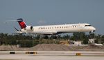
Florida Metal
@ KFLL

Mark Pasqualino
@ KATL

Florida Metal
@ KFLL

Florida Metal
@ FLL
Recent Routes
IN FLIGHT
EDV4991
| Time | Callsign | FL | Speed | Heading | Route |
|---|---|---|---|---|---|
| 2026-10-24 15:14 UTC | EDV4991 | FL5 | 97 kt | 90° |
ATL → LS46
ATL
→
LS46
Hartsfield/jackson Atlanta International Airport → Wc Fld Airport |
| 2026-10-24 14:14 UTC | EDV5234 | — | 8 kt | 3° | — |
| 2026-10-23 23:58 UTC | EDV5203 | FL12 | 136 kt | 45° | — |
| 2026-10-23 21:54 UTC | EDV5308 | — | 0 kt | 315° | — |
| 2026-10-23 16:54 UTC | EDV5352 | — | 15 kt | 0° | — |
| 2026-10-23 12:36 UTC | EDV4947 | — | 3 kt | 270° |
ABE → ATL
ABE
→
ATL
Lehigh Valley International Airport → Hartsfield/jackson Atlanta International Airport |
| 2026-10-23 03:10 UTC | EDV4970 | — | 6 kt | 107° |
ATL → ABE
ATL
→
ABE
Hartsfield/jackson Atlanta International Airport → Lehigh Valley International Airport |
| 2026-10-21 22:56 UTC | EDV5528 | — | 3 kt | 90° | — |
| 2026-10-21 19:10 UTC | EDV5312 | — | 12 kt | 270° | — |
| 2026-10-21 15:40 UTC | EDV5111 | — | 0 kt | 270° | — |
| 2026-10-21 10:12 UTC | EDVM910 | — | 10 kt | 0° | — |
| 2026-10-20 23:36 UTC | EDV5314 | — | 1 kt | 270° |
ATL → KL32
ATL
→
KL32
Hartsfield/jackson Atlanta International Airport → Jonesville Airport |
| 2026-10-20 12:48 UTC | EDV4940 | — | 16 kt | 90° | — |
| 2026-10-20 02:50 UTC | EDV5452 | FL133 | 373 kt | 260° | — |
| 2026-10-19 23:02 UTC | EDV5377 | — | 1 kt | 270° | — |
| 2026-10-19 19:58 UTC | EDV4955 | — | 0 kt | 270° | — |
| 2026-10-19 16:32 UTC | EDV5309 | — | 0 kt | 270° | — |
| 2026-10-19 12:16 UTC | EDV4927 | — | 0 kt | 270° | — |
| 2026-10-19 02:32 UTC | EDV5074 | FL93 | 289 kt | 249° | — |
| 2026-10-18 23:40 UTC | EDV5529 | — | 17 kt | 90° | — |
| 2026-10-18 18:22 UTC | EDV4707 | — | 0 kt | 110° | — |
| 2026-10-18 13:04 UTC | EDV5525 | — | 6 kt | 93° | — |
| 2026-10-18 02:54 UTC | EDV5535 | FL3 | 117 kt | 38° | — |
| 2026-10-17 23:40 UTC | EDV4633 | — | 0 kt | 270° | — |
| 2026-10-17 18:16 UTC | EDV5425 | — | 11 kt | 180° | — |
| 2026-10-17 00:50 UTC | EDV5282 | — | 19 kt | 90° | — |
| 2026-10-16 20:14 UTC | EDV5468 | — | 0 kt | 270° | — |
| 2026-10-16 15:50 UTC | EDV5142 | — | 13 kt | 6° | — |
| 2026-10-16 10:26 UTC | EDV5013 | — | 10 kt | 270° | — |
| 2026-10-15 14:54 UTC | EDV5143 | — | 12 kt | 17° | — |
| 2026-10-15 11:02 UTC | EDV5255 | — | 6 kt | 68° | — |
| 2026-10-15 02:34 UTC | EDV5443 | FL21 | 155 kt | 350° | — |
| 2026-10-15 00:16 UTC | EDV4709 | — | 15 kt | 0° | — |
| 2026-10-14 18:48 UTC | EDV4952 | — | 1 kt | 270° |
BMI → ATL
BMI
→
ATL
Central Il Rgnl/bloomington-normal Airport → Hartsfield/jackson Atlanta International Airport |
| 2026-10-14 11:50 UTC | EDV4912 | — | 0 kt | 281° |
DHN → ATL
DHN
→
ATL
Dothan Regional Airport → Hartsfield/jackson Atlanta International Airport |
| 2026-10-14 01:30 UTC | EDV4910 | FL4 | 139 kt | 315° |
ATL → DHN
ATL
→
DHN
Hartsfield/jackson Atlanta International Airport → Dothan Regional Airport |
| 2026-10-13 00:24 UTC | EDV5275 | — | 0 kt | 270° | — |
| 2026-10-12 21:44 UTC | EDV4889 | FL14 | 131 kt | 160° | — |
| 2026-10-12 18:28 UTC | EDV5283 | FL10 | 136 kt | 209° | — |
| 2026-10-12 13:48 UTC | EDV5479 | — | 17 kt | 28° | — |
| 2026-10-12 03:42 UTC | EDV5478 | FL9 | 142 kt | 0° | — |
| 2026-10-12 01:42 UTC | EDV4990 | FL8 | 142 kt | 29° | — |
| 2026-10-11 20:58 UTC | EDV4942 | FL16 | 149 kt | 236° | — |
| 2026-10-11 17:20 UTC | EDV5061 | — | 0 kt | 132° | — |
| 2026-10-11 11:42 UTC | EDV5454 | — | 1 kt | 214° | — |
| 2026-10-11 00:34 UTC | EDV5268 | FL2 | 138 kt | 358° | — |
| 2026-10-10 21:40 UTC | EDV5482 | — | 10 kt | 222° | — |
| 2026-10-10 11:34 UTC | EDV5137 | — | 0 kt | 132° |
BGR → LGA
BGR
→
LGA
Bangor International Airport → Laguardia Airport |
| 2026-10-10 03:16 UTC | EDV5396 | — | 1 kt | 17° |
LGA → BGR
LGA
→
BGR
Laguardia Airport → Bangor International Airport |
| 2026-10-10 01:00 UTC | EDV5002 | — | 1 kt | 149° |
LGA → BNA
LGA
→
BNA
Laguardia Airport → Nashville International Airport |
| 2026-10-09 21:38 UTC | EDV4647 | FL20 | 130 kt | 56° | — |
| 2026-10-09 13:00 UTC | EDV5092 | FL4 | 139 kt | 208° | — |
| 2026-10-09 00:28 UTC | EDV4676 | FL4 | 148 kt | 328° | — |
| 2026-10-08 21:28 UTC | EDV5184 | — | 0 kt | 132° | — |
| 2026-10-08 17:54 UTC | EDV5028 | — | 56 kt | 225° |
JFK → RDU
JFK
→
RDU
John F Kennedy International Airport → Raleigh-durham International Airport |
| 2026-10-08 15:30 UTC | EDV5294 | — | 15 kt | 172° | — |
| 2026-10-08 13:12 UTC | EDV5269 | — | 66 kt | 228° |
DCA → RDU
DCA
→
RDU
Ronald Reagan Washington Ntl Airport → Raleigh-durham International Airport |
| 2026-10-08 11:20 UTC | EDV5006 | — | 3 kt | 163° | — |
| 2026-10-08 02:12 UTC | EDV5285 | — | 45 kt | 225° |
BNA → RDU
BNA
→
RDU
Nashville International Airport → Raleigh-durham International Airport |
| 2026-10-07 23:44 UTC | EDV5336 | FL8 | 140 kt | 198° |
LGA → BNA
LGA
→
BNA
Laguardia Airport → Nashville International Airport |
| 2026-10-07 20:48 UTC | EDV5046 | — | 0 kt | 141° |
LGA → CLT
LGA
→
CLT
Laguardia Airport → Charlotte/douglas International Airport |
| 2026-10-07 14:40 UTC | EDV5172 | — | 2 kt | 323° |
OKC → LGA
OKC
→
LGA
Okc Will Rogers International Airport → Laguardia Airport |
| 2026-10-07 02:00 UTC | EDV5072 | — | 13 kt | 346° |
LGA → OKC
LGA
→
OKC
Laguardia Airport → Okc Will Rogers International Airport |
| 2026-10-06 02:36 UTC | EDV5247 | — | 13 kt | 338° |
BNA → RDU
BNA
→
RDU
Nashville International Airport → Raleigh-durham International Airport |
| 2026-10-05 20:30 UTC | EDV5132 | — | 0 kt | 132° | — |
| 2026-10-05 15:30 UTC | EDV5333 | — | 2 kt | 293° | — |
| 2026-10-05 03:06 UTC | EDV5493 | FL3 | 126 kt | 178° | — |
| 2026-10-05 01:08 UTC | EDV4969 | — | 0 kt | 132° | — |
| 2026-10-04 18:44 UTC | EDV5124 | FL7 | 136 kt | 208° | — |
| 2026-10-04 16:10 UTC | EDV4997 | FL13 | 144 kt | 328° | — |
| 2026-10-04 13:12 UTC | EDV5099 | FL6 | 131 kt | 208° | — |
| 2026-10-04 02:16 UTC | EDV5126 | FL7 | 126 kt | 209° |
GRB → DTW
GRB
→
DTW
Green Bay/austin Straubel International Airport → Detroit Metro Wayne County Airport |
| 2026-10-04 00:06 UTC | EDV5345 | FL5 | 131 kt | 208° | — |
| 2026-10-03 13:08 UTC | EDV5494 | FL4 | 136 kt | 29° | — |
| 2026-10-03 04:26 UTC | EDV5082 | FL5 | 159 kt | 129° | — |
| 2026-10-03 00:42 UTC | EDV5514 | FL6 | 131 kt | 28° | — |
| 2026-10-02 22:26 UTC | EDV5107 | FL33 | 194 kt | 218° | — |
| 2026-10-02 20:00 UTC | EDV5346 | — | 10 kt | 222° | — |
| 2026-10-02 15:04 UTC | EDV4631 | — | 9 kt | 124° | — |
| 2026-10-02 01:02 UTC | EDV4630 | FL9 | 135 kt | 183° | — |
| 2026-10-01 14:32 UTC | EDV4981 | — | 2 kt | 222° |
STL → LGA
STL
→
LGA
St Louis Lambert International Airport → Laguardia Airport |
| 2026-10-01 01:24 UTC | EDV4926 | — | 2 kt | 135° |
LGA → STL
LGA
→
STL
Laguardia Airport → St Louis Lambert International Airport |
| 2026-09-30 21:50 UTC | EDV4923 | — | 9 kt | 222° | — |
| 2026-09-30 15:34 UTC | EDV4960 | — | 0 kt | 135° |
LIT → LGA
LIT
→
LGA
Bill And Hillary Clinton Ntl/adams Fld Airport → Laguardia Airport |
| 2026-09-30 00:36 UTC | EDV4902 | — | 0 kt | 113° |
LGA → LIT
LGA
→
LIT
Laguardia Airport → Bill And Hillary Clinton Ntl/adams Fld Airport |
| 2026-09-29 03:42 UTC | EDV4648 | — | 14 kt | 323° | — |
| 2026-09-29 00:34 UTC | EDV5408 | FL31 | 200 kt | 193° |
JFK → 21MO
JFK
→
21MO
John F Kennedy International Airport → Baker Farm Airport |
| 2026-09-28 20:22 UTC | EDV5262 | FL3 | 142 kt | 301° | — |
| 2026-09-28 15:36 UTC | EDV5230 | FL19 | 146 kt | 12° | — |
| 2026-09-28 12:02 UTC | EDV4956 | — | 15 kt | 37° |
LGA → RDU
LGA
→
RDU
Laguardia Airport → Raleigh-durham International Airport |
| 2026-09-28 03:36 UTC | EDV5101 | — | 6 kt | 188° |
LGA → RDU
LGA
→
RDU
Laguardia Airport → Raleigh-durham International Airport |
| 2026-09-27 15:58 UTC | EDV4924 | — | 7 kt | 222° | — |
| 2026-09-26 21:30 UTC | EDV4922 | — | 8 kt | 188° |
LGA → STL
LGA
→
STL
Laguardia Airport → St Louis Lambert International Airport |
| 2026-09-25 18:04 UTC | EDV4645 | FL4 | 139 kt | 29° | — |
| 2026-09-25 00:42 UTC | EDV5353 | FL4 | 134 kt | 28° | — |
| 2026-09-24 23:06 UTC | EDV5194 | FL5 | 135 kt | 49° | — |
| 2026-09-24 20:04 UTC | EDV5391 | — | 2 kt | 312° | — |
| 2026-09-24 17:40 UTC | EDV5423 | FL50 | 229 kt | 60° | — |
Live location data from OpenSky Network
Airframe Info
| Manufacturer | Bombardier |
| Model | CRJ-900ER (CL-600-2D24) Search all Bombardier CRJ-900ER (CL-600-2D24) |
| Year built | 2007 |
| Construction Number (C/N) | 15143 |
| Aircraft Type | Fixed wing multi engine |
| Number of Seats | 22 |
| Number of Engines | 2 |
| Engine Type | Turbofan |
| Engine Manufacturer and Model | Ge CF34-8C5 |
Aircraft
| Registration Number | N910XJ |
| Mode S (ICAO24) Code | ac98c1 |
| Certification Class | Standard |
| Certification Issued | 2009-12-31 |
| Air Worthiness Test | 2007-10-11 |
| Last Action Taken | 2023-08-04 |
| Current Status | Valid |
Owner
| Registration Type | Corporation |
| Owner | DELTA AIR LINES INC |
| Address |
Dept 595 Aircraft Registrations Atlanta, GA 303543743 United States |
| Region | Southern |