Aircraft N913XJ Data
1
aircraft record found
N913XJ
2007 Bombardier CRJ-900ER (CL-600-2D24), c/n 15148
Latest photos of N913XJ
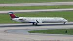
FloridaMetal
@ KATL
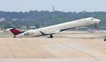
FloridaMetal
@ KATL
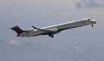
FloridaMetal
@ KATL
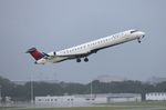
Florida Metal
@ KTPA
Recent Routes
IN FLIGHT
EDV5022
| Time | Callsign | FL | Speed | Heading | Route |
|---|---|---|---|---|---|
| 2026-10-23 22:58 UTC | EDV5022 | FL330 | 455 kt | 8° | — |
| 2026-10-23 18:46 UTC | EDV4964 | — | 2 kt | 194° | — |
| 2026-10-23 11:48 UTC | EDV4702 | — | 0 kt | 219° |
RST → MSP
RST
→
MSP
Rochester International Airport → Minneapolis-st Paul Intl/wold-chamberlain Airport |
| 2026-10-23 03:32 UTC | EDV4706 | — | 0 kt | 73° |
MSP → RST
MSP
→
RST
Minneapolis-st Paul Intl/wold-chamberlain Airport → Rochester International Airport |
| 2026-10-22 21:56 UTC | EDV5474 | — | 0 kt | 214° | — |
| 2026-10-22 19:08 UTC | EDV4640 | FL12 | 137 kt | 316° | — |
| 2026-10-22 17:14 UTC | EDV5303 | FL5 | 145 kt | 29° | — |
| 2026-10-22 15:18 UTC | EDV5086 | FL12 | 138 kt | 272° | — |
| 2026-10-22 12:40 UTC | EDV5008 | — | 21 kt | 121° |
CLE → JFK
CLE
→
JFK
Cleveland-hopkins International Airport → John F Kennedy International Airport |
| 2026-10-22 01:20 UTC | EDV5071 | FL6 | 141 kt | 50° | — |
| 2026-10-21 22:44 UTC | EDV4643 | FL5 | 143 kt | 28° | — |
| 2026-10-21 20:28 UTC | EDV4680 | FL3 | 140 kt | 329° | — |
| 2026-10-21 17:14 UTC | EDV4852 | — | 0 kt | 205° |
MSP → RST
MSP
→
RST
Minneapolis-st Paul Intl/wold-chamberlain Airport → Rochester International Airport |
| 2026-10-21 13:30 UTC | EDV5427 | — | 4 kt | 293° |
YUL → MSP
YUL
→
MSP
Montreal / Pierre Elliott Trudeau International Airport → Minneapolis-st Paul Intl/wold-chamberlain Airport |
| 2026-10-21 03:18 UTC | EDV5489 | — | 12 kt | 129° |
MSP → YUL
MSP
→
YUL
Minneapolis-st Paul Intl/wold-chamberlain Airport → Montreal / Pierre Elliott Trudeau International Airport |
| 2026-10-20 23:32 UTC | EDV4638 | — | 2 kt | 211° | — |
| 2026-10-20 21:08 UTC | EDV5491 | FL51 | 255 kt | 109° | — |
| 2026-10-20 18:30 UTC | EDV5159 | — | 0 kt | 203° |
GRB → MSP
GRB
→
MSP
Green Bay/austin Straubel International Airport → Minneapolis-st Paul Intl/wold-chamberlain Airport |
| 2026-10-20 14:22 UTC | EDV5523 | — | 1 kt | 228° | — |
| 2026-10-20 02:46 UTC | EDV5527 | FL14 | 137 kt | 46° | — |
| 2026-10-19 21:56 UTC | EDV4693 | — | 0 kt | 211° | — |
| 2026-10-19 18:20 UTC | EDV5435 | FL1 | 146 kt | 330° | — |
| 2026-10-19 15:04 UTC | EDV5214 | — | 13 kt | 267° | — |
| 2026-10-19 11:24 UTC | EDV4661 | — | 0 kt | 270° | — |
| 2026-10-19 03:08 UTC | EDV4669 | FL8 | 149 kt | 227° | — |
| 2026-10-19 00:26 UTC | EDV5376 | — | 10 kt | 53° | — |
| 2026-10-18 20:58 UTC | EDV5519 | — | 7 kt | 270° | — |
| 2026-10-18 17:00 UTC | EDV5084 | — | 6 kt | 31° |
ATL → ABY
ATL
→
ABY
Hartsfield/jackson Atlanta International Airport → Southwest Georgia Regional Airport |
| 2026-10-18 13:14 UTC | EDV4937 | — | 0 kt | 270° | — |
| 2026-10-18 03:36 UTC | EDV4950 | FL5 | 129 kt | 270° | — |
| 2026-10-18 00:20 UTC | EDV5275 | — | 2 kt | 180° | — |
| 2026-10-17 21:38 UTC | EDV4889 | FL12 | 142 kt | 340° | — |
| 2026-10-17 18:26 UTC | EDV5283 | FL3 | 141 kt | 209° | — |
| 2026-10-17 11:42 UTC | EDV5279 | FL3 | 132 kt | 29° | — |
| 2026-10-17 03:36 UTC | EDV5448 | FL14 | 118 kt | 331° | — |
| 2026-10-17 00:40 UTC | EDV5499 | FL6 | 117 kt | 29° | — |
| 2026-10-16 22:06 UTC | EDV5313 | FL5 | 137 kt | 147° | — |
| 2026-10-16 19:36 UTC | EDV5419 | — | 0 kt | 326° | — |
| 2026-10-16 17:14 UTC | EDV5206 | FL57 | 195 kt | 239° | — |
| 2026-10-16 00:18 UTC | EDV5105 | — | 0 kt | 90° | — |
| 2026-10-15 19:30 UTC | EDV5157 | — | 10 kt | 0° |
ATL → 9LS1
ATL
→
9LS1
Hartsfield/jackson Atlanta International Airport → Bayou Meadows Airport |
| 2026-10-15 14:36 UTC | EDV5309 | — | 0 kt | 270° | — |
| 2026-10-15 11:06 UTC | EDV5462 | — | 0 kt | 281° | — |
| 2026-10-15 02:58 UTC | EDV5515 | FL2 | 130 kt | 211° | — |
| 2026-10-14 23:12 UTC | EDV5389 | — | 0 kt | 293° |
ATL → BMI
ATL
→
BMI
Hartsfield/jackson Atlanta International Airport → Central Il Rgnl/bloomington-normal Airport |
| 2026-10-14 17:56 UTC | EDV4686 | — | 0 kt | 270° | — |
| 2026-10-13 19:48 UTC | EDV4663 | — | 0 kt | 281° | — |
| 2026-10-13 14:16 UTC | EDV5013 | — | 10 kt | 0° | — |
| 2026-10-12 18:30 UTC | EDV4955 | — | 0 kt | 270° | — |
| 2026-10-12 14:52 UTC | EDV5143 | — | 0 kt | 281° | — |
| 2026-10-12 10:18 UTC | EDV5291 | — | 0 kt | 270° | — |
| 2026-10-12 03:34 UTC | EDV5358 | FL2 | 141 kt | 169° | — |
| 2026-10-12 00:42 UTC | EDV5161 | — | 20 kt | 90° | — |
| 2026-10-11 21:02 UTC | EDV5244 | — | 2 kt | 90° | — |
| 2026-10-11 19:02 UTC | EDV5199 | FL8 | 148 kt | 0° |
LGA → OKC
LGA
→
OKC
Laguardia Airport → Okc Will Rogers International Airport |
| 2026-10-11 16:20 UTC | EDV5378 | FL7 | 136 kt | 29° | — |
| 2026-10-11 14:04 UTC | EDV5354 | FL10 | 131 kt | 213° | — |
| 2026-10-10 22:32 UTC | EDV5238 | FL6 | 137 kt | 209° | — |
| 2026-10-10 18:48 UTC | EDV5390 | — | 23 kt | 28° | — |
| 2026-10-10 12:56 UTC | EDV5092 | FL5 | 141 kt | 209° | — |
| 2026-10-10 01:20 UTC | EDV5293 | FL4 | 146 kt | 327° | — |
| 2026-10-09 21:30 UTC | EDV5289 | — | 15 kt | 121° |
ROC → JFK
ROC
→
JFK
Frederick Douglass/greater Rochester International Airport → John F Kennedy International Airport |
| 2026-10-09 19:26 UTC | EDV5211 | — | 1 kt | 59° | — |
| 2026-10-09 17:16 UTC | EDV5505 | FL6 | 136 kt | 209° | — |
| 2026-10-09 14:30 UTC | EDV5502 | FL18 | 128 kt | 56° | — |
| 2026-10-09 11:48 UTC | EDV5226 | — | 14 kt | 309° | — |
| 2026-10-09 03:18 UTC | EDV5485 | FL2 | 126 kt | 322° | — |
| 2026-10-09 00:02 UTC | EDV4990 | FL8 | 137 kt | 209° | — |
| 2026-10-08 21:02 UTC | EDV4942 | FL20 | 143 kt | 56° | — |
| 2026-10-08 17:44 UTC | EDV5254 | — | 1 kt | 290° |
BGR → LGA
BGR
→
LGA
Bangor International Airport → Laguardia Airport |
| 2026-10-08 12:46 UTC | EDV5050 | — | 6 kt | 222° | — |
| 2026-10-08 03:10 UTC | EDV4918 | FL11 | 130 kt | 221° | — |
| 2026-10-08 00:36 UTC | EDV5004 | — | 8 kt | 219° | — |
| 2026-10-07 18:48 UTC | EDV5075 | — | 10 kt | 118° | — |
| 2026-10-07 15:16 UTC | EDV5026 | FL9 | 132 kt | 180° | — |
| 2026-10-07 12:44 UTC | EDV5120 | — | 0 kt | 287° | — |
| 2026-10-07 00:52 UTC | EDV5222 | FL4 | 128 kt | 45° |
EWR → RDU
EWR
→
RDU
Newark Liberty International Airport → Raleigh-durham International Airport |
| 2026-10-06 19:54 UTC | EDV5260 | FL3 | 137 kt | 45° |
EWR → RDU
EWR
→
RDU
Newark Liberty International Airport → Raleigh-durham International Airport |
| 2026-10-06 17:16 UTC | EDV5273 | — | 12 kt | 225° | — |
| 2026-10-06 14:36 UTC | EDV5097 | — | 10 kt | 318° |
JFK → RDU
JFK
→
RDU
John F Kennedy International Airport → Raleigh-durham International Airport |
| 2026-10-06 12:14 UTC | EDV5445 | FL0 | 125 kt | 300° | — |
| 2026-10-06 00:24 UTC | EDV4676 | FL6 | 135 kt | 327° | — |
| 2026-10-05 20:40 UTC | EDV5046 | — | 9 kt | 121° |
LGA → CLT
LGA
→
CLT
Laguardia Airport → Charlotte/douglas International Airport |
| 2026-10-05 14:14 UTC | EDV5210 | — | 1 kt | 132° | — |
| 2026-10-05 02:44 UTC | EDV5040 | FL5 | 134 kt | 1° |
LGA → HSV
LGA
→
HSV
Laguardia Airport → Huntsville Intl-carl T Jones Fld Airport |
| 2026-10-04 23:00 UTC | EDV5212 | — | 3 kt | 132° | — |
| 2026-10-04 17:34 UTC | EDV4924 | — | 0 kt | 326° | — |
| 2026-10-03 20:16 UTC | EDV5166 | — | 1 kt | 290° |
YYZ → LGA
YYZ
→
LGA
Lester B Pearson International Airport → Laguardia Airport |
| 2026-10-03 17:28 UTC | EDV5094 | FL2 | 0 kt | 115° |
LGA → YYZ
LGA
→
YYZ
Laguardia Airport → Lester B Pearson International Airport |
| 2026-10-03 14:28 UTC | EDV5457 | — | 8 kt | 222° | — |
| 2026-10-03 01:50 UTC | EDV5398 | FL4 | 136 kt | 90° | — |
| 2026-10-02 22:22 UTC | EDV5232 | — | 3 kt | 298° | — |
| 2026-10-02 19:18 UTC | EDV4675 | FL9 | 137 kt | 197° | — |
| 2026-10-02 16:26 UTC | EDV5153 | — | 0 kt | 309° |
LGA → K60J
LGA
→
K60J
Laguardia Airport → Odell Williamson Municipal Airport |
| 2026-10-02 11:28 UTC | EDV5334 | — | 4 kt | 158° | — |
| 2026-10-02 03:32 UTC | EDV5518 | FL4 | 126 kt | 218° | — |
| 2026-10-01 16:04 UTC | EDV5513 | — | 13 kt | 177° | — |
| 2026-10-01 12:16 UTC | EDV4673 | — | 11 kt | 270° | — |
| 2026-10-01 01:26 UTC | EDV4692 | FL7 | 129 kt | 65° | — |
| 2026-09-30 22:56 UTC | EDV5537 | — | 1 kt | 79° | — |
| 2026-09-30 18:56 UTC | EDV4970 | — | 13 kt | 180° |
ATL → ABE
ATL
→
ABE
Hartsfield/jackson Atlanta International Airport → Lehigh Valley International Airport |
| 2026-09-30 13:26 UTC | EDV5317 | — | 1 kt | 90° | — |
| 2026-09-30 00:26 UTC | EDV5003 | FL12 | 139 kt | 225° | — |
| 2026-09-29 21:42 UTC | EDV4923 | — | 0 kt | 132° | — |
| 2026-09-29 14:52 UTC | EDV5172 | — | 0 kt | 141° |
OKC → LGA
OKC
→
LGA
Okc Will Rogers International Airport → Laguardia Airport |
| 2026-09-28 23:16 UTC | EDV5463 | — | 3 kt | 146° | — |
| 2026-09-28 16:54 UTC | EDV4960 | — | 5 kt | 253° |
LIT → LGA
LIT
→
LGA
Bill And Hillary Clinton Ntl/adams Fld Airport → Laguardia Airport |
| 2026-09-28 02:22 UTC | EDV4902 | — | 0 kt | 113° |
LGA → LIT
LGA
→
LIT
Laguardia Airport → Bill And Hillary Clinton Ntl/adams Fld Airport |
| 2026-09-27 22:28 UTC | EDV5184 | — | 6 kt | 149° | — |
| 2026-09-27 17:58 UTC | EDV5028 | FL7 | 136 kt | 226° |
JFK → RDU
JFK
→
RDU
John F Kennedy International Airport → Raleigh-durham International Airport |
| 2026-09-27 15:24 UTC | EDV5294 | FL4 | 139 kt | 31° | — |
| 2026-09-27 12:52 UTC | EDV5269 | FL6 | 134 kt | 225° |
DCA → RDU
DCA
→
RDU
Ronald Reagan Washington Ntl Airport → Raleigh-durham International Airport |
| 2026-09-27 11:12 UTC | EDV5006 | — | 25 kt | 354° | — |
| 2026-09-27 03:00 UTC | EDV4648 | FL5 | 129 kt | 45° | — |
| 2026-09-27 00:14 UTC | EDV5408 | FL33 | 202 kt | 225° |
JFK → 21MO
JFK
→
21MO
John F Kennedy International Airport → Baker Farm Airport |
| 2026-09-26 19:54 UTC | EDV5009 | FL3 | 123 kt | 31° | — |
| 2026-09-25 17:46 UTC | EDV5270 | FL4 | 141 kt | 29° | — |
| 2026-09-25 15:34 UTC | EDV4983 | FL18 | 142 kt | 44° | — |
| 2026-09-25 11:46 UTC | EDV5183 | — | 4 kt | 233° |
YYZ → LGA
YYZ
→
LGA
Lester B Pearson International Airport → Laguardia Airport |
| 2026-09-25 01:08 UTC | EDV5019 | FL1 | 0 kt | 113° |
LGA → YYZ
LGA
→
YYZ
Laguardia Airport → Lester B Pearson International Airport |
| 2026-09-24 22:04 UTC | EDV5089 | — | 5 kt | 98° | — |
| 2026-09-24 15:28 UTC | EDV5447 | — | 2 kt | 158° |
YYZ → LGA
YYZ
→
LGA
Lester B Pearson International Airport → Laguardia Airport |
| 2026-09-24 12:56 UTC | EDV5187 | — | 1 kt | 90° |
LGA → YYZ
LGA
→
YYZ
Laguardia Airport → Lester B Pearson International Airport |
| 2026-09-24 04:18 UTC | EDV5109 | — | 1 kt | 326° |
BNA → LGA
BNA
→
LGA
Nashville International Airport → Laguardia Airport |
| 2026-09-24 01:20 UTC | EDV5152 | — | 14 kt | 53° | — |
| 2026-09-23 23:00 UTC | EDV5101 | — | 12 kt | 326° |
LGA → RDU
LGA
→
RDU
Laguardia Airport → Raleigh-durham International Airport |
Live location data from OpenSky Network
Airframe Info
| Manufacturer | Bombardier |
| Model | CRJ-900ER (CL-600-2D24) Search all Bombardier CRJ-900ER (CL-600-2D24) |
| Year built | 2007 |
| Construction Number (C/N) | 15148 |
| Aircraft Type | Fixed wing multi engine |
| Number of Seats | 22 |
| Number of Engines | 2 |
| Engine Type | Turbofan |
| Engine Manufacturer and Model | Ge CF34-8C5 |
| Also Registered As |
Aircraft
| Registration Number | N913XJ |
| Mode S (ICAO24) Code | aca3e6 |
| Certification Class | Standard |
| Certification Issued | 2009-12-31 |
| Air Worthiness Test | 2008-01-04 |
| Last Action Taken | 2023-08-04 |
| Current Status | Valid |
Owner
| Registration Type | Corporation |
| Owner | DELTA AIR LINES INC |
| Address |
Dept 595 Aircraft Registrations Atlanta, GA 303543743 United States |
| Region | Southern |