Aircraft N922AE Data
2
aircraft records found
N922AE
2005 Embraer ERJ-145LR (EMB-145LR), c/n 14500906
Latest photos of N922AE
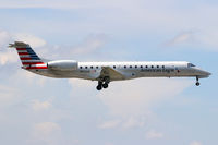
Dave Turpie
@ KMIA
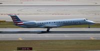
Florida Metal
@ KMIA

Florida Metal
@ KMIA

magnaman
@ ORD
Recent Routes
NO LIVE DATA
Piedmont Airlines (1948-1989)
| Time | Callsign | FL | Speed | Heading | Route |
|---|---|---|---|---|---|
| 2026-10-24 16:56 UTC | PDT5845 / PI5845 | — | 8 kt | 20° | — |
| 2026-10-24 14:28 UTC | PDT5925 / PI5925 | FL6 | 126 kt | 33° | — |
| 2026-10-24 11:12 UTC | PDT6060 / PI6060 | FL-6 | 116 kt | 339° | — |
| 2026-10-24 04:12 UTC | PDT5856 / PI5856 | FL22 | 119 kt | 44° | — |
| 2026-10-24 02:52 UTC | PDT6088 / PI6088 | FL5 | 113 kt | 357° | — |
| 2026-10-24 01:20 UTC | PDT5912 / PI5912 | FL46 | 217 kt | 315° | — |
| 2026-10-23 23:00 UTC | PDT6024 / PI6024 | FL11 | 124 kt | 356° | — |
| 2026-10-23 19:56 UTC | PDT5801 / PI5801 | FL8 | 125 kt | 357° | — |
| 2026-10-23 15:44 UTC | PDT6094 / PI6094 | FL6 | 129 kt | 356° | — |
| 2026-10-23 14:04 UTC | PDT6093 / PI6093 | FL11 | 134 kt | 44° | — |
| 2026-10-23 11:58 UTC | PDT5792 / PI5792 | — | 32 kt | 357° | — |
| 2026-10-23 02:00 UTC | PDT5822 / PI5822 | FL39 | 260 kt | 122° | — |
| 2026-10-22 23:06 UTC | PDT6058 / PI6058 | FL7 | 137 kt | 356° | — |
| 2026-10-22 21:46 UTC | PDT5829 / PI5829 | FL9 | 136 kt | 32° | — |
| 2026-10-22 19:54 UTC | PDT5984 / PI5984 | FL18 | 141 kt | 356° | — |
| 2026-10-22 17:02 UTC | PDT6008 / PI6008 | FL18 | 134 kt | 357° |
CLT → KEBD
CLT
→
KEBD
Charlotte/douglas International Airport → Southern West Virginia Regional Airport |
| 2026-10-22 13:42 UTC | PDT5955 / PI5955 | FL15 | 133 kt | 355° | — |
| 2026-10-22 10:00 UTC | PDT5793 / PI5793 | FL14 | 132 kt | 356° | — |
| 2026-10-22 03:44 UTC | PDT5902 / PI5902 | FL14 | 159 kt | 189° | — |
| 2026-10-22 01:02 UTC | PDT5842 / PI5842 | FL10 | 128 kt | 355° | — |
| 2026-10-21 20:34 UTC | PDT6085 / PI6085 | FL7 | 134 kt | 357° | — |
| 2026-10-21 15:42 UTC | PDT5996 / PI5996 | FL7 | 136 kt | 356° | — |
| 2026-10-21 12:00 UTC | PDT6070 / PI6070 | FL9 | 122 kt | 357° | — |
| 2026-10-21 00:02 UTC | PDT6073 / PI6073 | FL6 | 139 kt | 297° | — |
| 2026-10-20 21:06 UTC | PDT6049 / PI6049 | FL6 | 123 kt | 356° | — |
| 2026-10-20 16:34 UTC | PDT5983 / PI5983 | FL9 | 139 kt | 357° | — |
| 2026-10-20 12:52 UTC | PDT5787 / PI5787 | FL6 | 122 kt | 356° | — |
| 2026-10-20 03:38 UTC | PDT5803 / PI5803 | FL27 | 206 kt | 204° | — |
| 2026-10-20 00:34 UTC | PDT5985 / PI5985 | — | 17 kt | 340° | — |
| 2026-10-19 21:10 UTC | PDT5865 / PI5865 | — | 33 kt | 357° | — |
| 2026-10-19 17:40 UTC | PDT5997 / PI5997 | FL9 | 136 kt | 356° | — |
| 2026-10-19 14:12 UTC | PDT6001 / PI6001 | FL5 | 131 kt | 355° | — |
| 2026-10-18 16:24 UTC | PDT9654 / PI9654 | FL3 | 131 kt | 357° | — |
| 2026-10-18 14:00 UTC | PDT9653 / PI9653 | FL9 | 139 kt | 142° | — |
| 2026-10-18 04:36 UTC | PDT6041 / PI6041 | — | 36 kt | 357° | — |
| 2026-10-18 00:50 UTC | PDT5989 / PI5989 | FL5 | 113 kt | 356° | — |
| 2026-10-17 19:42 UTC | PDT6064 / PI6064 | FL7 | 134 kt | 357° | — |
| 2026-10-17 14:54 UTC | PDT6030 / PI6030 | — | 33 kt | 354° |
ROA → CLT
ROA
→
CLT
Roanoke/blacksburg Regional (woodrum Fld) Airport → Charlotte/douglas International Airport |
| 2026-10-17 10:04 UTC | PDT8860 / PI8860 | FL10 | 121 kt | 356° | — |
| 2026-10-17 03:36 UTC | PDT5970 / PI5970 | FL31 | 284 kt | 76° | — |
| 2026-10-17 01:50 UTC | PDT6081 / PI6081 | FL9 | 133 kt | 176° | — |
| 2026-10-16 19:42 UTC | PDT6089 / PI6089 | FL8 | 140 kt | 176° | — |
| 2026-10-16 16:00 UTC | PDT5990 / PI5990 | FL10 | 131 kt | 176° | — |
| 2026-10-16 12:54 UTC | PDT5897 / PI5897 | FL39 | 176 kt | 176° |
ROA → CLT
ROA
→
CLT
Roanoke/blacksburg Regional (woodrum Fld) Airport → Charlotte/douglas International Airport |
| 2026-10-15 04:06 UTC | PDT9979 / PI9979 | FL11 | 118 kt | 328° | — |
| 2026-10-14 13:44 UTC | PDT6129 / PI6129 | FL6 | 132 kt | 219° | — |
| 2026-10-14 02:46 UTC | PDT5840 / PI5840 | — | 13 kt | 20° | — |
| 2026-10-13 22:38 UTC | PDT5947 / PI5947 | FL39 | 156 kt | 340° | — |
| 2026-10-13 16:00 UTC | PDT5878 / PI5878 | FL8 | 133 kt | 357° | — |
| 2026-10-13 14:14 UTC | PDT6083 / PI6083 | FL3 | 121 kt | 0° | — |
| 2026-10-13 11:26 UTC | PDT5920 / PI5920 | — | 90 kt | 357° | — |
| 2026-10-13 03:26 UTC | PDT6101 / PI6101 | FL58 | 276 kt | 184° | — |
| 2026-10-13 00:50 UTC | PDT5991 / PI5991 | FL8 | 130 kt | 356° | — |
| 2026-10-12 17:32 UTC | PDT5938 / PI5938 | FL9 | 145 kt | 356° | — |
| 2026-10-12 14:02 UTC | PDT6061 / PI6061 | FL11 | 133 kt | 356° | — |
| 2026-10-12 10:16 UTC | PDT5933 / PI5933 | FL12 | 129 kt | 356° | — |
| 2026-10-12 06:36 UTC | PDT5802 / PI5802 | FL30 | 144 kt | 226° | — |
| 2026-10-12 03:52 UTC | PDT5870 / PI5870 | — | 15 kt | 250° | — |
| 2026-10-11 23:00 UTC | PDT5923 / PI5923 | — | 18 kt | 338° | — |
| 2026-10-11 16:38 UTC | PDT6116 / PI6116 | — | 12 kt | 301° | — |
| 2026-10-11 14:08 UTC | PDT5839 / PI5839 | FL6 | 137 kt | 87° | — |
| 2026-10-11 11:54 UTC | PDT5887 / PI5887 | — | 12 kt | 248° |
YYZ → PHL
YYZ
→
PHL
Lester B Pearson International Airport → Philadelphia International Airport |
| 2026-10-10 21:16 UTC | PDT5886 / PI5886 | — | 9 kt | 39° |
YYZ → PHL
YYZ
→
PHL
Lester B Pearson International Airport → Philadelphia International Airport |
| 2026-10-10 18:06 UTC | PDT5827 / PI5827 | — | 8 kt | 228° | — |
| 2026-10-09 21:12 UTC | PDT5954 / PI5954 | — | 11 kt | 245° | — |
| 2026-10-09 16:00 UTC | PDT6114 / PI6114 | FL31 | 244 kt | 224° | — |
| 2026-10-09 12:52 UTC | PDT6056 / PI6056 | — | 10 kt | 340° | — |
| 2026-10-08 23:28 UTC | PDT5807 / PI5807 | FL9 | 125 kt | 297° | — |
| 2026-10-08 22:12 UTC | PDT5949 / PI5949 | — | 15 kt | 281° | — |
| 2026-10-08 13:48 UTC | PDT6002 / PI6002 | FL9 | 155 kt | 212° | — |
| 2026-10-08 11:40 UTC | PDT5916 / PI5916 | FL8 | 143 kt | 356° | — |
| 2026-10-08 01:48 UTC | PDT5881 / PI5881 | FL72 | 236 kt | 320° | — |
| 2026-10-07 23:12 UTC | PDT5967 / PI5967 | FL12 | 142 kt | 356° | — |
| 2026-10-07 19:08 UTC | PDT6003 / PI6003 | FL9 | 146 kt | 356° | — |
| 2026-10-07 10:08 UTC | PDT6072 / PI6072 | FL10 | 145 kt | 356° | — |
| 2026-10-07 02:56 UTC | PDT5899 / PI5899 | FL46 | 249 kt | 91° | — |
| 2026-10-06 19:48 UTC | PDT5952 / PI5952 | FL10 | 142 kt | 356° | — |
| 2026-10-06 15:02 UTC | PDT6065 / PI6065 | FL10 | 132 kt | 356° | — |
| 2026-10-05 19:08 UTC | PDT6031 / PI6031 | FL8 | 134 kt | 357° | — |
| 2026-10-05 14:04 UTC | PDT5960 / PI5960 | FL8 | 137 kt | 356° | — |
| 2026-10-05 09:44 UTC | PDT5814 / PI5814 | FL8 | 133 kt | 356° | — |
| 2026-10-05 03:32 UTC | PDT5913 / PI5913 | FL39 | 205 kt | 314° | — |
| 2026-10-05 01:46 UTC | PDT5964 / PI5964 | FL7 | 131 kt | 356° | — |
| 2026-10-04 22:22 UTC | PDT5995 / PI5995 | FL10 | 140 kt | 356° | — |
| 2026-10-04 18:18 UTC | PDT6016 / PI6016 | FL7 | 135 kt | 357° |
CLT → 14MS
CLT
→
14MS
Charlotte/douglas International Airport → Rose Fld Airport |
| 2026-10-04 11:30 UTC | PDT5834 / PI5834 | FL7 | 130 kt | 356° | — |
| 2026-10-01 20:16 UTC | PDT9980 / PI9980 | FL7 | 118 kt | 215° | — |
| 2026-10-01 13:10 UTC | PDT6037 / PI6037 | — | 8 kt | 295° | — |
| 2026-09-30 23:26 UTC | PDT6000 / PI6000 | — | 9 kt | 290° | — |
| 2026-09-30 21:40 UTC | PDT6120 / PI6120 | FL11 | 139 kt | 297° | — |
| 2026-09-30 19:04 UTC | PDT6042 / PI6042 | FL14 | 140 kt | 357° | — |
| 2026-09-30 14:50 UTC | PDT5993 / PI5993 | FL17 | 151 kt | 356° | — |
| 2026-09-30 01:56 UTC | PDT6013 / PI6013 | FL21 | 170 kt | 57° | — |
| 2026-09-29 21:38 UTC | PDT5841 / PI5841 | FL10 | 144 kt | 356° | — |
| 2026-09-29 15:14 UTC | PDT6079 / PI6079 | FL17 | 140 kt | 225° | — |
| 2026-09-29 12:40 UTC | PDT5830 / PI5830 | — | 9 kt | 278° |
ROA → PHL
ROA
→
PHL
Roanoke/blacksburg Regional (woodrum Fld) Airport → Philadelphia International Airport |
| 2026-09-29 02:50 UTC | PDT5905 / PI5905 | FL15 | 129 kt | 328° | — |
| 2026-09-28 19:46 UTC | PDT6128 / PI6128 | FL10 | 138 kt | 357° | — |
| 2026-09-28 14:58 UTC | PDT5928 / PI5928 | FL8 | 141 kt | 356° | — |
| 2026-09-28 10:56 UTC | PDT5852 / PI5852 | FL12 | 134 kt | 355° | — |
| 2026-09-28 03:36 UTC | PDT5876 / PI5876 | FL54 | 249 kt | 47° | — |
| 2026-09-27 15:50 UTC | PDT5962 / PI5962 | FL9 | 136 kt | 356° | — |
| 2026-09-27 11:10 UTC | PDT5799 / PI5799 | FL13 | 130 kt | 356° | — |
| 2026-09-27 00:08 UTC | PDT5893 / PI5893 | FL20 | 115 kt | 31° | — |
| 2026-09-26 22:06 UTC | PDT6010 / PI6010 | FL10 | 135 kt | 356° |
PHL → BDL
PHL
→
BDL
Philadelphia International Airport → Bradley International Airport |
| 2026-09-26 18:22 UTC | PDT5883 / PI5883 | — | 15 kt | 166° | — |
| 2026-09-26 13:12 UTC | PDT6071 / PI6071 | FL8 | 131 kt | 356° | — |
| 2026-09-26 03:36 UTC | PDT5891 / PI5891 | FL7 | 126 kt | 2° | — |
| 2026-09-26 00:04 UTC | PDT5981 / PI5981 | FL9 | 118 kt | 356° | — |
| 2026-09-25 20:48 UTC | PDT6097 / PI6097 | FL7 | 137 kt | 356° | — |
| 2026-09-25 12:34 UTC | PDT5846 / PI5846 | FL7 | 123 kt | 357° | — |
| 2026-09-25 00:14 UTC | PDT5968 / PI5968 | FL14 | 122 kt | 356° | — |
| 2026-09-24 20:00 UTC | PDT5999 / PI5999 | FL18 | 128 kt | 355° | — |
Live location data from OpenSky Network
Airframe Info
| Manufacturer | Embraer |
| Model | ERJ-145LR (EMB-145LR) Search all Embraer ERJ-145LR (EMB-145LR) |
| Year built | 2005 |
| Construction Number (C/N) | 14500906 |
| Aircraft Type | Fixed wing multi engine |
| Number of Seats | 55 |
| Number of Engines | 2 |
| Engine Type | Turbofan |
| Engine Manufacturer and Model | Rolls-Royce Ae3007A1P |
Aircraft
| Registration Number | N922AE |
| Mode S (ICAO24) Code | acc59d |
| Certification Class | Standard |
| Certification Issued | 2011-09-29 |
| Air Worthiness Test | 2005-04-29 |
| Last Action Taken | 2023-03-17 |
| Current Status | Valid |
Owner
| Registration Type | Corporation |
| Owner | AMERICAN AIRLINES INC |
| Address |
Md 8b369 Fort Worth, TX 76155 United States |
| Region | Southwestern |
N922AE
1991 British Aerospace BAe-3201 Jetstream, c/n 922
Airframe Info
| Manufacturer | British Aerospace |
| Model | BAe-3201 Jetstream Search all British Aerospace BAe-3201 Jetstream |
| Year built | 1991 |
| Construction Number (C/N) | 922 |
| Aircraft Type | Fixed wing multi engine |
| Number of Seats | 19 |
| Number of Engines | 2 |
| Engine Type | Turbo-prop |
| Engine Manufacturer and Model | Airesearch TPE331 SERIES |
| Also Registered As |
Aircraft
| Registration Number | N922AE |
| Mode S (ICAO24) Code | |
| Current Status | De-registered |
| Delivery Date | 1991-04-09 |
Owner
| Owner | Corporate Express Airlines |
| Address |
Smyrna, TN United States |