Nash General Hospital Heliport (0NC5)
Nash General Hospital Heliport (0NC5)
0NC5
Nash General Hospital Heliport (0NC5)
Rocky Mount, NC
Latest photos of Nash General Hospital Heliport (0NC5)
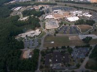
T Parker
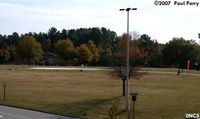
Paul Perry
| FAA Information Effective | 2026-09-03 |
| Airport Identifier | 0NC5 |
| Airport Status | Operational |
| Longitude/Latitude |
77°51'6.7911"
W /
35°58'28.2919"
N -77.851886 / 35.974525 (Estimated) |
| Elevation | 164.00 ft / 49.99 m (Estimated) |
| From nearest city | 1 nautical miles N of Rocky Mount, NC |
| Location | Nash County, NC |
| Magnetic Variation | 10W (2025) |
| Airport Use | Private |
| Wind indicator | Yes |
| Segmented Circle | No |
| Control Tower | NON-ATCT |
| Lighting Schedule | SEE RMK |
| Landing fee charge | No |
| Sectional chart | CHARLOTTE |
| Region | ASO - Southern |
| Responsible ARTCC | ZDC - WASHINGTON |
| Tie-in FSS | RDU - RALEIGH |
| FSS on Airport | No |
| FSS Toll Free | 1-800-WX-BRIEF |
| NOTAMs Facility | FDC |
Runway H1
| Dimensions | 100 x 100 ft (30 x 30 m) |
| Surface | CONC (GOOD) |
| Surface treatment | |
| Edge lights | PERI |
| H1 | ||
|---|---|---|
| Physical elevation | 164.00 ft | ft |
| Coordinates | 35.973636 / -77.853097 | 0.000000 / 0.000000 |
| Traffic pattern | Left | Left |
| Runway marking | Basic , Good Condition |
Runway H2
| Dimensions | 50 x 50 ft (15 x 15 m) |
| Surface | CONC (GOOD) |
| Surface treatment | |
| Edge lights | PERI |
| H2 | ||
|---|---|---|
| Physical elevation | 148.00 ft | ft |
| Coordinates | 35.975415 / -77.850676 | 0.000000 / 0.000000 |
| Traffic pattern | Left | Left |
| Runway marking | Basic , Good Condition |