Jackson County Airport (24A)
Jackson County Airport (24A)
24A
Jackson County Airport (24A)
Sylva, NC
Latest photos of Jackson County Airport (24A)
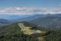
Jim Monroe
Bob Simmermon
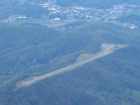
Bob Simmermon
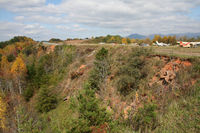
Bradley Bormuth
| FAA Information Effective | 2026-09-03 |
| Airport Identifier | 24A |
| Airport Status | Operational |
| Longitude/Latitude |
83°12'34.9330"
W /
35°19'1.9600"
N -83.209704 / 35.317211 (Estimated) |
| Elevation | 2857.00 ft / 870.81 m (Surveyed) |
| Land | 147 acres |
| From nearest city | 3 nautical miles SE of Sylva, NC |
| Location | Jackson County, NC |
| Magnetic Variation | 05W (2000) |
| Airport Use | Open to public |
| Wind indicator | Yes |
| Segmented Circle | Yes |
| Control Tower | NON-ATCT |
| Lighting Schedule | SEE RMK |
| Beacon Color | White-Green (lighted land airport) |
| Landing fee charge | No |
| Sectional chart | ATLANTA |
| Region | ASO - Southern |
| Responsible ARTCC | ZTL - ATLANTA |
| Tie-in FSS | RDU - RALEIGH |
| FSS on Airport | No |
| FSS Toll Free | 1-800-WX-BRIEF |
| NOTAMs Facility | RDU (NOTAM-d service available) |
Runway 15/33
| Dimensions | 3210 x 60 ft (978 x 18 m) |
| Surface | ASPH (GOOD) |
| Surface treatment | |
| Edge lights | Medium |
| 15 | 33 | |
|---|---|---|
| Alignment | 142° | 322° |
| Physical elevation | 2856.60 ft | 2806.60 ft |
| Coordinates | 35.320681 / -83.213021 | 35.313742 / -83.206387 |
| Traffic pattern | Left | Left |
| Runway marking | Non-precision instrument , Good Condition | Non-precision instrument , Good Condition |
| VGSI |
2-light PAPI on left *UNUSBL BYD 8 DEG LEFT OF CNTRLN. |
2-light PAPI on left |
| Runway end lights | Yes | Yes |
- NO DSGND HELI AT THIS ARPT - ARPT MASTER RECORD INCORRECTLY DESIGNATES H1 EXISTS.
- MTN HAZ RED BCN LGTS LCTD ON MTN RANGE APPROX 1.7 MILES SSW OF ARPT - LGTS OPN UNRELBL.
- RWY 15 300 FT DROP-OFF 300 FT FM THLD BOTH SIDES AND 90 FT LEFT/RIGHT OF CNTRLN ALONG RWY.
- RWY 33 300 FT DROP-OFF 200 FT FM THLD 50 FT LEFT OF CNTRLN.
- RPDLY RSG TRRN ALL QUADS.
- FOR CD CTC ATLANTA ARTCC AT 770-210-7692.
- COLD TEMPERATURE AIRPORT. ALTITUDE CORRECTION REQUIRED AT OR BELOW -13C.