Boyceville Municipal Airport (3T3)
Boyceville Municipal Airport (3T3)
3T3
Boyceville Municipal Airport (3T3)
Boyceville, WI
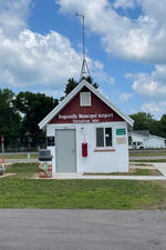
Latest photo of Boyceville Municipal Airport (3T3)
Timothy Aanerud
| Airport Use | Open to public |
| Wind indicator | Yes |
| Segmented Circle | Yes |
| Control Tower | NON-ATCT |
| Lighting Schedule | SEE RMK |
| Beacon Color | White-Green (lighted land airport) |
| Landing fee charge | No |
| Sectional chart | GREEN BAY |
| Region | AGL - Great Lakes |
| Responsible ARTCC | ZMP - MINNEAPOLIS |
| Tie-in FSS | GRB - GREEN BAY |
| FSS on Airport | No |
| FSS Toll Free | 1-800-WX-BRIEF |
| NOTAMs Facility | GRB (NOTAM-d service available) |
Runway 08/26
| Dimensions | 3299 x 60 ft (1006 x 18 m) |
| Surface | ASPH (EXCELLENT) |
| Surface treatment | |
| Edge lights | Medium |
| 08 | 26 | |
|---|---|---|
| Alignment | 84° | 264° |
| Physical elevation | 952.00 ft | 967.10 ft |
| Coordinates | 45.043447 / -92.027669 | 45.044460 / -92.014987 |
| Traffic pattern | Left | Left |
| Runway marking | Non-precision instrument , Good Condition | Non-precision instrument , Good Condition |
| VGSI | 2-light PAPI on left | 2-light PAPI on left |
| Runway end lights | Yes |