Sun Valley Airport (A20)
Sun Valley Airport (A20)
A20
Sun Valley Airport (A20)
Bullhead City, AZ
Latest photos of Sun Valley Airport (A20)
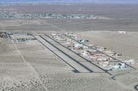
Mark Pasqualino
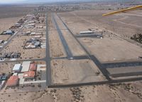
Stan Gatewood
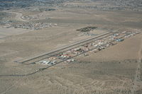
Nick Taylor
| FAA Information Effective | 2026-07-09 |
| Airport Identifier | A20 |
| Airport Status | Operational |
| Longitude/Latitude |
114°33'54.1000"
W /
35°0'20.3000"
N -114.565028 / 35.005639 (Estimated) |
| Elevation | 725.00 ft / 220.98 m (Estimated) |
| Land | 100 acres |
| From nearest city | 7 nautical miles S of Bullhead City, AZ |
| Location | Mohave County, AZ |
| Magnetic Variation | 14E (1985) |
| Airport Use | Open to public |
| Wind indicator | Yes |
| Segmented Circle | Yes |
| Control Tower | NON-ATCT |
| Lighting Schedule | SEE RMK |
| Beacon Color | White-Green (lighted land airport) |
| Landing fee charge | No |
| Sectional chart | PHOENIX |
| Region | AWP - Western-Pacific |
| Responsible ARTCC | ZLA - LOS ANGELES |
| Tie-in FSS | PRC - PRESCOTT |
| FSS on Airport | No |
| FSS Toll Free | 1-800-WX-BRIEF |
| NOTAMs Facility | PRC (NOTAM-d service available) |
Runway 18/36
| Dimensions | 3700 x 42 ft (1128 x 13 m) |
| Surface | ASPH (GOOD) |
| Surface treatment | |
| Edge lights | Low |
| 18 | 36 | |
|---|---|---|
| Coordinates | 35.010728 / -114.565033 | 35.000561 / -114.565019 |
| Traffic pattern | Left | Right |
| Runway marking | Nonstandard , Good Condition | Nonstandard , Good Condition |
| VGSI |
nonstandard system *NON STD; SINGLE UNIT RED & WHITE LGTS L SIDE OF RWY; 3 DEG. |