Skagit Regional Airport (BVS)
Skagit Regional Airport (BVS)
BVS
Skagit Regional Airport (BVS)
Burlington/mount Vernon, WA
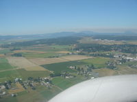
Latest photo of Skagit Regional Airport (BVS)
Shale Parker
| FAA Information Effective | 2026-09-03 |
| Airport Identifier | BVS |
| Airport Status | Operational |
| Longitude/Latitude |
122°25'18.0820"
W /
48°28'13.8940"
N -122.421689 / 48.470526 (Estimated) |
| Elevation | 145.10 ft / 44.23 m (Surveyed) |
| Land | 1847 acres |
| From nearest city | 3 nautical miles W of Burlington/mount Vernon, WA |
| Location | Skagit County, WA |
| Magnetic Variation | 16E (2015) |
| Airport Use | Open to public |
| Wind indicator | Yes |
| Segmented Circle | Yes |
| Control Tower | NON-ATCT |
| Lighting Schedule | SEE RMK |
| Beacon Color | White-Green (lighted land airport) |
| Landing fee charge | No |
| Sectional chart | SEATTLE |
| Region | ANM - Northwest Mountain |
| Traffic Pattern Alt | 500 ft |
| Responsible ARTCC | ZSE - SEATTLE |
| Tie-in FSS | SEA - SEATTLE |
| FSS on Airport | No |
| FSS Toll Free | 1-800-WX-BRIEF |
| NOTAMs Facility | BVS (NOTAM-d service available) |
Runway 04/22
| Dimensions | 3000 x 60 ft (914 x 18 m) |
| Surface | ASPH (EXCELLENT) |
| Surface treatment | |
| Edge lights | Low |
| 04 | 22 | |
|---|---|---|
| Alignment | 56° | 236° |
| Physical elevation | 84.00 ft | 93.90 ft |
| Coordinates | 48.463031 / -122.426559 | 48.467575 / -122.416255 |
| Traffic pattern | Left | Left |
| Runway marking | Basic , Good Condition | Basic , Good Condition |
| VGSI | 2-light PAPI on left | 2-light PAPI on left |
Runway 11/29
| Dimensions | 5480 x 100 ft (1670 x 30 m) |
| Surface | ASPH (EXCELLENT) |
| Surface treatment | |
| Edge lights | Medium |
| 11 | 29 | |
|---|---|---|
| Alignment | 126° | 306° |
| Physical elevation | 145.10 ft | 103.20 ft |
| Coordinates | 48.477846 / -122.430930 | 48.468924 / -122.412760 |
| Traffic pattern | Left | Left |
| Runway marking | Non-precision instrument , Good Condition | Non-precision instrument , Good Condition |
| VGSI | 4-light PAPI on left | 4-light PAPI on left |
| Runway end lights | Yes | Yes |
- FOR CD CTC WHIDBEY APCH AT 360-257-3310.
- RWY 04/22 CLSD TO ACFT MORE THAN 12500 LB AND WINGSPAN MORE THAN 49 FT.
- MIGRATORY WATERFOWL & BIRDS ON AND INVOF ARPT.
- HELICOPTER TRAINING OPS ON AIRPORT W/ AUTOROTATIONS ON RUNWAY
- USE OF TWY B BY ACFT WITH WINGSPAN 49 FT OR GREATER PROHIBITED WHEN RY 04/22 IN USE.
- POSSIBLE TURBULENCE INVOF EXHAUST STACKS 3,500 FT SW OF RW 04, AVOID LOW ALT OVERFLT.
- U.S. CUST SVC AVBL FOR INTL ARR. CHK PORT OF SKAGIT WEBSITE FOR REQ FOR SVC INSRT, WWW.PORTOFSKAGIT.COM. AVBL SEVEN DAYS A WEEK, PER APVL. USAGE FEES APPLY.
- PRVDD ARPT MGR BRIEFS ALL ARPT USERS ON SPL OPNS; I.E., CONVERT ABNDD N/S TWY TO LTD USE RWY 16/34; A NOTAM BE ISSUED WHICH ALERTS THE GENERAL PUBLIC TO THIS OPN & WHICH STATES THE SPL PROCS TO BE USED WHEN OPERG TO/FROM ARPT; ARPT UNICOM BE ACTVTD AND MANNED WHENEVER THIS SPL OPN IN PROG.