Desert Center Airport (CN64)
Desert Center Airport (CN64)
CN64
Desert Center Airport (CN64)
Desert Center, CA
Latest photo of Desert Center Airport (CN64)
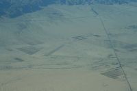
Nick Taylor Photography
| FAA Information Effective | 2026-09-03 |
| Airport Identifier | CN64 |
| Airport Status | Operational |
| Longitude/Latitude |
115°19'30.9000"
W /
33°44'51.8000"
N -115.325250 / 33.747722 (Estimated) |
| Elevation | 559.00 ft / 170.38 m (Surveyed) |
| Land | 1129 acres |
| From nearest city | 5 nautical miles NE of Desert Center, CA |
| Location | Riverside County, CA |
| Magnetic Variation | 13E (1985) |
| Airport Use | Private |
| Wind indicator | Yes |
| Segmented Circle | No |
| Control Tower | NON-ATCT |
| Landing fee charge | No |
| Sectional chart | LOS ANGELES |
| Region | AWP - Western-Pacific |
| Responsible ARTCC | ZLA - LOS ANGELES |
| Tie-in FSS | RAL - RIVERSIDE |
| FSS on Airport | No |
| FSS Toll Free | 1-800-WX-BRIEF |
Runway 05/23
| Dimensions | 4200 x 50 ft (1280 x 15 m) |
| Surface | ASPH (FAIR) |
| Surface treatment |
| 05 | 23 | |
|---|---|---|
| Coordinates | 33.745283 / -115.331494 | 33.750181 / -115.318981 |
| Traffic pattern | Left | Left |
| Runway marking | Basic , Fair Condition | Basic , Fair Condition |
| Runway end lights | No | No |
| TDZ lights | No | No |