Prince Rupert Airport (CYPR) — Prince Rupert
Prince Rupert Airport (CYPR)
CYPR
Prince Rupert Airport (CYPR)
Prince Rupert,
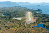
Latest photo of Prince Rupert Airport (CYPR)
Remi Farvacque
Prince Rupert Airport (CYPR) is a public-use airport located in Prince Rupert. The airport sits at an elevation of 116 feet above mean sea level. It features 1 runway. The gallery includes 1 photo of operations and aircraft at the airport.
| FAA Information Effective | 2026-09-03 |
| Airport Identifier | CYPR |
| Airport Status | Operational |
| Longitude/Latitude |
130°26'41.0000"
W /
54°17'9.0000"
N -130.444722 / 54.285833 (Estimated) |
| Elevation | 116.00 ft / 35.36 m (Estimated) |
| From nearest city | 5 nautical miles WSW of Prince Rupert, |
| Location | B.c., Canada County, CN |
| Magnetic Variation | 22E () |