Powell River Airport (CYPW)

CYPW
Powell River Airport (CYPW)
Powell River,
Latest photos of Powell River Airport (CYPW)
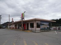
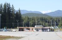
CYPW, Powell River airport, BC, photo by Jack Poelstra
Jack Poelstra
CYPW, Terminal of Powell River BC, photo by Jack Poelstra
Jack Poelstra
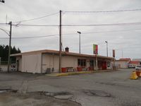
CYPW, Executive terminal, photo by Mark Pasqualino
Mark Pasqualino
Location & QuickFacts
FAA Information Effective 2026-07-09
Airport Identifier CYPW
Airport Status Operational
Longitude/Latitude 124°30'1.0000" W / 49°50'3.0000" N
-124.500278 / 49.834167 (Estimated)
Elevation 425.00 ft / 129.54 m (Estimated)
Location B.c., Canada County, CN
Magnetic Variation 19E ()
Owner & Manager
Ownership Publicly owned
Airport Operations and Facilities
Airport Use Open to public
Control Tower NON-ATCT
Responsible ARTCC ZVR - VANCOUVER
Tie-in FSS YKA - KAMLOOPS FIC
NOTAMs Facility CYBL
Airport Services
Fuel types 100LL,A1
Runway Information
Runway 09/27
Dimensions 3621 x 150 ft (1104 x 46 m)
Surface ASPH
Surface treatment
Edge lights Medium
09 27
Traffic pattern Right Left
Runway end lights Yes Yes
Remarks
  • DEER INVOF RY.