Dover Afb Airport (DOV)
Dover Afb Airport (DOV)
DOV
Dover Afb Airport (DOV)
Dover, DE
Latest photos of Dover Afb Airport (DOV)

Jim Monroe
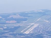
Jim Monroe
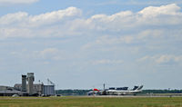
Daniel L. Berek
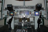
scotch-canadian
| FAA Information Effective | 2026-09-03 |
| Airport Identifier | DOV |
| Airport Status | Operational |
| Longitude/Latitude |
75°27'57.4600"
W /
39°7'46.3400"
N -75.465961 / 39.129539 (Estimated) |
| Elevation | 28.90 ft / 8.81 m (Estimated) |
| From nearest city | 3 nautical miles E of Dover, DE |
| Location | Kent County, DE |
| Magnetic Variation | 12W (2020) |
| Airport Use | Open to public |
| Segmented Circle | No |
| Control Tower | ATCT-RAPCON |
| Beacon Color | White-Green (lighted land airport) |
| Sectional chart | WASHINGTON |
| Region | AEA - Eastern |
| Responsible ARTCC | ZDC - WASHINGTON |
| Tie-in FSS | MIV - MILLVILLE |
| FSS on Airport | No |
| FSS Toll Free | 1-800-WX-BRIEF |
| NOTAMs Facility | DOV (NOTAM-d service available) |
| Certification type/date | 2005/11 |
Runway 01/19
| Dimensions | 9602 x 150 ft (2927 x 46 m) |
| Surface | CONC |
| Surface treatment | Saw-cut or plastic Grooved |
| Edge lights | High |
| PCN | 150 |
| 01 | 19 | |
|---|---|---|
| Alignment | 3° | 183° |
| Physical elevation | 25.00 ft | 22.20 ft |
| Coordinates | 39.117194 / -75.464606 | 39.143517 / -75.462703 |
| Traffic pattern | Left | Left |
| Runway marking | Precision instrument , Good Condition | Precision instrument , Good Condition |
| ILS type | ILS | ILS |
| VGSI | 4-light PAPI on left | 4-light PAPI on left |
| RVR equipment | touchdown | touchdown |
| Approach light | ALSF2 | ALSF1 |
| Runway end lights | Yes | |
| CL lights | Yes | Yes |
| TDZ lights | Yes |
Runway 14/32
| Dimensions | 12903 x 150 ft (3933 x 46 m) |
| Surface | ASPH-CONC |
| Surface treatment | Saw-cut or plastic Grooved |
| Edge lights | High |
| PCN | 105 |
| 14 | 32 | |
|---|---|---|
| Alignment | 126° | 306° |
| Physical elevation | 28.80 ft | 26.20 ft |
| Coordinates | 39.139300 / -75.486117 | 39.118567 / -75.449236 |
| Traffic pattern | Left | Left |
| Runway marking | Non-precision instrument , Good Condition | Precision instrument , Good Condition |
| VGSI | 4-light PAPI on left | 4-light PAPI on left |
| Runway end lights | Yes |
- RSTD: ALL ACFT WITH HAZ MATERIAL/RQR REMOTE/ISOLATED PRK WILL CTC 436 APS EXPLOSIVE HANDLING SECTION DSN 445-2304 1230-2130Z++ OR ATOC DUTY OFFICER DSN 445-2300 2130-1230Z++ FOR PPR. BASE OPS DSN 445-2861/4192, C302-677-2861/4192.
- RSTD: ALL INBD PAX/CARGO MUST CTC COMD POST NO LATER THAN 30 MIN PRIOR TO LDG. RY 32 TKOF DIST AVBL 10,070 FT.
- RSTD: ACFT TAXIING OUT OF MAIN RAMP USING TAXI LANE L BTN DELTA ROW AND SPOT ECHO MUST USE MIN PWR AND IN-BOARD ENG ONLY (C5 ACFT SHOULD NOT EXCEED 40 PERCENT N1 RPM) WHEN TURNING ONTO TAXI LANE A.
- CAUTION: POSSIBLE JET WAKE TURBULENCE IN TFC PAT & C5 JET BLAST DUR GND OPR. SPECIAL HAZ EXIST FOR WIDE BODY ACFT TAXIING FM RAMP. 'FOLLOWW ME TRUCK' RQR FOR ALL MOVEMENTS ON RAMP BY NON C5 TRAN ACFT, TRAN C5 FLW ME SVC AVBL O/R.
- CAUTION: TREE LINE E OF RY 19 APCH END MAY CAUSE WIND SHEAR DUR LDG WHEN WIND IS FR SE. BA LESS THAN OPTIMUM WHEN RY IS WET DUE TO RUBBER BUILD-UP.
- NS ABTMT: STRICT COMPLIANCE WITH PRO RQR.
- FIRST 4250 FT RWY 14 AND FIRST 1650 FT RWY 32 GROOVED CONCRETE, MIDDLE 7000 FT ASPHALT.
- FLUID; SP PRESAIR LPOX LOX.
- CAUTION: HIGH SPEED, LOW ALTITUDE HEAVY JET TRAFFIC WITH 10 NM OF DOVER.
- AFLD MANAGEMENT HAS LTD AMOUNT OF STORAGE FOR CLASIFIED MATERIAL. SIZE LTD TO SMALL BACKPACKS OR SMALLER ONLY. BASE OPERATIONS HAS LIMITED AMOUNT OF STORAGE FOR CLASSIFIED MATERIAL, SIZE LIMITED TO SMALL BACKPACK OR SMALLER ONLY. BASE OPS HAS NO COMSEC TO TRAN AIRCREWS. TRAN AIRCREWS SHOULD PLAN TO ARR WITH APPROPRIATE AMOUNT OF COMSEC TO COMPLETE ENTIRE MSN.
- RSTD: NON-DOD CIVIL ACFT OPERATIONS 72 HR PPR BY CONTACTING (302) 571-6375.
- TWY DELTA EDGE LGTS 40 FT FROM TWY EDGE BTN RWY 32 HOLD LINE & RWY 01/19.
- MISC RWY 32 FIRST 2000 FT, MIDDLE 1500 FT 1000 FT SE OF TWY C AND LAST 1000 FT CONC REMAINDER OF RWY ASPHALT.
- SERVICE: AOE.
- USAF ARFF MEETS ALL EMERG RESPONSE TIMES. ARFF IS CAT 6 FIREFIGHTING AGENT (12.1K) LEVEL WITH NFPA CAT 10 STAFFING LEVEL (13). SUFFICIENT CAPABILITY IS PROVIDED FOR INITIAL RESPONSE, SCENE ASSESSMENT AND IMPLEMENTATION OF MITIGATION TACTICS.
- RWY 32 WINDS DERIVED FROM APCH END OF RWY 01. RWY 14 WINDS DERIVED FROM APCH END OF RWY 19.
- RSTD: CONTACT AIRFIELD MANAGEMENT DSN 445-2861 FOR BIRD WATCH CONDITIONS (BWC).
- RSTD: PPR EXC AMC, SAM, DOD COURIER SVC AND EVAC MSN DSN 445-2861.
- CAUTION: 5 CIV ARPT LCTD WITHIN 10 NM RAD.
- RWY 32 ASSAULT LDG ZONE (ALZ) NSTD AFLD MRK CONSISTING OF WHITE BOX (500 FT X 90 FT) BEGINNING 500 FT FR THLD WITH WHITE BAR 3000 FT FR END OF BOX. AFLD IS TERPS FROM SFC (GRD LEVEL), DER CROSSING HGT 0 FT.
- MISC: JET SIDE SERVICE 1-STOP SHOP PRINTS INTEGRATED FMS CREW PACKAGES.
- COMMUNICATIONS-PMSV METRO: WX FLT DSN 445-4175/4176, C302-677-4175/4176. IF FCSTR IS OUT OF OFFICE AND DOES NOT ANSWER ON UHF CTC COMD POST DSN 445-4201, C302-677-4201 FOR FONE PATCH. IF FONE PATCH FAILS, CTC FRCSTR ON SBY FONE C302-922-2210. BLDG OBST MAY IMPACT PREVAILING VIS 150--260-. DUR EVAC OF WX FLT CTC 15 OWS AT DSN 576-9690, C618-256-9690. ALTN WX LCTN VIS SLIGHTLY LTD DUE TO BLDG AND PRK ACFT. ATC WILL SUPPLEMENT OBSN AS NEEDED.
- LGT PAPI COINCIDENTAL WITH ILS GS RY 01/19 AND WITH TACAN VDP RY 01/19, 32 FOR H PAPI GT GP 4 ACFT ONLY. PAPI PROVIDES PROPER TCH FOR HGT GP 4 ACFT ONLY.
- NSTD MRK - C17 STAR TURN MRK LCTD ON TWY A AT INT OF TWY D (2 WHITE STRIPES 100' APART, 190' LENGTH X 1' WIDE. C17 BACKING DEMONSTRATION ZONE MRK ON TWY C BTN RWY 14/32 AND TWY B. MRK WILL BE WHITE AND VARY IN WIDTH AND GEOMETRY.
- MISC: RWY COND CODE NOT RPRTD.
- MISC: B747 (ALL SERIES) MUST ARR WITH TOW BAR.
- COMM COMD POST: CALL SIGN FIRST OPS.
- CAUTION: C-17 ACFT WINGTIP TRNG LINES ON TAXI LANE L IN FRONT OF PRK SPOT E. C-5 ACFT WINGTIP TRNG LINES ON TAXI LANE L BTN PRK SPOT D2 AND E. C-5 AND C-17 WING TIP TRNG SIGN LCTD OFF OF TWY G. SIGNS DEPICT 10 FT AND 25 FT WING TIP CLNC.
- CAUTION: SFC PAINTED APN ENTRANCE POINT MRKGS EXIST ON HAZ CARGO RAMP, SOUTH RAMP AND CHRISTMAS TREE RAMP. TWY D BTN RWY 01/19 AND HAZ CARGO PAD DOES NOT HAVE SHOULDER MRKGS.
- RSTD: DIGNIFIED TRANSFER MISSIONS CONTACT 436 AW/CP FOR ADVANCE COORDINATION AND TO OBTAIN A CURRENT COPY OF DT AIRCREW BROCHURE.
- JASU: (ADAPTERS NOT AVBL.) 3(MA-1A) (M32A-86).
- OIL: 0-133-148 SOAP.
- TRAN ALERT: OPR H24.