Duplin County Airport (DPL / KDPL) — Kenansville, NC
Duplin County Airport (DPL)
DPL
Duplin County Airport (DPL)
Kenansville, NC
Latest photos of Duplin County Airport (DPL)
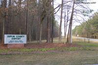
J.B. Barbour
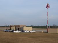
Tigerland
Duplin County Airport (DPL/KDPL) is a public-use airport located in Kenansville, NC. The airport sits at an elevation of 136 feet above mean sea level. It features 1 runway. Aviation communications are supported by 7 published radio frequencies. The gallery includes 2 photos of operations and aircraft at the airport.
| FAA Information Effective | 2026-09-03 |
| Airport Identifier | DPL |
| Airport Status | Operational |
| Longitude/Latitude |
77°58'53.9700"
W /
35°0'0.1310"
N -77.981658 / 35.000036 (Estimated) |
| Elevation | 136.60 ft / 41.64 m (Surveyed) |
| Land | 435 acres |
| From nearest city | 2 nautical miles NW of Kenansville, NC |
| Location | Duplin County, NC |
| Magnetic Variation | 09W (2010) |
| Airport Use | Open to public |
| Wind indicator | Yes |
| Segmented Circle | Yes |
| Control Tower | NON-ATCT |
| Lighting Schedule | SEE RMK |
| Beacon Color | White-Green (lighted land airport) |
| Landing fee charge | No |
| Sectional chart | CHARLOTTE |
| Region | ASO - Southern |
| Responsible ARTCC | ZDC - WASHINGTON |
| Tie-in FSS | RDU - RALEIGH |
| FSS on Airport | No |
| FSS Toll Free | 1-800-WX-BRIEF |
| NOTAMs Facility | DPL (NOTAM-d service available) |
Runway 05/23
| Dimensions | 6003 x 100 ft (1830 x 30 m) |
| Surface | ASPH (EXCELLENT) |
| Surface treatment | |
| Edge lights | Medium |
| 05 | 23 | |
|---|---|---|
| Alignment | 36° | 216° |
| Physical elevation | 134.90 ft | 136.60 ft |
| Coordinates | 34.993396 / -77.987601 | 35.006676 / -77.975714 |
| Traffic pattern | Left | Left |
| Runway marking | Precision instrument , Good Condition | Precision instrument , Good Condition |
| VGSI | 4-light PAPI on left | 4-light PAPI on left |
| Runway end lights | Yes | Yes |
- DEER/DOGS/BIRDS ON & INVOF ARPT.
- MIL ACFT LAND FORWARD OF NUMBERS AND LIMIT DELAY ON RWY TO AVOID DAMAGE TO RWY SURFACES.
- NOISE ABATEMENT PROCEDURES IN EFFECT, CALL AMGR 910-296-2188.
- DUPLIN CO ARPT CLSD TO TOUCH & GO/PRACTICE APPROACHES 2100-0600 LCL DLY. (ALL OTHER TIMES T&G/PRACTICE APPROACHES LIMITED TO 30 MINUTES EACH).
- ARPT CLSD TO MIL ACFT EXCEPT 1 HR PPR.
- CD CTC SEYMOUR JOHNSON APCH AT 919-722-4186.