Meadow Lake Airport (FLY)
Meadow Lake Airport (FLY)
FLY
Meadow Lake Airport (FLY)
Colorado Springs, CO
Latest photos of Meadow Lake Airport (FLY)
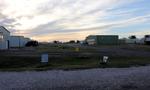
Olivier Cortot
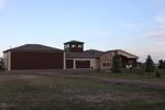
Olivier Cortot
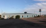
Olivier Cortot
Olivier Cortot
| FAA Information Effective | 2026-07-09 |
| Airport Identifier | FLY |
| Airport Status | Operational |
| Longitude/Latitude |
104°34'11.6570"
W /
38°56'33.9710"
N -104.569905 / 38.942770 (Estimated) |
| Elevation | 6878.10 ft / 2096.44 m (Surveyed) |
| Land | 757 acres |
| From nearest city | 14 nautical miles NE of Colorado Springs, CO |
| Location | El Paso County, CO |
| Magnetic Variation | 07E (2025) |
| Airport Use | Open to public |
| Wind indicator | Yes |
| Segmented Circle | Yes |
| Control Tower | NON-ATCT |
| Lighting Schedule | SEE RMK |
| Beacon Color | White-Green (lighted land airport) |
| Landing fee charge | No |
| Sectional chart | DENVER |
| Region | ANM - Northwest Mountain |
| Responsible ARTCC | ZDV - DENVER |
| Tie-in FSS | DEN - DENVER |
| FSS on Airport | No |
| FSS Toll Free | 1-800-WX-BRIEF |
| NOTAMs Facility | DEN (NOTAM-d service available) |
Runway 08/26
| Dimensions | 2126 x 35 ft (648 x 11 m) |
| Surface | ASPH-GRVL (FAIR) |
| Surface treatment |
| 08 | 26 | |
|---|---|---|
| Alignment | 91° | 271° |
| Physical elevation | 6824.80 ft | 6799.40 ft |
| Coordinates | 38.945941 / -104.570478 | 38.945836 / -104.563007 |
| Traffic pattern | Right | Left |
| Runway marking | None , Poor Condition | None , Poor Condition |
Runway 15/33
| Dimensions | 6001 x 60 ft (1829 x 18 m) |
| Surface | ASPH (EXCELLENT) |
| Surface treatment | |
| Edge lights | Medium |
| 15 | 33 | |
|---|---|---|
| Alignment | 160° | 340° |
| Physical elevation | 6878.10 ft | 6791.40 ft |
| Coordinates | 38.953470 / -104.574613 | 38.937950 / -104.567560 |
| Traffic pattern | Left | Right |
| Runway marking | Non-precision instrument , Poor Condition | Non-precision instrument , Poor Condition |
| VGSI | 2-light PAPI on left | 2-light PAPI on left |
| Runway end lights | Yes | Yes |
Runway 16/34
| Dimensions | 5001 x 200 ft (1524 x 61 m) |
| Surface | TURF (FAIR) |
| Surface treatment |
| 16 | 34 | |
|---|---|---|
| Alignment | 160° | 340° |
| Physical elevation | 6776.80 ft | 6776.80 ft |
| Coordinates | 38.944383 / -104.572772 | 38.931449 / -104.566892 |
| Traffic pattern | Left | Left |
| Runway marking | None , Poor Condition | None , Poor Condition |
- CTN: ; INTENSIVE USAF STUDENT TNG INVOF COLORADO SPRINGS & PUEBLO COLORADO.
- RWY 26: 15 FT ROAD EXTDS EAST FM THLD.
- CTN: PWRD PARAGLIDERS AND MOBILE AEROSTATS OPER SOUTHEAST SIDE OF ARPT SFC-500 FT.
- RWY 16/34 HAS EDGES AND THLDS MKD WITH WHITE TIRES.
- FOR CD CTC COLORADO SPRINGS APCH AT 719-556-9105.
- RWY 08/26 EDGES MKD WITH WHITE REFLECTORS AND TIRES.
- GLIDERS OPERATE ON 16/34 AND WEST SIDE OF ARPT.
- RWY 26; 4 FT TERRAIN 5 FT FM RWY EDGE FIRST 100 FT ON BOTH SIDES OF RWY.
- WILDLIFE ON AND INVOF OF AIRPORT.
- RWY 26; 4 FT FENCE 50 FT RIGHT OF CNTRLN 95 FT FM THLD.