Westfield Airport (I72)
Westfield Airport (I72)
I72
Westfield Airport (I72)
Westfield, IN
Latest photo of Westfield Airport (I72)
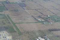
Mark Pasqualino
| FAA Information Effective | 2026-09-03 |
| Airport Identifier | I72 |
| Airport Status | Operational |
| Longitude/Latitude |
86°9'27.9630"
W /
40°2'56.1350"
N -86.157768 / 40.048926 (Estimated) |
| Elevation | 932.00 ft / 284.07 m (Estimated) |
| Land | 15 acres |
| From nearest city | 2 nautical miles W of Westfield, IN |
| Location | Hamilton County, IN |
| Magnetic Variation | 02W (1985) |
| Airport Use | Open to public |
| Wind indicator | Yes |
| Segmented Circle | No |
| Control Tower | NON-ATCT |
| Lighting Schedule | SEE RMK |
| Landing fee charge | No |
| Sectional chart | CHICAGO |
| Region | AGL - Great Lakes |
| Responsible ARTCC | ZID - INDIANAPOLIS |
| Tie-in FSS | HUF - TERRE HAUTE |
| FSS on Airport | No |
| FSS Toll Free | 1-800-WX-BRIEF |
| NOTAMs Facility | HUF (NOTAM-d service available) |
Runway 18/36
| Dimensions | 3000 x 100 ft (914 x 30 m) |
| Surface | TURF (GOOD) |
| Surface treatment | |
| Edge lights | Low |
| 18 | 36 | |
|---|---|---|
| Physical elevation | 930.00 ft | 930.00 ft |
| Coordinates | 40.053369 / -86.160267 | 40.045133 / -86.160444 |
| Traffic pattern | Left | Left |
| Runway end lights | No | No |
| CL lights | No | No |
| TDZ lights | No | No |