St James Municipal Airport (JYG)
St James Municipal Airport (JYG)
JYG
St James Municipal Airport (JYG)
St James, MN
Latest photos of St James Municipal Airport (JYG)
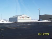
Ed Wells
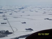
Ed Wells
| FAA Information Effective | 2026-09-03 |
| Airport Identifier | JYG |
| Airport Status | Operational |
| Longitude/Latitude |
94°33'28.7070"
W /
43°59'10.8740"
N -94.557974 / 43.986354 (Estimated) |
| Elevation | 1067.70 ft / 325.43 m (Surveyed) |
| From nearest city | 3 nautical miles E of St James, MN |
| Location | Watonwan County, MN |
| Magnetic Variation | 01E (2020) |
| Airport Use | Open to public |
| Wind indicator | Yes |
| Segmented Circle | No |
| Control Tower | NON-ATCT |
| Lighting Schedule | SEE RMK |
| Beacon Color | White-Green (lighted land airport) |
| Sectional chart | OMAHA |
| Region | AGL - Great Lakes |
| Responsible ARTCC | ZMP - MINNEAPOLIS |
| Tie-in FSS | PNM - PRINCETON |
| FSS on Airport | No |
| FSS Toll Free | 1-800-WX-BRIEF |
| NOTAMs Facility | JYG (NOTAM-d service available) |
Runway 15/33
| Dimensions | 3999 x 75 ft (1219 x 23 m) |
| Surface | ASPH (GOOD) |
| Surface treatment | |
| Edge lights | Medium |
| 15 | 33 | |
|---|---|---|
| Alignment | 149° | 329° |
| Physical elevation | 1061.30 ft | 1065.30 ft |
| Coordinates | 43.991068 / -94.561860 | 43.981640 / -94.554089 |
| Traffic pattern | Left | Left |
| Runway marking | Non-precision instrument , Good Condition | Non-precision instrument , Good Condition |
| VGSI | 4-light PAPI on left | 4-light PAPI on left |
| Runway end lights | Yes | Yes |
- ULTRALIGHT ACT ON & INVOF ARPT.
- GCO AVBL ON FREQ 121.725 THRU MINNEAPOLIS ARTCC & FLT SVCS.
- RWY 33 RT OF CTR LINE FRM APP END -120 TO -183 FT CATTAILS IN PRIMARY SURFACE
- ARR/DEP BLDG ACES CODE FM RAMP: 1215#; ACES CODE FM PRKG LOT: 1215.
- FOR CD IF UNA VIA GCO CTC MINNEAPOLIS ARTCC AT 651-463-5588.