Hesperia Airport (L26)
Hesperia Airport (L26)
L26
Hesperia Airport (L26)
Hesperia, CA
Latest photos of Hesperia Airport (L26)
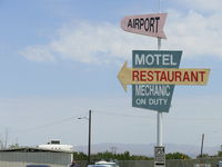
COOL LAST SAMURAI
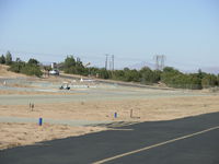
COOL LAST SAMURAI
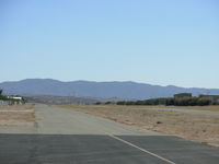
COOL LAST SAMURAI
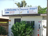
COOL LAST SAMRAI
| FAA Information Effective | 2026-07-09 |
| Airport Identifier | L26 |
| Airport Status | Operational |
| Longitude/Latitude |
117°18'57.8000"
W /
34°22'37.0000"
N -117.316056 / 34.376944 (Estimated) |
| Elevation | 3390.00 ft / 1033.27 m (Estimated) |
| Land | 26 acres |
| From nearest city | 3 nautical miles S of Hesperia, CA |
| Location | San Bernardino County, CA |
| Magnetic Variation | 14E (1985) |
| Airport Use | Open to public |
| Wind indicator | Yes |
| Segmented Circle | Yes |
| Control Tower | NON-ATCT |
| Lighting Schedule | SEE RMK |
| Beacon Color | White-Green (lighted land airport) |
| Landing fee charge | No |
| Sectional chart | LOS ANGELES |
| Region | AWP - Western-Pacific |
| Responsible ARTCC | ZLA - LOS ANGELES |
| Tie-in FSS | RAL - RIVERSIDE |
| FSS on Airport | No |
| FSS Toll Free | 1-800-WX-BRIEF |
| NOTAMs Facility | RAL (NOTAM-d service available) |
Runway 03/21
| Dimensions | 3910 x 50 ft (1192 x 15 m) |
| Surface | ASPH (POOR) |
| Surface treatment | |
| Edge lights | Low |
| 03 | 21 | |
|---|---|---|
| Physical elevation | 3390.00 ft | ft |
| Coordinates | 34.372717 / -117.320061 | 34.381167 / -117.312053 |
| Traffic pattern | Right | Left |
| Runway marking | Basic , Fair Condition | Basic , Fair Condition |
| Runway end lights | No | No |
| CL lights | No | No |
| TDZ lights | No | No |
- PUBLIC ROAD ACCESS TO RUNWAY AND TAXIWAY IN MULTIPLE LOCATIONS.
- SLIGHT UPHILL GRADE TO RY 21. PILOTS SHOULD BE AWARE OF RISING SURROUNDING TERRAIN TO THE SOUTH. RY 21 HAS A PERIMETER FENCE THAT SEPARATES RY 21 FROM ROAD.
- CALM WIND USE RY 21.
- FOR CD CTC JOSHUA APCH AT 661-277-3843.
- ESTABD PRIOR TO 5/15/59.