Alpine County Airport (M45)
Alpine County Airport (M45)
M45
Alpine County Airport (M45)
Markleeville, CA
Latest photos of Alpine County Airport (M45)
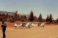
S B J
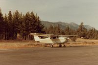
S B J
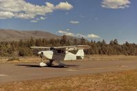
S B J
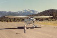
S B J
| FAA Information Effective | 2026-07-09 |
| Airport Identifier | M45 |
| Airport Status | Operational |
| Longitude/Latitude |
119°46'1.4000"
W /
38°44'5.1000"
N -119.767056 / 38.734750 (Estimated) |
| Elevation | 5871.70 ft / 1789.69 m (Surveyed) |
| Land | 300 acres |
| From nearest city | 3 nautical miles N of Markleeville, CA |
| Location | Alpine County, CA |
| Magnetic Variation | 16E (1985) |
| Airport Use | Open to public |
| Wind indicator | Yes |
| Segmented Circle | Yes |
| Control Tower | NON-ATCT |
| Landing fee charge | No |
| Sectional chart | SAN FRANCISCO |
| Region | AWP - Western-Pacific |
| Traffic Pattern Alt | 800 ft |
| Responsible ARTCC | ZOA - OAKLAND |
| Tie-in FSS | RNO - RENO |
| FSS on Airport | No |
| FSS Toll Free | 1-800-WX-BRIEF |
| NOTAMs Facility | RNO (NOTAM-d service available) |
Runway 17/35
| Dimensions | 4443 x 50 ft (1354 x 15 m) |
| Surface | ASPH (POOR) |
| Surface treatment |
| 17 | 35 | |
|---|---|---|
| Alignment | 184° | 4° |
| Physical elevation | 5827.30 ft | 5871.70 ft |
| Coordinates | 38.740842 / -119.766537 | 38.728673 / -119.767552 |
| Traffic pattern | Left | Right |
| Runway marking | Basic , Fair Condition | Basic , Fair Condition |
| Runway end lights | No | No |
| CL lights | No | No |
| TDZ lights | No | No |
- LARGE STONES ALONG EDGE OF RWY OFF GRADED SFC.
- NO SNOW REMOVAL, ARPT CLOSED WHEN SNOW ON RUNWAY.
- TREES PENETRATING TRANSITIONAL SFCS E & W OF RY.
- SOIL CONDITIONS OFF RY IS POOR IN WET CONDITIONS. CALL PUBLIC WORKS FOR ADDITIONAL INFORMATION 530-694-2140 EXT."0".
- RY 17/35 LIMITED BY AIRPORT OPERATOR TO 4,800 LBS SINGLE WHEEL, 9,600 LBS DUAL WHEEL.
- FOR CD CTC OAKLAND ARTCC AT 510-745-3380.