Castle Airport (MER)
Castle Airport (MER)
MER
Castle Airport (MER)
Atwater, CA
Latest photos of Castle Airport (MER)
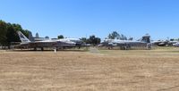
Florida Metal
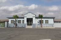
Timothy Aanerud
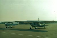
S B J
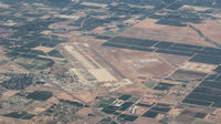
Ted Ziemba
| FAA Information Effective | 2026-09-03 |
| Airport Identifier | MER |
| Airport Status | Operational |
| Longitude/Latitude |
120°34'5.4710"
W /
37°22'49.7440"
N -120.568186 / 37.380484 (Estimated) |
| Elevation | 190.40 ft / 58.03 m (Surveyed) |
| Land | 1360 acres |
| From nearest city | 3 nautical miles NE of Atwater, CA |
| Location | Merced County, CA |
| Magnetic Variation | 15E (2000) |
| Airport Use | Open to public |
| Wind indicator | Yes |
| Segmented Circle | Yes |
| Control Tower | ATCT |
| Lighting Schedule | SEE RMK |
| Beacon Color | White-Green (lighted land airport) |
| Landing fee charge | No |
| Sectional chart | SAN FRANCISCO |
| Region | AWP - Western-Pacific |
| Responsible ARTCC | ZOA - OAKLAND |
| Tie-in FSS | RIU - RANCHO MURIETA |
| FSS on Airport | No |
| FSS Toll Free | 1-800-WX-BRIEF |
| NOTAMs Facility | MER (NOTAM-d service available) |
Runway 13/31
| Dimensions | 11802 x 150 ft (3597 x 46 m) |
| Surface | ASPH-CONC (GOOD) |
| Surface treatment | |
| Edge lights | High |
| 13 | 31 | |
|---|---|---|
| Alignment | 141° | 321° |
| Physical elevation | 190.40 ft | 177.70 ft |
| Coordinates | 37.393085 / -120.580959 | 37.367883 / -120.555418 |
| Traffic pattern | Left | Right |
| Runway marking | Non-precision instrument , Good Condition | Precision instrument , Good Condition |
| ILS type | LOC/GS | |
| VGSI | 4-light PAPI on left | 4-light PAPI on left |
| Approach light | ALSF1 | ALSF1 |
| Runway end lights | No |
- WHEN ATCT CLSD MAX OF 5 ACFT PMTD IN VFR TFC PAT AT ANY ONE TIME AND 2000 FT CIG AND 3 MIS VIS RCMDD.
- FOR CD WHEN ATCT IS CLSD CTC NORCAL APCH AT 916-361-0516.
- TWY B CLSD TO ACFT GTR THAN 30000 LBS.
- RY 13/31 180 DEGREE TURNS PROHIBITIED.
- FOR ARPT INFO 209-385-7686, EXTN 4180.
- RY 31 WILL BE THE DESIGNATED CALM WIND RY (WIND 5 KNOTS OR LESS).
- OPPOSITE END OF RY NOT VISIBLE ON TKOF. WHEN ATCT CLSD OPPOSITE DIRECTION TAKEOFFS AND LANDINGS ARE NOT AUTHORIZED.
- CIVILIAN AND MILITARY TRAINING MAY OCCASIONALLY CAUSE PATTERN CONGESTION.
- NO OBJECTIONS