Millard Airport (MLE)
Millard Airport (MLE)
MLE
Millard Airport (MLE)
Omaha, NE
Latest photo of Millard Airport (MLE)
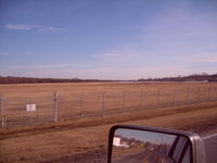
Gary Schenaman
| FAA Information Effective | 2026-09-03 |
| Airport Identifier | MLE |
| Airport Status | Operational |
| Longitude/Latitude |
96°6'44.1530"
W /
41°11'45.5500"
N -96.112265 / 41.195986 (Estimated) |
| Elevation | 1050.70 ft / 320.25 m (Surveyed) |
| Land | 165 acres |
| From nearest city | 7 nautical miles SW of Omaha, NE |
| Location | Douglas County, NE |
| Magnetic Variation | 06E (1990) |
| Airport Use | Open to public |
| Wind indicator | Yes |
| Segmented Circle | No |
| Control Tower | NON-ATCT |
| Lighting Schedule | SEE RMK |
| Beacon Color | White-Green (lighted land airport) |
| Landing fee charge | No |
| Sectional chart | OMAHA |
| Region | ACE - Central |
| Responsible ARTCC | ZMP - MINNEAPOLIS |
| Tie-in FSS | OLU - COLUMBUS |
| FSS on Airport | No |
| FSS Toll Free | 1-800-WX-BRIEF |
| NOTAMs Facility | MLE (NOTAM-d service available) |
Runway 12/30
| Dimensions | 3801 x 75 ft (1159 x 23 m) |
| Surface | ASPH (GOOD) |
| Surface treatment | |
| Edge lights | Medium |
| 12 | 30 | |
|---|---|---|
| Alignment | 129° | 309° |
| Physical elevation | 1050.60 ft | 1046.00 ft |
| Coordinates | 41.199252 / -96.117648 | 41.192720 / -96.106882 |
| Traffic pattern | Left | Left |
| Runway marking | Non-precision instrument , Good Condition | Non-precision instrument , Good Condition |
| VGSI | 2-light PAPI on left | 2-light PAPI on left |
| Runway end lights | Yes |
- MIL JETS OVERFLYING AT 3000 FT MSL.
- AFTER TKOF ON RY 30 ALTER HDG 20 DEGS TO THE R TO AVOID NOISE SENSITIVE AREA.
- NORMAL CALM & CROSS WIND TKOFS & LNDGS OF RY 12; NO INTXN TKOFS.
- RADIO CONTROLLED ACFT OCCASIONAL OPERATION 1.7 MI SW OF ARPT.
- VFR ACFT REQUESTING FLIGHT FLWG & IFR ACFT SHOULD CONTACT OMAHA APCH ON FREQ 125.4 PRIOR TO TAKING THE RY FOR CLNC/TRAFFIC ADVISORIES/GEN INFO.
- DEER ON & INVOF ARPT.
- SELF-SVC FUEL AVBL 24 HRS WITH CREDIT CARD.