Winona Health Services Heliport (MN39) — Winona, MN
Winona Health Services Heliport (MN39)
MN39
Winona Health Services Heliport (MN39)
Winona, MN
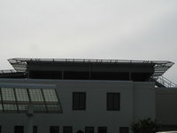
Latest photo of Winona Health Services Heliport (MN39)
Mitch Sando
Winona Health Services Heliport (MN39) is a private-use heliport located in Winona, MN. The airport sits at an elevation of 717 feet above mean sea level. It features 1 runway. Aviation communications are supported by 2 published radio frequencies. The gallery includes 1 photo of operations and aircraft at the airport.
| Airport Use | Private |
| Wind indicator | Yes |
| Segmented Circle | No |
| Control Tower | NON-ATCT |
| Lighting Schedule | SS-SR |
| Beacon Color | White-Green-Yellow (lighted heliport) |
| Sectional chart | GREEN BAY |
| Region | AGL - Great Lakes |
| Responsible ARTCC | ZMP - MINNEAPOLIS |
| Tie-in FSS | PNM - PRINCETON |
| FSS on Airport | No |
| FSS Toll Free | 1-800-WX-BRIEF |
| NOTAMs Facility | FDC |