District One Hospital Heliport (MN59)
District One Hospital Heliport (MN59)
MN59
District One Hospital Heliport (MN59)
Faribault, MN
Latest photos of District One Hospital Heliport (MN59)
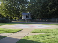
Mitch Sando
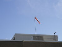
Mitch Sando
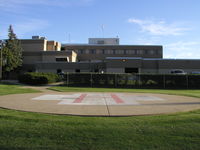
Mitch Sando
| FAA Information Effective | 2026-09-03 |
| Airport Identifier | MN59 |
| Airport Status | Operational |
| Longitude/Latitude |
93°15'28.4200"
W /
44°17'22.2100"
N -93.257894 / 44.289503 (Estimated) |
| Elevation | 1060.00 ft / 323.09 m (Estimated) |
| From nearest city | 1 nautical miles S of Faribault, MN |
| Location | Rice County, MN |
| Magnetic Variation | 01E (2010) |
| Airport Use | Private |
| Wind indicator | Yes |
| Segmented Circle | No |
| Control Tower | NON-ATCT |
| Lighting Schedule | SS-SR |
| Beacon Color | White-Green-Yellow (lighted heliport) |
| Sectional chart | OMAHA |
| Region | AGL - Great Lakes |
| Responsible ARTCC | ZMP - MINNEAPOLIS |
| Tie-in FSS | PNM - PRINCETON |
| FSS on Airport | No |
| FSS Toll Free | 1-800-WX-BRIEF |
| NOTAMs Facility | FDC |
- FOR CD CTC MINNEAPOLIS APCH AT 612-713-4016.
- PRVDD ALL APCH/DEP OPNS 280-290 DEGS AND 080-090 DEGS AND 30 FT POLE 90 DEGS FROM HELIPAD REMOVED & WIRES 270 DEGS FROM HELIPAD MARKED. TKOF/LNDG AREA MKD; NON-OBSTRUCTING WIND INDICATOR MAINTAINED; ALL TRAFFIC INBND/OUTBND MONITORED BY TWO-WAY RADIO COM BTWN PILOT & HOSPITAL.