Montrose Regional Airport (MTJ)
Montrose Regional Airport (MTJ)
MTJ
Montrose Regional Airport (MTJ)
Montrose, CO
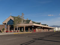
Latest photo of Montrose Regional Airport (MTJ)
Jack Poelstra
| FAA Information Effective | 2026-09-03 |
| Airport Identifier | MTJ |
| Airport Status | Operational |
| Longitude/Latitude |
107°53'39.3000"
W /
38°30'35.3000"
N -107.894250 / 38.509806 (Estimated) |
| Elevation | 5758.50 ft / 1755.19 m (Surveyed) |
| Land | 966 acres |
| From nearest city | 1 nautical miles NW of Montrose, CO |
| Location | Montrose County, CO |
| Magnetic Variation | 12E (1995) |
| Airport Use | Open to public |
| Wind indicator | Yes |
| Segmented Circle | Yes |
| Control Tower | NON-ATCT |
| Lighting Schedule | SEE RMK |
| Beacon Color | White-Green (lighted land airport) |
| Landing fee charge | No |
| Sectional chart | DENVER |
| Region | ANM - Northwest Mountain |
| Responsible ARTCC | ZDV - DENVER |
| Tie-in FSS | DEN - DENVER |
| FSS on Airport | No |
| FSS Toll Free | 1-800-WX-BRIEF |
| NOTAMs Facility | MTJ (NOTAM-d service available) |
| Certification type/date | 1973/05 |
Runway 13/31
| Dimensions | 7510 x 100 ft (2289 x 30 m) |
| Surface | ASPH (GOOD) |
| Surface treatment | Saw-cut or plastic Grooved |
| Edge lights | High |
| 13 | 31 | |
|---|---|---|
| Alignment | 139° | 319° |
| Physical elevation | 5698.50 ft | 5758.50 ft |
| Coordinates | 38.509224 / -107.904857 | 38.493567 / -107.887792 |
| Traffic pattern | Left | Left |
| Runway marking | Non-precision instrument , Good Condition | Non-precision instrument , Good Condition |
| VGSI | 4-box on left | 4-box on left |
| Runway end lights | No | Yes |
Runway 17/35
| Dimensions | 10000 x 150 ft (3048 x 46 m) |
| Surface | ASPH (GOOD) |
| Surface treatment | Saw-cut or plastic Grooved |
| Edge lights | High |
| 17 | 35 | |
|---|---|---|
| Alignment | 180° | 360° |
| Physical elevation | 5693.70 ft | 5734.10 ft |
| Coordinates | 38.529832 / -107.892740 | 38.502381 / -107.892629 |
| Traffic pattern | Left | Left |
| Runway marking | Precision instrument , Good Condition | Precision instrument , Good Condition |
| ILS type | LOC/GS | |
| VGSI | 4-light PAPI on left | 4-light PAPI on left |
| Approach light | MALSR | |
| Runway end lights | No | Yes |
- FOR CD, IFUN TO CTC ON DENVER ARTCC APP/DEP CTL FREQ, CTC DENVER ARTCC AT 303-651-4257.
- BIRDS & WILDLIFE ON & INVOF ARPT.
- ACR ACES TRML RAMP VIA TWY C; OUBD TFC TWY D.
- RAMP CNCTR ADJ TO T HNGR ROW CLSD INDEF; TWY E & E6 CLSD EXC WINGSPAN LESS THAN 78 FT.
- TWY B LTD TO SNGL WHEEL MAX 80000 LB; DBL WHEEL MAX 105000 LB; DBL TAND WHEEL MAX 170000 LB.