Mesmer Airport (NY49) — Niagara Falls, NY

NY49
Mesmer Airport (NY49)
Niagara Falls, NY
Latest photos of Mesmer Airport (NY49)
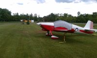
NY49, Mesmer field looking North, photo by Tom Witherspoon
Tom Witherspoon
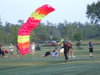
NY49, A few folks "dropped-in" during an EAA meeting at Bob's home/airport., photo by Jim Uber
Jim Uber
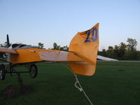
NY49, "Custom" vertical Stabilizer- indicative of Bob's sense of humor, photo by Jim Uber
Jim Uber
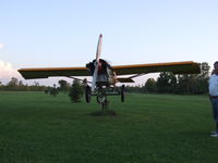
NY49, Somewhat unique wind vane at Bob Mesmer's place, photo by Jim Uber
Jim Uber

Mesmer Airport (NY49) is a private-use airport located in Niagara Falls, NY. The airport sits at an elevation of 600 feet above mean sea level. It features 1 runway. The gallery includes 4 photos of operations and aircraft at the airport.

Location & QuickFacts
FAA Information Effective 2026-09-03
Airport Identifier NY49
Airport Status Operational
Longitude/Latitude 78°59'11.0000" W / 42°59'34.0000" N
-78.986389 / 42.992778 (Estimated)
Elevation 600.00 ft / 182.88 m (Estimated)
Land 20 acres
From nearest city 5 nautical miles SE of Niagara Falls, NY
Location Erie County, NY
Owner & Manager
Ownership Privately owned
Owner ROBERT MESMER
Address 2548 LOVE RD
GRAND ISLAND, NY 14072
Phone number 716-983-6851
Manager ROBERT MESMER
Address 2548 LOVE RD
GRAND ISLAND, NY 14072
Phone number 716-983-6851
Airport Operations and Facilities
Airport Use Private
Segmented Circle No
Control Tower NON-ATCT
Sectional chart DETROIT
Region AEA - Eastern
Responsible ARTCC ZOB - CLEVELAND
Tie-in FSS BUF - BUFFALO
FSS Toll Free 1-800-WX-BRIEF
Runway Information
Runway 02/20
Dimensions 1470 x 70 ft (448 x 21 m)
Surface TURF
Surface treatment
02 20
Traffic pattern Left Left
Remarks
  • FOR CD CTC CLEVELAND ARTCC AT 440-774-0490.
  • PRVDD VFR, CLEAR 20:1 APCH PATH, OPR TO MINIMIZE NOISE, TWO TWRS OBST MKD/LGTD.