Rhode Island Tf Green International Airport (PVD / KPVD) — Providence, RI
Rhode Island Tf Green International Airport (PVD)
PVD
Rhode Island Tf Green International Airport (PVD)
Providence, RI
Latest photos of Rhode Island Tf Green International Airport (PVD)
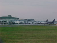
Geoff Cook
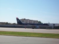
Mark Pasqualino
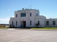
Mark Pasqualino
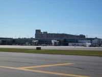
Mark Pasqualino
Rhode Island Tf Green International Airport (PVD/KPVD) is a public-use airport located in Providence, RI. The airport sits at an elevation of 54 feet above mean sea level. It features 2 runways. Aviation communications are supported by 23 published radio frequencies. The gallery includes 6 photos of operations and aircraft at the airport.
| FAA Information Effective | 2026-09-03 |
| Airport Identifier | PVD |
| Airport Status | Operational |
| Longitude/Latitude |
71°25'39.8000"
W /
41°43'20.4000"
N -71.427722 / 41.722333 (Estimated) |
| Elevation | 54.00 ft / 16.46 m (Surveyed) |
| Land | 1111 acres |
| From nearest city | 6 nautical miles S of Providence, RI |
| Location | Kent County, RI |
| Magnetic Variation | 15W (1985) |
| Airport Use | Open to public |
| Wind indicator | Yes |
| Segmented Circle | Yes |
| Control Tower | ATCT-TRACON |
| Lighting Schedule | SEE RMK |
| Beacon Color | White-Green (lighted land airport) |
| Landing fee charge | Yes |
| Sectional chart | NEW YORK |
| Region | ANE - New England |
| Responsible ARTCC | ZBW - BOSTON |
| Tie-in FSS | BDR - BRIDGEPORT |
| FSS on Airport | No |
| FSS Toll Free | 1-800-WX-BRIEF |
| NOTAMs Facility | PVD (NOTAM-d service available) |
| Certification type/date | 1973/05 |
Runway 05/23
| Dimensions | 8700 x 150 ft (2652 x 46 m) |
| Surface | ASPH (FAIR) |
| Surface treatment | Saw-cut or plastic Grooved |
| Edge lights | High |
| 05 | 23 | |
|---|---|---|
| Alignment | 32° | 212° |
| Physical elevation | 52.90 ft | 44.30 ft |
| Coordinates | 41.710262 / -71.437949 | 41.730472 / -71.420981 |
| Traffic pattern | Left | Left |
| Runway marking | Precision instrument , Good Condition | Precision instrument , Good Condition |
| ILS type | ILS/DME | ILS/DME |
| VGSI | 4-light PAPI on right | 4-box on left |
| RVR equipment | touchdown, midfield, rollout | touchdown, midfield, rollout |
| Approach light | ALSF2 | MALSR |
| Runway end lights | No | No |
| CL lights | Yes | Yes |
| TDZ lights | Yes | No |
Runway 16/34
| Dimensions | 6081 x 150 ft (1853 x 46 m) |
| Surface | ASPH (GOOD) |
| Surface treatment | Saw-cut or plastic Grooved |
| Edge lights | High |
| 16 | 34 | |
|---|---|---|
| Alignment | 142° | 322° |
| Physical elevation | 53.70 ft | 32.80 ft |
| Coordinates | 41.731654 / -71.432175 | 41.718579 / -71.418332 |
| Traffic pattern | Left | Left |
| Runway marking | Precision instrument , Good Condition | Precision instrument , Good Condition |
| ILS type | ILS/DME | |
| VGSI | 4-light PAPI on left | 4-light PAPI on left |
| RVR equipment | rollout | touchdown |
| Approach light | MALSR | |
| Runway end lights | Yes | No |
- GND VEHICLES MNT CTAF WHEN ATCT CLSD.
- TRML RAMP PROHIBITED FOR USE BY GA.
- TWY V CLSD DLY 2000-0800 BTN RWY 16/34 AND TWY C.
- PARKED ACFT ON THE NE RAMP WEST OF TWY A, BE ALERT. FQT FLT SCHOOL, TSNT JET ACFT, AND VER ACTVTY.
- NE RAMP ACFT WITH WINGSPAN GTR THAN 150 FT RQR GND CREW ASSISTANCE FOR THRU TAXI AND PRKG.
- FOR CD WHEN APCH CLSD CTC BOSTON ARTCC AT 603-879-6859.
- DEER & BIRDS ON & INVOF ARPT.
- TWY A UNEVEN PAVEMENT BTN TWY M & RWY 23.
- 110 FT UNMKD LGT POLES, 2700 FT FM THR RWY 34, 900 FT LEFT OF CNTRLN.
- RUN UP PAD FOR TWY F CLSD TO ACFT WITH WINGSPAN OVER 118 FT.
- NOISE ABATEMENT PROCS IN EFCT. HELS AVOID RESL AREAS WHEN BLW 1000 FT.
- NW RAMP ACFT WITH WINGSPAN GTR THAN 110 FT RQR GND CREW ASSISTANCE FOR THRU TAXI AND PRKG.
- EXISTED PRIOR TO 1959.