San Carlos Airport (SQL)
San Carlos Airport (SQL)
SQL
San Carlos Airport (SQL)
San Carlos, CA
Latest photos of San Carlos Airport (SQL)
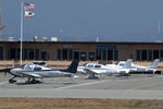
Van Propeller
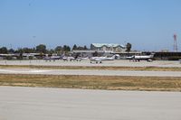
Florida Metal
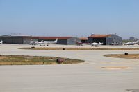
Florida Metal
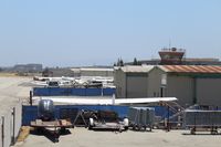
Florida Metal
| FAA Information Effective | 2026-07-09 |
| Airport Identifier | SQL |
| Airport Status | Operational |
| Longitude/Latitude |
122°14'58.3120"
W /
37°30'42.7000"
N -122.249531 / 37.511861 (Estimated) |
| Elevation | 5.50 ft / 1.68 m (Surveyed) |
| Land | 110 acres |
| From nearest city | 2 nautical miles NE of San Carlos, CA |
| Location | San Mateo County, CA |
| Magnetic Variation | 15E (2000) |
| Airport Use | Open to public |
| Wind indicator | Yes |
| Segmented Circle | Yes |
| Control Tower | ATCT |
| Lighting Schedule | SEE RMK |
| Beacon Color | White-Green (lighted land airport) |
| Landing fee charge | No |
| Sectional chart | SAN FRANCISCO |
| Region | AWP - Western-Pacific |
| Traffic Pattern Alt | 800 ft |
| Responsible ARTCC | ZOA - OAKLAND |
| Tie-in FSS | OAK - OAKLAND |
| FSS on Airport | No |
| FSS Toll Free | 1-800-WX-BRIEF |
| NOTAMs Facility | SQL (NOTAM-d service available) |
Runway 12/30
| Dimensions | 2621 x 75 ft (799 x 23 m) |
| Surface | ASPH (FAIR) |
| Surface treatment | |
| Edge lights | Medium |
| 12 | 30 | |
|---|---|---|
| Alignment | 138° | 318° |
| Physical elevation | 5.00 ft | 5.10 ft |
| Coordinates | 37.514535 / -122.252556 | 37.509187 / -122.246506 |
| Traffic pattern | Left | Right |
| Runway marking | Non-precision instrument , Good Condition | Non-precision instrument , Good Condition |
| VGSI | 2-box on left |
2-box on left *UNUSBL BYD 8 DEG LEFT OF CNTRLN. |
| Runway end lights | Yes | Yes |
| CL lights | No | No |
| TDZ lights | No | No |
- FOR CD WHEN ATCT IS CLSD CTC NORCAL APCH AT 916-361-3829.
- RABBIT AVIATION 130.00
- LRG HEL SHOULD AVOID OVERFLIGHT OF DIRT INFIELD AREAS.
- NO TGL OR STOP AND GO LDGS WHEN ATCT CLSD.
- CALM WIND RWY 12.
- NOISE SENSITIVE AREAS S THRU NE OF ARPT. FOR NOISE ABATEMENT PROCEDURES CTC AMGR (650) 573-3700.
- MIGRATORY BIRD ACT ON & INVOF OF ARPT.
- 100 FT STEEL TRANSMISSION TWRS AND POWERLINES LCTD 750 FT WEST AND PARALLEL TO RWY 12/30.
- 7 FT LIGHTED DIKE LCTD IN RWY SAFETY AREA ON APCH END RWY 30.