Trident Basin Seaplane Base (T44)
Trident Basin Seaplane Base (T44)
T44
Trident Basin Seaplane Base (T44)
Kodiak, AK
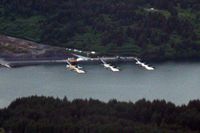
Latest photo of Trident Basin Seaplane Base (T44)
Timothy Aanerud
| FAA Information Effective | 2026-09-03 |
| Airport Identifier | T44 |
| Airport Status | Operational |
| Longitude/Latitude |
152°23'29.0000"
W /
57°46'51.0000"
N -152.391389 / 57.780833 (Estimated) |
| Elevation | 0.00 ft / 0.00 m (Estimated) |
| Location | Kodiak Island County, AK |
| Magnetic Variation | 21E (1995) |
| Airport Use | Open to public |
| Wind indicator | No |
| Segmented Circle | No |
| Control Tower | NON-ATCT |
| Landing fee charge | No |
| Sectional chart | KODIAK |
| Region | AAL - Alaska |
| Responsible ARTCC | ZAN - ANCHORAGE |
| Tie-in FSS | ENA - KENAI |
| FSS on Airport | No |
| FSS Phone | 907-283-7211 |
| FSS Toll Free | 1-866-864-1737 |
| NOTAMs Facility | ENA (NOTAM-d service available) |
- PILOTS ARRIVING/DEPARTING TRIDENT BASIN MUST CTC KODIAK TWR FOR TFC ADVISORIES AND/OR SPECIAL VFR CLEARANCE. WHEN TWR CLSD, PILOTS WILL SELF-ANNOUNCE ON CTAF.
- KODIAK WX CAMERA AVBL ON INTERNET AT HTTPS://WEATHERCAMS.FAA.GOV
- BIRDS INVOF LNDG BASIN.
- BOATS OCCASIONALLY USE SPB WATERLANE.
- REEF EXPOSED AT BOTH ENDS OF RY DURING LOW TIDES.
- PRVDD CITY OF KODIAK AMEND CITY ORDANCE TO MAKE COMMUNICATIONS AT TRIDENT BASIN MANDATORY.